Bradley in Greenwood County, South Carolina — The American South (South Atlantic)
Londonborough Settlement
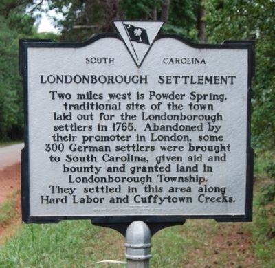
Two miles west is Power Spring, traditional site of the town laid out for the Londonborough settlers in 1765. Abandoned by their promoter in London, some three hundred German settlers were brought to South Carolina, given aid and bounty, and granted land in Londonborough Township. They settled in this area along Hard Labor and Cuffytown Creeks.
Erected 1964 by Edgefield and Greenwood County Historical Societies. (Marker Number 24-8.)
Topics and series. This historical marker is listed in these topic lists: Colonial Era • Notable Places • Settlements & Settlers. In addition, it is included in the South Carolina, Greenwood County Historical Society series list. A significant historical year for this entry is 1765.
Location. 34° 0.532′ N, 82° 11.781′ W. Marker is in Bradley, South Carolina, in Greenwood County. Marker is on Callison Road. Marker is located about 50 yards south of the intersection of Power Springs Road and Callison Road. Touch for map. Marker is in this post office area: Bradley SC 29819, United States of America. Touch for directions.
Other nearby markers. At least 10 other markers are within 9 miles of this marker, measured as the crow flies. Bradley CCC Camp F-7 (approx. 3.9 miles away); Patrick H. Bradley (approx. 3.9 miles away); Bethany Church (approx. 5.9 miles away); Long Canes Massacre (approx. 6 miles away); Long Cane Associated Reformed Presbyterian Church (approx. 6 miles away); Cedar Springs A.R.P. Church (approx. 7.8 miles away); John Perkins Barratt (approx. 7.8 miles away); a different marker also named Long Canes Massacre (approx. 8.2 miles away); McCormick Train Station (approx. 8.7 miles away); McCormick Passenger Train Steps (approx. 8.7 miles away). Touch for a list and map of all markers in Bradley.
Also see . . .
1. Londonborough Township. South Carolina Encyclopedia website entry (Submitted on January 30, 2022, by Larry Gertner of New York, New York.)
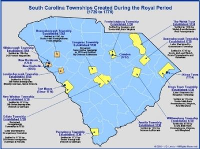
2. The Royal Colony of South Carolina: The Township Acts. Just About Everything You May Want to Know About Carolina Before 1729 website entry:
There are many contradicting histories on what really led to the establishment of "Townships" in the interior of South Carolina immediately after the Crown took over the colony in 1729. (Submitted on February 19, 2010, by Brian Scott of Anderson, South Carolina.)
Credits. This page was last revised on January 30, 2022. It was originally submitted on September 11, 2008, by Brian Scott of Anderson, South Carolina. This page has been viewed 2,051 times since then and 59 times this year. Photos: 1. submitted on February 19, 2010, by Brian Scott of Anderson, South Carolina. 2. submitted on September 11, 2008, by Brian Scott of Anderson, South Carolina. 3. submitted on November 21, 2009, by Brian Scott of Anderson, South Carolina.


