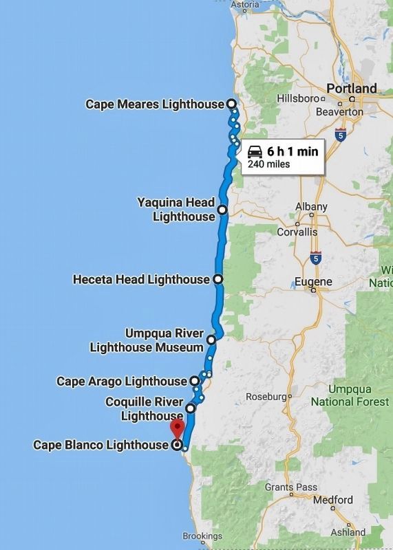
Near Tillamook in Tillamook County, Oregon — The American West (Northwest)
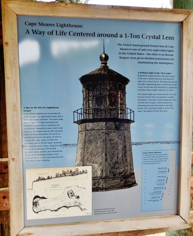
A Way of Life Centered around a 1-Ton Crystal Lens
Inscription.
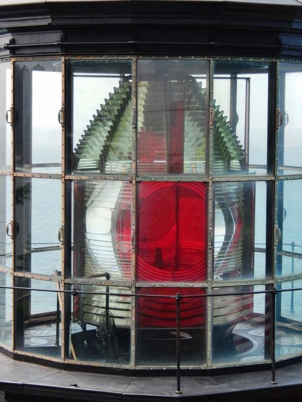
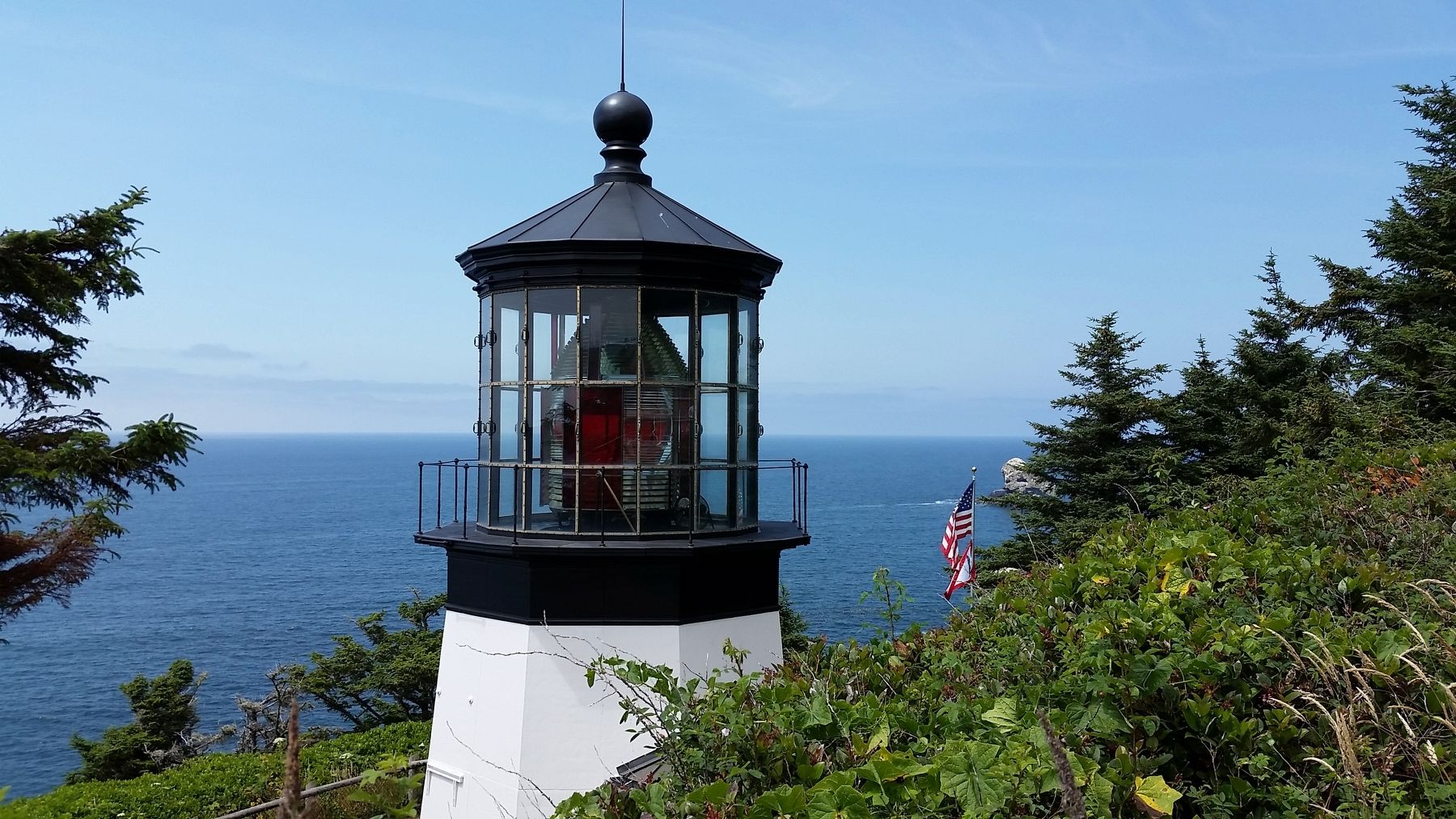
The French hand-ground Fresnel lens at Cape Meares is one of only two eight-sided lights in the United States – the other is in Hawaii. Keepers were given detailed instructions for maintaining the masterpiece.
A brilliant light of the "first order"
Shaped like a giant beehive, the outer surface of the lens is made of prisms, that bend the light into a narrow beam. The beam then pass through a magnifying glass, or bull's-eye, at the center of each side that intensifies it, producing' a brilliant sheet of light visible for 21 miles.
The original light was a heavy bronze five-wick kerosene lantern that was turned by weights and pulleys. Four sides of this 8-sided lens were covered with red glass, which produced an alternating red and white beam as the light turned. The Cape Meares light is of the "first order," the largest of seven lens sizes.
A day in the life of a lighthouse keeper
Cape Meares lighthouse was tended by three keepers: an appointed keeper and a first and second assistant. The main tasks were to keep the light burning from sunset to sunrise and to maintain the equipment. Among the many daily tasks done by the keeper and his first assistant were: 1) clean and polish the lenses to prevent pitting by salt spray; 2) trim or replace the large wicks; 3) filter the kerosene; and 4) fill the lamp. Kerosene was strained many times, using fine silk for the final filtering. The second assistant swept, dusted, and cleaned the inside of the building. Keepers wore linen aprons to avoid scratching the lens with their coarse clothing.
Topics. This historical marker is listed in these topic lists: Man-Made Features • Notable Buildings • Waterways & Vessels.
Location. 45° 29.151′ N, 123° 58.487′ W. Marker is near Tillamook, Oregon, in Tillamook County. Marker can be reached from Cape Meares Lighthouse Drive west of Bayshore Drive when traveling west. Marker is located at the Welcome Kiosk in Cape Meares State Scenic Viewpoint and National Wildlife Refuge, an Oregon State Park. Touch for map. Marker is at or near this postal address: 3500 Cape Meares Loop, Tillamook OR 97141, United States of America. Touch for directions.
Other nearby markers. At least 8 other markers are within 7 miles of this marker, measured as the crow flies. Captain Robert Gray (approx. 5.6 miles away); a different marker also named Captain Robert Gray (approx. 5.6 miles away); Kelly Building (approx. 6.6 miles away); Tillamook Hotel (approx. 6.7 miles away); Mill Stone (approx. 6.7 miles away); Beals Building (approx. 6.7 miles away); Steam Donkey (approx. 6.7 miles away); Tillamook County (approx. 6.7 miles away). Touch for a list and map of all markers in Tillamook.
Photographed By Cosmos Mariner, July 8, 2015
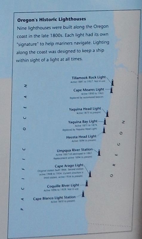
2. Marker detail: Oregons Historic Lighthouses
Nine lighthouses were built along the Oregon coast in the late 1800s. Each light had its own “signature” to help mariners navigate. Lighting along the coast was designed to keep a ship within sight of a light at all times.
Tillamook Rock Light
Active 1881 to 1957. Not in use.
Cape Meares Light
Active 1890 to 1963
Replaced by the automated beacon
Yaquina Head Light
Active 1873 to present
Yaquina Bay Light
Active 1871 to 1874
Replaced by Yaquina Head Light
Heceta Head Light
Active 1894 to present
Umpqua River Station
Active 1857 till destroyed in 1863
Replacement active 1894 to present
Cape Arago Light
Original station built 1866.
Second station active 1908 to 1934
Third station active 1934 to present
Coquille River Light
Active 1896 to 1939. Not in use.
Cape Blanco Lightstation
Active 1870 to present
Related markers. Click here for a list of markers that are related to this marker. Oregon Coast Lighthouses
Also see . . . Cape Meares Lighthouse.
On July 6, 1788, Meares entered Tillamook Bay, which he called "Quicksand Bay." Soon after arriving, he turned to head back north. On his way out of Tillamook Bay, he named the point of land just south "Cape Lookout." This name stayed with the point until the early 1850s when nautical charts were published and incorrectly placed the name Cape Lookout on a much larger point of land, about ten miles to the south. Rather than correct the error, in 1857, George Davidson of the U.S. Coast Survey named the northern headland Cape Meares, in honor of its discoverer, forever affixing the name. (Submitted on January 27, 2018, by Cosmos Mariner of Cape Canaveral, Florida.)
Photographed By Cosmos Mariner, July 8, 2015
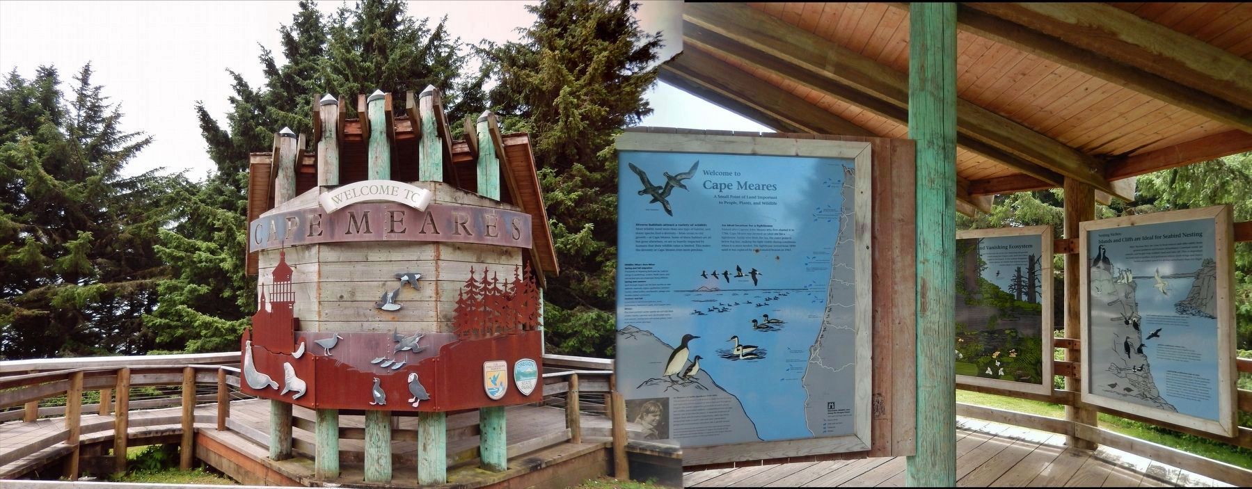
6. Cape Meares Welcome Kiosk (marker is located to the right of this sign)
An ideal location for a lighthouse
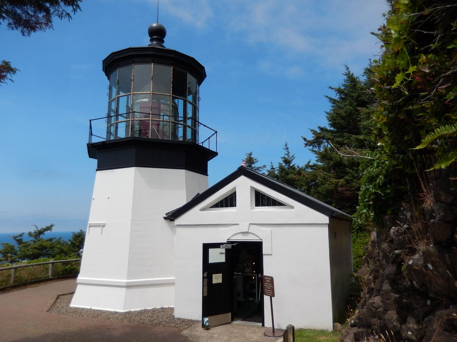
Named after Captain John Meares who first charted it in 1788, Cape Meares was deemed an ideal site for a lighthouse. Easily seen from the sea, the outer point is below fog line, making the light visible during conditions when it is most needed. The lighthouse served from 1890 until it was replaced by an automated beacon in 1963.
Named after Captain John Meares who first charted it in 1788, Cape Meares was deemed an ideal site for a lighthouse. Easily seen from the sea, the outer point is below fog line, making the light visible during conditions when it is most needed. The lighthouse served from 1890 until it was replaced by an automated beacon in 1963.
Credits. This page was last revised on October 20, 2020. It was originally submitted on January 25, 2018, by Cosmos Mariner of Cape Canaveral, Florida. This page has been viewed 298 times since then and 31 times this year. Last updated on February 9, 2018, by Cosmos Mariner of Cape Canaveral, Florida. Photos: 1. submitted on January 25, 2018, by Cosmos Mariner of Cape Canaveral, Florida. 2, 3, 4, 5, 6. submitted on January 27, 2018, by Cosmos Mariner of Cape Canaveral, Florida. 7. submitted on April 8, 2018, by Cosmos Mariner of Cape Canaveral, Florida. • Bill Pfingsten was the editor who published this page.
