Georgetown in Northwest Washington in Washington, District of Columbia — The American Northeast (Mid-Atlantic)
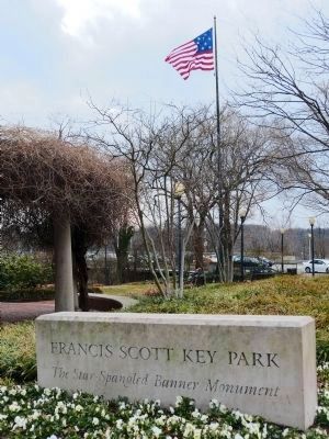
Francis Scott Key Park
A Place With It Own History
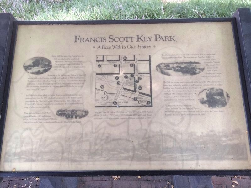
Before 1620 the area of the Francis Scott Key Park was inhabited by members of the Algonquian, Nacostine, Nacotchatank, Piscatoway and Patawomeke tribes. In 1634 it became part of the English Colony of Maryland.
Beginning in the 18th Century, Falls or M Street (1) was the trail to the Potomac river falls, and Frederick or 34th Street (2) was the access to the west landing of the port of George Town and Hite's Ferry (3) to Virginia. George Washington passed along 34th Street on the way to his first Presidential Inauguration in 1789, and again in 1793 to lay the cornerstone to the U.S. Capitol.
In 1789 this land was added to George Town, an early trading center and major tobacco port. In 1791, the land was included in the 10-mile square designated as the "Nation's Capital." During the late 18th century, the "Court End" of George Town saw the construction of "Gentleman's Houses," some of which are still standing doday.
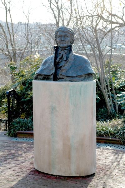
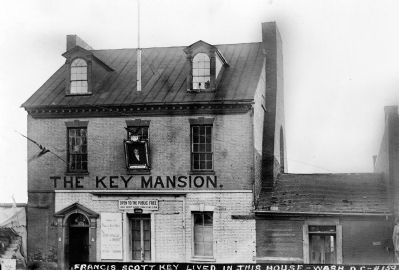
These included Francis Scott Key's house (4) built c. 1803 and dismantled in 1947; John Mason's house (5) built c. 1794 and his model farm on Analosian (Roosevelt) Island (6); the Forrest-Marbury House (7) built c. 1788; Halcyon House (8) built c 1786; Prospect House (9) built c. 1790; Quality Hill (10) built c. 1799; and Foxhall House (11) built c. 1802. Georgetown University (12) was established in 1789.
The Chesapeake & Ohio Canal (13) was begun in 1828 as a major trade route to and from the West. The now destroyed Aqueduct Bridge (14) carried the Canal to Alexandria, Virginia. The Canal's 1924 demise was the result of river flooding and competition from the railroads.
The Park site became more commercial at the end of the 19th century and homes were replaced by small shops and businesses. Around 1923, all of the buildings were demolished when Key Bridge (15) was built. Archaeological investigations in 1989 and 1992 examined some of the foundations of these buildings and analyzed artifacts from our early history.
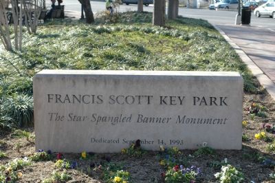
The Francis Scott Key Foundation created and built the Star Spangled Banner Monument with private funds and donated it as a gift to the United States from the American people on September 14, 1993.
Topics and series. This historical marker is listed in these topic lists: Bridges & Viaducts • Settlements & Settlers • Waterways & Vessels. In addition, it is included in the Chesapeake and Ohio (C&O) Canal series list. A significant historical month for this entry is September 1824.
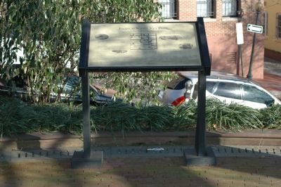
Location. This marker has been replaced by another marker nearby. It was located near 38° 54.289′ N, 77° 4.077′ W. Marker was in Northwest Washington in Washington, District of Columbia. It was in Georgetown. Marker was at the intersection of M Street Northwest and 34th Street Northwest, on the left when traveling west on M Street Northwest. The park is between M Street and the Canal on the east side of the bridge. Touch for map. Marker was at or near this postal address: 3350 M Street Northwest, Washington DC 20007, United States of America. Touch for directions.
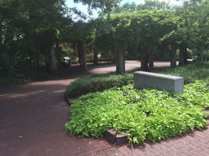
Other nearby markers. At least 5 other markers are within walking distance of this location. Francis Scott Key Park … a place to reflect (here, next to this marker); Window on Washington (a few steps from this marker); Forrest Marbury House (within shouting distance of this marker); An Industrial Georgetown (within shouting distance of this marker); Francis Scott Key Bridge (within shouting distance of this marker). Touch for a list and map of all markers in Northwest Washington.
Photographed By Tom Fuchs, February 20, 2006
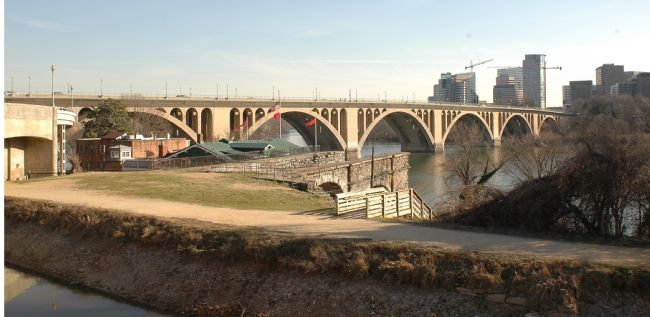
4. Francis Scott Key Bridge
The bridge carries U.S. Route 29 across the Potomac River, connecting Georgetown in D.C. to Rosslyn in Virginia. The C&O Canal is in the foreground. The remains of the Aqueduct Bridge that carried boats across the river can be seen jutting out into the river.
Credits. This page was last revised on December 10, 2023. It was originally submitted on February 23, 2006, by Tom Fuchs of Greenbelt, Maryland. This page has been viewed 12,652 times since then and 82 times this year. Photos: 1. submitted on September 11, 2016, by J. Makali Bruton of Accra, Ghana. 2. submitted on February 23, 2006, by Tom Fuchs of Greenbelt, Maryland. 3. submitted on September 11, 2016, by J. Makali Bruton of Accra, Ghana. 4. submitted on February 24, 2006, by Tom Fuchs of Greenbelt, Maryland. 5, 6. submitted on February 23, 2006, by Tom Fuchs of Greenbelt, Maryland. 7, 8. submitted on April 18, 2015, by Allen C. Browne of Silver Spring, Maryland. • J. J. Prats was the editor who published this page.
