Coconut Grove in Miami-Dade County, Florida — The American South (South Atlantic)
Churches
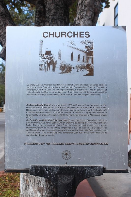
Originally African American residents of Coconut Grove attended integrated religious services at Union Chapel, now known as Plymouth Congregational Church. The African Americans, who were used to a more spirited religious experience, found the services at Union Chapel to be lifeless and straightlaced. Their discontent with these services and the establishment of their community led them to form their own religious institutions.
St. Agnes Baptist Church was organized in 1895 by Reverand S.A. Sampson and fifty-six members of Union Chapel. It was the first church for African Americans in Dade County. Religious services were held in a small house donated by Count Jean D'Hedouville until members erected an edifice on Thomas Avenue. In 1903 the congregation moved to a larger facility on Charles Avenue. In 1922 the name was changed to Macedonia Baptist Church.
St. Paul African Methodist Episcopal Church was organized in December of 1895, by a few members of St. Agnes Baptist Church under the leadership of Reverend Jeremiah A. Butler. The group purchased a lot in the Frow Homestead and built a small church. As the membership grew, a new church was constructed in 1934 on the corner of Douglas Road and Thomas Avenue. It remains the only African American Methodist Episcopal Church in Coconut Grove. The old building was demolished July, 1991 but a new office will be completed at the same location.
(side 2)
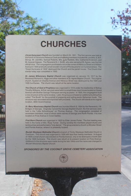
Christ Episcopal Church was founded on March 24, 1901. The first service was held at the home of David and Rebecca Clark and founding members included Mr. and Mrs. E.W.F. Stirrup, Mr. and Mrs. Samuel Roberts, Mrs. Lula Reddick, Mrs. Catherine Anderson, and Mr. Azariah Sawyer. The Reverend G.I. Smith, who also served at St. Agnes, was the first official vicar. The congregation purchased a lot on the corner of Hibiscus Street and William Avenue in 1904 and built a small wooden church of Florida pine for six hundred dollars. The "Great Hurricane of 1926" destroyed the Church and the parish house. The Church that stands today was completed in 1930.
St. James Missionary Baptist Church was organized on January 10, 1917 by the Reverend Richard H. Higgs and other members of St. Agnes Baptist Church. The original church, located on Charles Avenue and Hibiscus Street was destroyed by the 1926 and 1935 hurricanes. The church was rebuilt at the same location.
The Church of God of Prophecy was organized in 1919 under the leadership of Bishop Timothy Williams. At first, services were held in a small three-room house located on Grand Avenue with Brother George Thompson serving as pastor. In 1925, the congregation built a new structure at the same location. Later, the group purchased an additional building they called "The Booth" for the purpose of preparing and selling exotic Bahamian foods. The structure was renovated and improved with proceeds. The church still stands at its original location, 3655 Grand Avenue.
St. Mary Missionary Baptist Church was founded March 9, 1924 by the Reverend J.W. Bridges of Georgia. Originally named the Baptist Church, the first services were held in the "Little Schoolhouse" on Thomas Avenue. The congregation consisted of seventeen members, most of whom were natives of Georgia and North Florida. it is now located on Frow Avenue in Coral Gables.
First Born Church was organized in 1925 by Elder James Porter. The first meeting was held in the home of Mrs. Rosa Turner. During worship the members played drums and tambourines and performed a "holy dance." The group erected a church on Brooker Street and Florida Avenue, where it is presently located.
Beulah Wesleyan Methodist Church is branch of Trinity Wesleyan Methodist Church in Overtown. This church was organized in 1926 with less than twenty members. In August of 1926 a small church was erected on Florida Avenue, only to be destroyed a month later by the 1926 hurricane. The church was rebuilt at its present location on Frow Avenue. Additions to the structure were made during the late 1940s and the name was changed to Beulah Missionary Baptist Church.
Erected by Coconut Grove Cemetery Association.
Topics and series. This historical marker is listed in these topic lists: African Americans • Churches & Religion • Settlements & Settlers. In addition, it is included in the African Methodist Episcopal (AME) Church series list. A significant historical year for this entry is 1895.
Location. 25° 43.535′ N, 80° 15.189′ W. Marker is in Coconut Grove, Florida, in Miami-Dade County. Marker is on Charles Avenue east of Southwest 37th Avenue (Douglas Road), on the right when traveling west. Touch for map. Marker is at or near this postal address: 3515 Douglas Rd, Miami FL 33133, United States of America. Touch for directions.
Other nearby markers. At least 8 other markers are within walking distance of this marker. Evangelist Street Charles Avenue (a few steps from this marker); The Historic Coconut Grove Cemetery (within shouting distance of this marker); Architecture (about 600 feet away, measured in a direct line); Cocoanut Grove Park (approx. ¼ mile away); Cocoanut Grove Public Utilities Company (approx. 0.3 miles away); St. Mary First Missionary Baptist Church (approx. 0.3 miles away); George Allen Avenue (approx. 0.4 miles away); Elizabeth Virrick Park (approx. 0.4 miles away). Touch for a list and map of all markers in Coconut Grove.
Credits. This page was last revised on March 21, 2023. It was originally submitted on July 22, 2018, by Tim Fillmon of Webster, Florida. This page has been viewed 322 times since then and 39 times this year. Photos: 1, 2, 3. submitted on July 22, 2018, by Tim Fillmon of Webster, Florida. • Bernard Fisher was the editor who published this page.


