Marker Logo HMdb.org THE HISTORICAL
MARKER DATABASE
“Bite-Size Bits of Local, National, and Global History”
Dannewerk in Schleswig-Flensburg, Sleswick-Holstein, Germany — Central Europe
 

Bastion 14 and the 1864 War

Haithabu und Danewerk


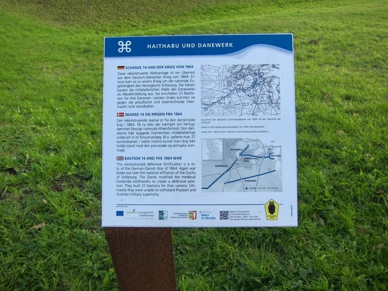
Bastion 14 and the 1864 War Marker image. Click for full size.
Photographed By Andrew Ruppenstein, September 25, 2018
1. Bastion 14 and the 1864 War Marker
Inscription.  
Schanze 14 Und Der Krieg Von 1864

Diese rekonstruierte Wehranlage ist ein Überrest aus dem Deutsch-Dänischen Krieg von 1864. Erneut kam es zu einem Krieg um die nationale Zugehörigkeit des Herzogtums Schleswig. Die Dänen bauten die mittelalterlichen Wälle des Danewerks als Abwehrstellung aus. Sie errichteten 27 Bastionen für ihre Kanonen. Letzten Endes konnten sie gegen die preußische und österreichische Übermacht nicht standhalten.

Skanse 14 Og Krigen Fra 1864

Den rekonstruerede skanse er fra den dansk-tyske krig i 1864. På ny blev der kæmpet om hertugdømmet Slesvigs nationale tilhørsforhold. Den danskerne hær byggede Dannevirkes middelalderlige volde om til et forsvarsanlæg. Bl.a. opførte man 27 kanonskanser. I sidste instans kunne man dog ikke holde stand mod den preussiske og østrigske overmagt.

Bastion 14 and the 1864 War

This reconstructed defensive fortification is a relic of the German-Danish War of 1864. Again war broke out over the national affiliation of the Duchy of Schleswig. The Danes modified the medieval Danevirke earthworks to create a

Paid Advertisement
Click on the ad for more information.
Please report objectionable advertising to the Editor.
Click or scan to see
this page online
defensive position. They built 27 bastions for their canons. Ultimately they were unable to withstand Prussian and Austrian military superiority.
 
Topics. This historical marker is listed in these topic lists: Forts and CastlesWars, Non-US. A significant historical date for this entry is February 1, 1864.
 
Location. 54° 28.832′ N, 9° 29.57′ E. Marker is in Dannewerk, Schleswig-Holstein (Sleswick-Holstein), in Schleswig-Flensburg. Marker can be reached from Am Wall. Touch for map. Marker is at or near this postal address: Am Wall 13B, Dannewerk SH 24867, Germany. Touch for directions.
 
Other nearby markers. At least 2 other markers are within 3 kilometers of this marker, measured as the crow flies. The Key Section of the Fortifications: The Main Wall (approx. 1.4 kilometers away); The "Kovirke" - New Defences for Hedeby? (approx. 1.8 kilometers away).
 
More about this marker. The easiest way to reach the bastion and marker is to park at the parking lot at the Danevirke Museum on Ochsenweg. From there, it is an approximately 400 meter easy walk along the path that follows the wall to the bastion.
 
Also see . . .  Second Schleswig War (Wikipedia). "The Second Schleswig War was the second military conflict over the Schleswig-Holstein Question of the nineteenth century. The war began on 1 February 1864, when Prussian forces
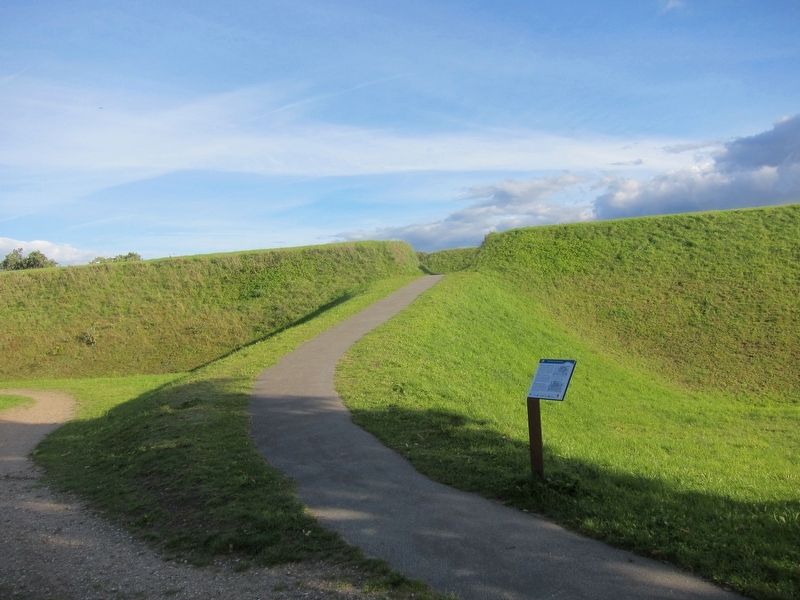
Bastion 14 and the 1864 War Marker - wide view image. Click for full size.
Photographed By Andrew Ruppenstein, September 25, 2018
2. Bastion 14 and the 1864 War Marker - wide view
The marker is in the foreground, with the path leading to the bastion in the background. Within the bastion itself there is little to see - several mounds that were probably gun emplacements, but overall the impression is of mounds of dirt arranged here and there without any discernible purpose.
crossed the border into Schleswig. Denmark fought the Kingdom of Prussia and the Austrian Empire. Like the First Schleswig War (1848–52), it was fought for control of the duchies of Holstein and Lauenburg, due to the succession disputes concerning them when the Danish king died without an heir acceptable to the German Confederation....The war ended on 30 October 1864, with the Treaty of Vienna and Denmark's cession of the Duchies of Schleswig (except for the island of Ærø, which remained Danish), Holstein and Saxe-Lauenburg to Prussia and Austria." (Submitted on October 18, 2018.) 
 
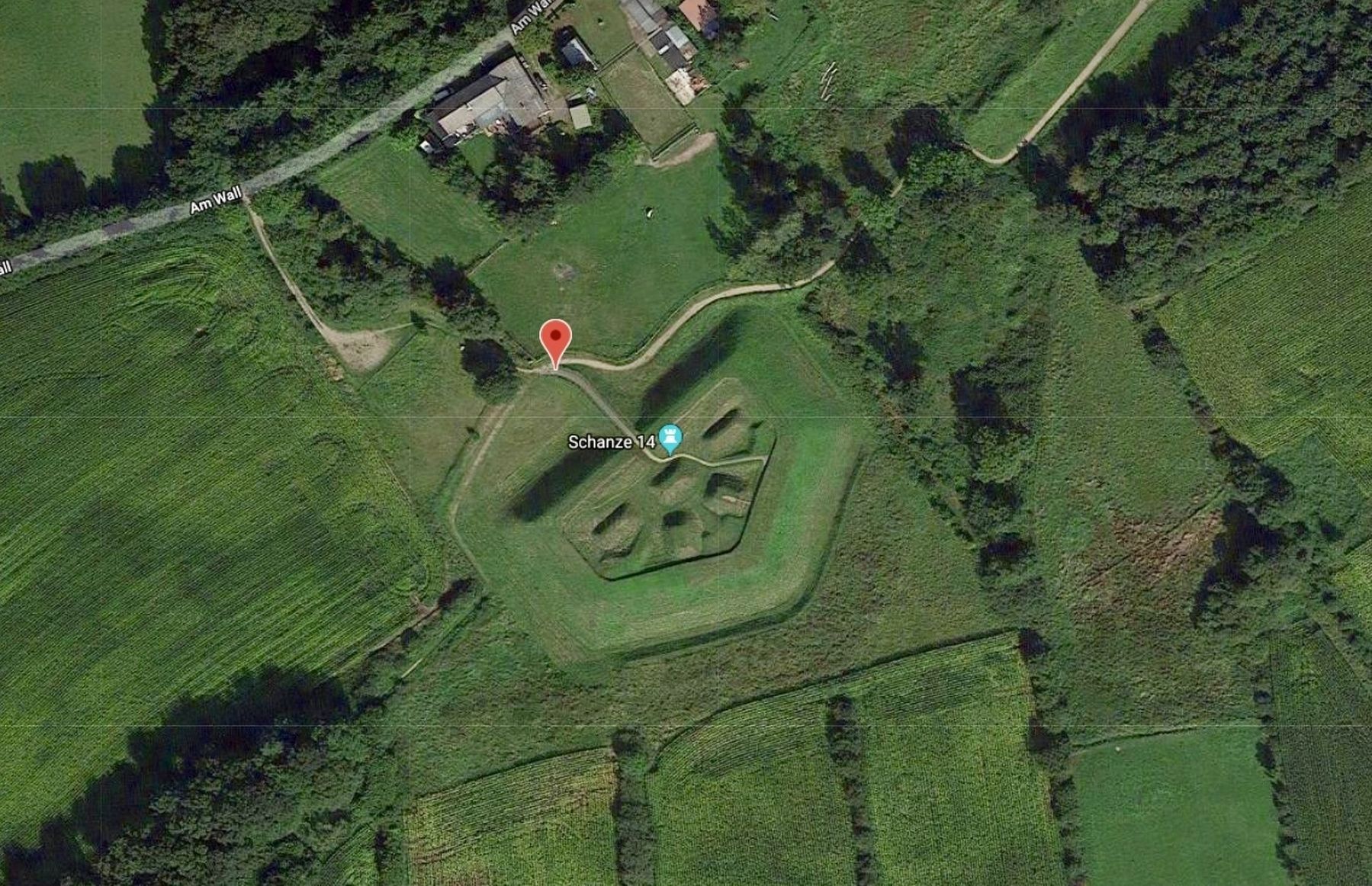
Bastion 14 and marker location from above image. Click for full size.
Photo courtesy of Google Maps
3. Bastion 14 and marker location from above
Although as noted in the previous photo that when one is within the bastion there is little to distinguish one pile of dirt from another, in terms of use or history. However, a view from overhead reveals what one would expect for a defensive fortification.
 
 
Credits. This page was last revised on January 28, 2022. It was originally submitted on October 18, 2018, by Andrew Ruppenstein of Lamorinda, California. This page has been viewed 97 times since then and 6 times this year. Photos:   1, 2, 3. submitted on October 18, 2018, by Andrew Ruppenstein of Lamorinda, California.
Share this page.  
Share on Tumblr
m=125089

CeraNet Cloud Computing sponsors the Historical Marker Database.
This website earns income from purchases you make after using our links to Amazon.com. We appreciate your support.
Paid Advertisement
Apr. 19, 2024