McRae-Helena in Telfair County, Georgia — The American South (South Atlantic)
Little Ocmulgee's Visitor Center
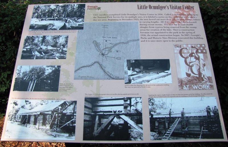
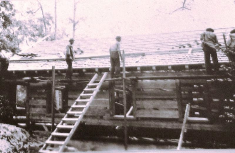
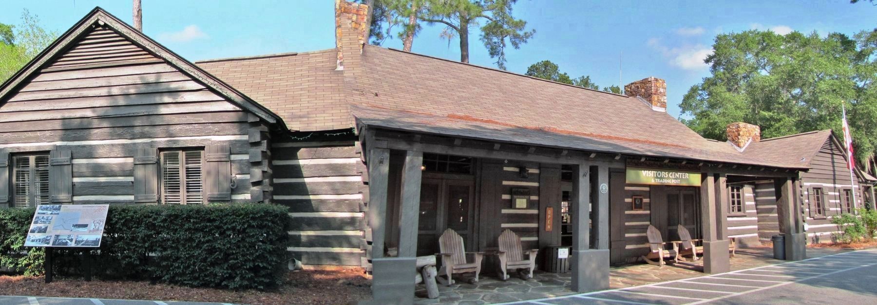
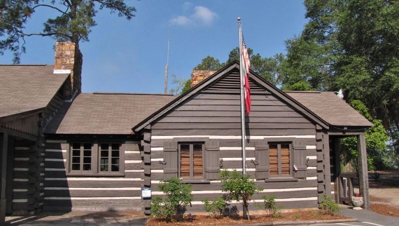
CCC enrollees completed Little Ocmulgee's Visitor Center in 1936. Called a combination building by the National Park Service for its multiple uses, it is labeled a casino on this early map of the park’s day use area. Beginning in December 1935, the men hewed out more than 125 six-inch square timbers in varying lengths. All of the timber had been downed during recent storms. The men cut around 20,000 shingles from cypress being removed from the swamp areas for creation of the lake. Once a construction foreman was appointed to the park in the spring of 1936, the actual construction began. In 2007, Georgia's Parks and Historic Sites Division renovated this building, and it is once more open to the public.
- photo captions -
In the spring, the CCC men cleared the area for the building, built forms for the foundation, and poured the concrete. The concrete wall was rubbed with Carborundum stone to give it a more natural appearance.
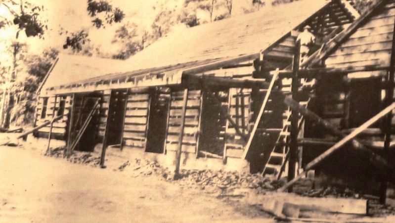
Under the direction of skilled carpenters, the men raised the rafters and trusses in mid-June of 1936.
This August 14, 1936 photograph shows an enrollee placing asphalt pitch between the squared dovetailed timbers.
A CCC worker lays flagstones for the porch of the combination building. The stone was quarried in North Georgia.
Erected by Georgia State Parks & Historic Sites.
Topics and series. This historical marker is listed in these topic lists: Charity & Public Work • Parks & Recreational Areas • Waterways & Vessels. In addition, it is included in the Civilian Conservation Corps (CCC) series list. A significant historical year for this entry is 1935.
Location. 32° 5.571′ N, 82° 53.757′ W. Marker is in McRae-Helena, Georgia, in Telfair County. Marker can be reached from Spanish Moss Drive (County Route 133) west of U.S. 441 when traveling west. Marker is located within Little Ocmulgee State Park, directly in front of the subject Visitor Center building, at the far west end of Spanish Moss Drive, near Little Ocmulgee Lake. Touch for map. Marker is in this post office area: Helena GA 31037, United States of America. Touch for directions.
Other nearby markers. At least 8 other markers are within 12 miles of this marker, measured as the crow flies. Telfair County Veterans Memorial (approx. 1.7 miles away); Telfair County (approx. 1.8 miles away); Marion Bayard Folsom (approx. 1.8 miles away); South Georgia College Administration Building (approx. 1.9 miles away); Talmadge Home (approx. 4.9 miles away); Wheeler County (approx. 7.7 miles away); Normandale (approx. 8.9 miles away); Methodism at Spring Hill (approx. 11.4 miles away). Touch for a list and map of all markers in McRae-Helena.
More about this marker. Marker
is a large composite plaque, mounted horizontally on waist-high metal posts.
Credits. This page was last revised on April 26, 2022. It was originally submitted on October 20, 2018, by Cosmos Mariner of Cape Canaveral, Florida. This page has been viewed 231 times since then and 21 times this year. Photos: 1, 2, 3, 4, 5, 6. submitted on October 23, 2018, by Cosmos Mariner of Cape Canaveral, Florida. • Andrew Ruppenstein was the editor who published this page.
