Cahokia Heights in St. Clair County, Illinois — The American Midwest (Great Lakes)
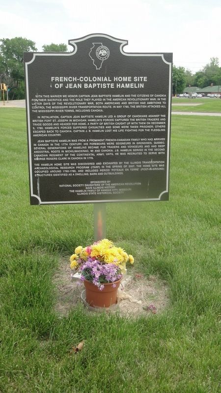
French-Colonial Home Site Of Jean Baptiste Hamelin
In retaliation, Captain Jean Baptiste Hamelin led a group of Cahokians against the British Fort St. Joseph in Michigan. Hamelin's forces captured the British traders and trade goods and headed for home. A party of British caught up with them on December 5, 1780. Hamelin's forces suffered casualties and some were taken prisoner; others escaped back to Cahokia. Captain J.B. Hamelin lost his life fighting for the fledgling American Country.
Jean Baptiste Hamelin was from a prominent French-Canadian family who had arrived in Canada in the 17th century. His forebears were Seigneurs in Grondines, Quebec. Several generations of Hamelins became fur traders and voyageurs and had deep ancestral roots in Michilimackinac, MI and Cahokia. J.B. Hamelin served in the Second Canadian Regiment of the Continental Army, until he was recruited to serve with George Rogers Clark in Cahokia in 1779.
The Hamelin home site was discovered and excavated by the Illinois Transportation Archaeological Research Program (ITARP) in the spring of 2007. The home site was occupied around 1760-1780, and included period 'Poteaux En Terre' (post-in-ground) structures identified as a dwelling, barn and outbuildings.
Erected 2013 by Illinois State Historical Society.
Topics and series. This historical marker is listed in these topic lists: Settlements & Settlers • War, US Revolutionary. In addition, it is included in the Illinois State Historical Society series list. A significant historical month for this entry is May 1780.
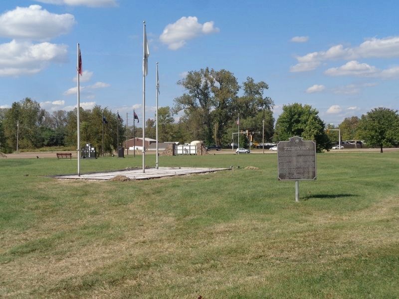
Location. 38° 34.242′ N, 90° 11.268′ W. Marker is in Cahokia Heights, Illinois, in St. Clair County. Marker is on East 1st Street, on the left when traveling east. The marker is located at the Cahokia Wedge, across from the Jarrot Mansion and at the intersection of Route 3 and Camp Jackson/Hwy 157. Touch for map. Marker is at or near this postal address: 999 East 1st Street, East Saint Louis IL 62206, United States of America. Touch for directions.
Other nearby markers. At least 8 other markers are within walking distance of this marker. Fort Bowman (within shouting distance of this marker); The Grand Plan (within shouting distance of this marker); Cahokia - The Birthplace of the Midwest (within shouting distance of this marker); Chief Pontiac (within shouting distance of this marker); Church of the Holy Family
(within shouting distance of this marker); Jarrot Mansion (within shouting distance of this marker); 13 Star Day (within shouting distance of this marker); Cahokia Association for the Tricentennial (within shouting distance of this marker). Touch for a list and map of all markers in Cahokia Heights.
Credits. This page was last revised on August 2, 2023. It was originally submitted on April 17, 2019, by Jason Voigt of Glen Carbon, Illinois. This page has been viewed 347 times since then and 25 times this year. Photos: 1. submitted on April 17, 2019, by Jason Voigt of Glen Carbon, Illinois. 2. submitted on October 3, 2019, by Jason Voigt of Glen Carbon, Illinois. • Andrew Ruppenstein was the editor who published this page.

