Ansonborough in Charleston in Charleston County, South Carolina — The American South (South Atlantic)
Gadsden's Wharf
Liberty Square
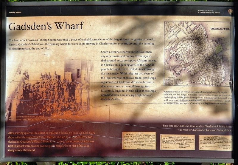
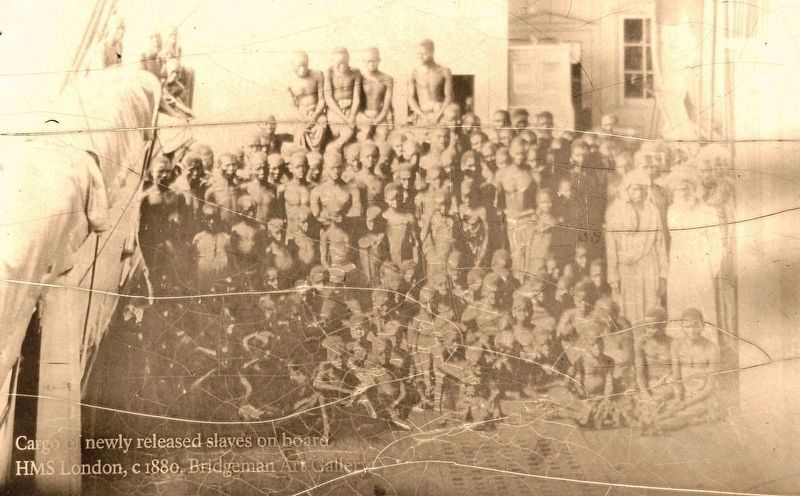
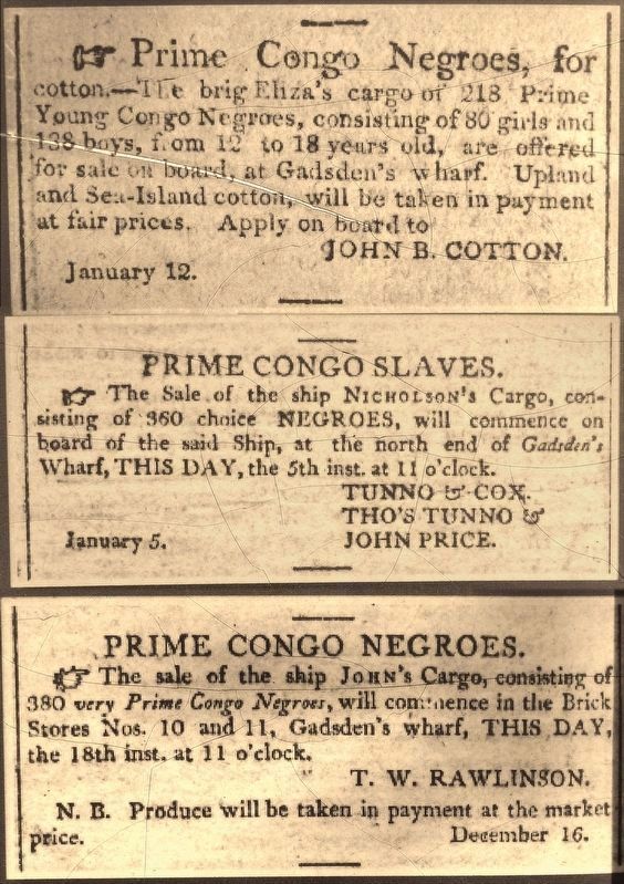
South Carolina received more slaves than any other mainland colony. From 1670 to 1808 around 260,000 captive Africans arrived in Charleston, equaling 40% of the 645,000 people brought to the United States through the slave trade. Within the last two years of the legal international slave trade, slave ships registered in Charleston did more business than every port in the world except for Liverpool, England. Nearly all of those ships unloaded their human cargo right here at Gadsden's Wharf.
After serving quarantine either at Sullivan’s Island or James Island, slave ships sailed through Charleston Harbor and up the Cooper River and docked at Gadsden’s Wharf. From 1783 to 1808, the number of Africans held in wharf warehouses awaiting sale ranged from just a few to as many as one thousand.
Erected by National Park Service, U.S. Department of the Interior.
Topics. This historical marker is listed in these topic lists: African Americans • Waterways & Vessels.
Location. 32° 47.411′ N, 79° 55.583′ W. Marker is in Charleston, South Carolina, in Charleston County. It is in Ansonborough. Marker can be reached from Calhoun Street east of Concord Street when traveling east. Marker is located within Liberty Square, near Fort Sumter National Monument, along "Freedom Lane" (an extension of Calhoun Street to the east of Concord Street). Touch for map. Marker is at or near this postal address: 340 Concord Street, Charleston SC 29401, United States of America. Touch for directions.
Other nearby markers. At least 8 other markers are within walking distance of this marker. Philip Simmons (within shouting distance of this marker); Septima Poinsette Clark (within shouting distance of this marker); Septima Poinsette Clark 1898-1987 (within shouting distance of this marker); Fort Sumter Bricks (about 400 feet away, measured in a direct line); Fort Sumter Today (about 500 feet away); Port of Charleston (about 500 feet away); The Borough Houses (approx. 0.2 miles away); a different marker also named The Borough Houses (approx. 0.2 miles away). Touch for a list and map of all markers in Charleston.
Also see . . .
1. A brief history of Gadsden’s Wharf. Slavevoyages.org reports that 200 cargos of captive Africans landed in Charleston during 1806 and 1807, bringing a little more than 33,000 people. On Jan. 1, 1808, the U.S. ban on slave imports took effect and Gadsden’s Wharf was put
to other use, though slavers continued to trade in human beings until the 1860s. (Submitted on May 24, 2019, by Cosmos Mariner of Cape Canaveral, Florida.)
2. The Story of Gadsden’s Wharf. The final twenty-two months of the legal importation of African captives into the United States, between late February 1806 and late December 1807, proved to be the most intense and horrific. During this era, mortality rates soared as greed and exploitation won the day. Several slave merchants held their newly-imported human cargo off the market in warehouses at Gadsden’s Wharf well into the spring of 1808, in an effort to drive prices higher as the last legally-imported supply of fresh human chattel dwindled. In the interest of profit, humans packed into warehouses died of fevers, exposure, and frostbite. (Submitted on May 24, 2019, by Cosmos Mariner of Cape Canaveral, Florida.)
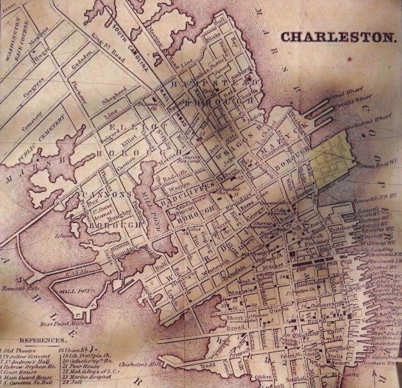
Charleston County Library
3. Marker detail: 1849 Map of Charleston
Gadsden's Wharf (in yellow) was a complex of warehouses for captive Africans, rice and indigo. It included lumberyards, a cooper shop, counting and weighing houses, jetties for large ships, a steam powered rice mill, a saw mill, turpentine distilleries, residential lots and a covered market. The sale of human beings was a part of everyday bustling, commercial activity.
Credits. This page was last revised on February 16, 2023. It was originally submitted on May 24, 2019, by Cosmos Mariner of Cape Canaveral, Florida. This page has been viewed 2,028 times since then and 127 times this year. Photos: 1, 2, 3, 4, 5. submitted on May 24, 2019, by Cosmos Mariner of Cape Canaveral, Florida.
