West Lafayette in Coshocton County, Ohio — The American Midwest (Great Lakes)
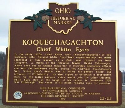
Koquechagachton
Chief White Eyes
Erected 1999 by Ohio Bicentennial Commission, The Longaberger Company, Arrowhead District of the Boy Scouts of America, and The Ohio Historical Society. (Marker Number 6-16.)
Topics and series. This historical marker is listed in these topic lists: Native Americans • Settlements & Settlers • War, US Revolutionary. In addition, it is included in the Ohio Historical Society / The Ohio History Connection series list. A significant historical month for this entry is November 1778.
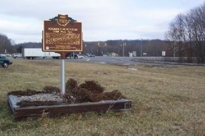
Location. 40° 17.61′ N, 81° 45.016′ W. Marker is in West Lafayette, Ohio, in Coshocton County. Marker is at the intersection of Ohio Route 93 and Ohio Route 36 on State Route 93. Touch for map. Marker is in this post office area: West Lafayette OH 43845, United States of America. Touch for directions.
Other nearby markers. At least 8 other markers are within 6 miles of this marker, measured as the crow flies. Pennsylvania National Guard Troop Train Accident, September 1950 (approx. 1.2 miles away); West Lafayette Volunteer Fire Department Centennial (approx. 1.2 miles away); West Lafayette War Memorial (approx. 1.9 miles away); Old Stone Fort (approx. 3.9 miles away); Dr. William Edgar Lower Co-Founder of Cleveland Clinic (approx. 4˝ miles away); Broadhead Massacre (approx. 5.1 miles away); North Appalachian Experimental Watershed (approx. 5.8 miles away); Veterans Memorial (approx. 5.9 miles away). Touch for a list and map of all markers in West Lafayette.
More about this marker. The Ohio Historical Society lists this marker as No. 6-16. However, it is numbered on its face as 25-25, an error.
Credits. This page was last revised on June 29, 2018. It was originally submitted on January 10, 2009, by William Fischer, Jr. of Scranton, Pennsylvania. This page has been viewed 1,492 times since then and 46 times this year. Photos: 1, 2. submitted on January 10, 2009, by William Fischer, Jr. of Scranton, Pennsylvania. • Kevin W. was the editor who published this page.

