Cumberland in Allegany County, Maryland — The American Northeast (Mid-Atlantic)
Abandonment of Ft. Cumberland
Fort Cumberland Trail
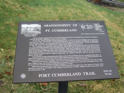
In early 1756, Colonel Washington favored a small garrison here to protect the fort, gather intelligence, and cover the forces sent to the Ohio Valley. After this time, he favored abandoning the fort, as it was no deterrent to the Indians but a continual drain on his command's resources. Lt. Governor Dinwiddie never allowed Washington to abandon the fort. It finally was abandoned in mid July, 1765, when Gen. Thomas Gage (here as lt. colonel) ordered British troops here removed.
The fort grounds were occupied once again in October, 1794, as Virginia and Maryland troops gathered here before marching off to suppress the Whiskey Rebellion. The troops camped along Will's Creek. They were marched up to the parade ground and inspected by President Washington on October 19th, to loud cheers. Nearly all of Cumberland's residents watched. The photo above shows the Kemmelmeyer oil painting of this occasion. Washington, as Commander-in-Chief and in full uniform, backed by Generals Daniel Morgan and Henry Lee, reviewed the troops on the old parade ground of the fort. Earth mounds can be seen in the background and may be remains of the fort. Frederick Kemmelmeyer was a Baltimore, Maryland, artist and was active in his work between 1790 and 1810.
George Washington began and ended his active military career at Fort Cumberland. The man who gained his early military experiences in the backwoods of this area later kept the spark of freedom burning in the darkest days of the American Revolution. His armies made possible the continued existence of our infant nation. He was truly "Father of His Country."
Cumberland was known as "Washington Town" for two years preceding it's creation on January 20, 1787, by the state legislature. Allegany County was created by the legislature on December 25, 1789, out of the western part of Washington County. Thus the city and county were both namesakes of George Washington, at one time.
We hope you have enjoyed the Fort Cumberland Trail and that you will visit us again to more fully appreciate it. Further tourist information and brochures are available at the Allegany County Division of Tourism. Allegany County has many historic, scenic, and recreational sites to offer.
Topics and series. This historical marker is listed in these topic lists: Colonial Era • Forts and Castles • War, French and Indian. In addition, it is included in the Former U.S. Presidents: #01 George Washington, and the Whiskey Rebellion series lists. A significant historical month for this entry is January 1923.
Location.
39° 39.017′ N, 78° 45.889′ W. Marker is in Cumberland, Maryland, in Allegany County. Marker can be reached from Prospect Square. Marker is in front of the Masonic hall. Touch for map. Marker is in this post office area: Cumberland MD 21502, United States of America. Touch for directions.
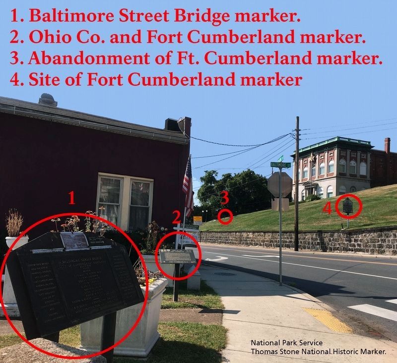
Other nearby markers. At least 8 other markers are within walking distance of this marker. Trenches and Tunnels / Army Discipline (here, next to this marker); Col. Thomas Cresap (within shouting distance of this marker); National Road Monument (within shouting distance of this marker); Riverside Park (within shouting distance of this marker); Fort Cumberland Trail (within shouting distance of this marker); Site of Fort Cumberland (within shouting distance of this marker); Where the Road Began (within shouting distance of this marker); Alteration of the Site (within shouting distance of this marker). Touch for a list and map of all markers in Cumberland.
Credits. This page was last revised on November 21, 2019. It was originally submitted on April 6, 2009, by Bill Pfingsten of Bel Air, Maryland. This page has been viewed 1,827 times since then and 39 times this year. Photos: 1. submitted on April 6, 2009, by Bill Pfingsten of Bel Air, Maryland. 2. submitted on September 27, 2019.

