Emporia, Virginia — The American South (Mid-Atlantic)
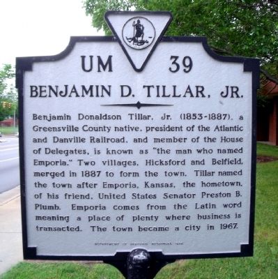
Benjamin D. Tillar, Jr.
Erected 1992 by Department of Historic Resources. (Marker Number UM-39.)
Topics and series. This historical marker is listed in these topic lists: Industry & Commerce • Railroads & Streetcars • Settlements & Settlers. In addition, it is included in the Virginia Department of Historic Resources (DHR) series list. A significant historical year for this entry is 1887.
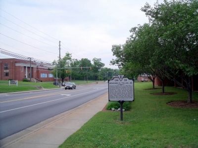
Location. 36° 41.26′ N, 77° 32.521′ W. Marker is in Emporia, Virginia. Marker is on South Main Street (U.S. 301) 0.1 miles north of Spring Street, on the right when traveling north. Touch for map. Marker is at or near this postal address: 204 South Main Street, Emporia VA 23847, United States of America. Touch for directions.
Other nearby markers. At least 8 other markers are within walking distance of this marker. Robert Hicks (within shouting distance of this marker); Chaplain Thomas M. Bulla (within shouting distance of this marker); Greensville County (about 300 feet away, measured in a direct line); In Memoriam (about 500 feet away); Veterans of the 1914-1918 World War I (about 500 feet away); Emporia – Greensville Veteran War Memorial (about 500 feet away); Shiloh Baptist Church (about 600 feet away); Meherrin River Trail (about 700 feet away). Touch for a list and map of all markers in Emporia.
Credits. This page was last revised on December 25, 2019. It was originally submitted on May 13, 2009, by Bernard Fisher of Richmond, Virginia. This page has been viewed 1,092 times since then and 30 times this year. Photos: 1, 2. submitted on May 13, 2009, by Bernard Fisher of Richmond, Virginia.

