Funkstown in Washington County, Maryland — The American Northeast (Mid-Atlantic)
Baltimore Street
Funkstown’s Link to the Chesapeake
— The Historic National Road - The Road That Built The Nation —
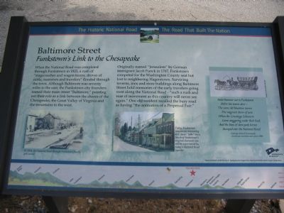
When the National Road was completed through Funkstown in 1823, a rush of “stagecoaches and wagon teams, droves of cattle, teamsters and travelers” flooded through the town. Although Baltimore was seventy miles to the east, the Funkstown city founders named their main street “Baltimore,” pointing out their role as a link between the shores of the Chesapeake, the Great Valley of Virgnia and the mountains to the west.
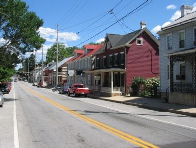
Originally named “Jerusalem” by German immigrant Jacob Funck in 1767, Funkstown competed for the Washington County seat but lost to neighboring Hagerstown. Surviving taverns, inns and store buildings along Baltimore Street hold memories of the early travelers going west along the National Road—“such a rush and roar of movement as this country will never see again.” One old resident recalled the busy road as having “the animation of a Perpetual Fair.”
(Sidebar Poem):
Nick Hammer sat in Funkstown
Before his tavern door —
The same old bluestone tavern
The wagoners knew of yore,
When the Conestoga Schooners
Came staggering under their load
And the lines of slow pack horses
Stamped over the National Road
—George Alfred Townsend, American novelist and poet, 1880.
Erected by America's Byways.
Topics and series. This historical marker is listed in this topic list: Roads & Vehicles. In addition, it is included in the The Historic National Road series list. A significant historical year for this entry is 1823.
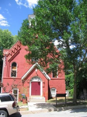
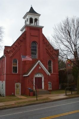
Location. 39° 36.568′ N, 77° 42.41′ W. Marker is in Funkstown, Maryland, in Washington County. Marker is on Baltimore Street (Alternate U.S. 40), on the right when traveling west. In front of the Old Town Hall. Touch for map. Marker is at or near this postal address: 225 Baltimore Street, Funkstown MD 21734, United States of America. Touch for directions.
Other nearby markers. At least 8 other markers are within walking distance of this marker. Keller Home (within shouting distance of this marker); This Plot is Dedicated to Public Use (about 500 feet away, measured in a direct line); Civil War Hospital Site (about 700 feet away); Battle of Funkstown (approx. 0.2 miles away); Veterans Memorial (approx. 0.2 miles away); M3A1 Light Tank (approx. ¼ mile away); Building the Funkstown Bridge (approx. ¼ mile away); Funkstown Bridge No. 2 (approx. 0.3 miles away). Touch for a list and map of all markers in Funkstown.
More about this marker. The marker displays a picture Funkstown from the early 20th Century captions, “In 1914, the National Road through Funkstown finally gets paved!” Contrasting is a picture of modern Funkstown, “Today, Funkstown remains and interesting and classic ‘pike’ town. Much of Funkstown’s original character can be still experienced by today’s National Road traveler.” A drawing of a Conestoga wagon complements the poem by Townsend. The background for the marker is "The National Road at Fairview Inn" from the Enoch Pratt Library Cator Collection.
Also see . . . Funck’s Jerusalem Town. Funkstown website entry (Submitted on February 28, 2022, by Larry Gertner of New York, New York.)
Credits. This page was last revised on March 24, 2024. It was originally submitted on August 6, 2007, by Craig Swain of Leesburg, Virginia. This page has been viewed 1,756 times since then and 10 times this year. Photos: 1, 2. submitted on August 6, 2007, by Craig Swain of Leesburg, Virginia. 3. submitted on March 9, 2008, by Christopher Busta-Peck of Shaker Heights, Ohio. 4. submitted on August 6, 2007, by Craig Swain of Leesburg, Virginia. • J. J. Prats was the editor who published this page.


