Lorton in Fairfax County, Virginia — The American South (Mid-Atlantic)
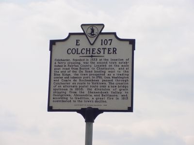
Colchester
Erected 1999 by Department of Historic Resources. (Marker Number E-107.)
Topics and series. This historical marker is listed in these topic lists: Colonial Era • Roads & Vehicles • Settlements & Settlers • Waterways & Vessels. In addition, it is included in the Former U.S. Presidents: #01 George Washington, the The Washington-Rochambeau Route, and the Virginia Department of Historic Resources (DHR) series lists. A significant historical year for this entry is 1753.
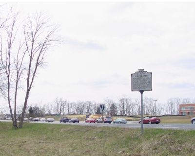
Location. 38° 40.203′ N, 77° 14.258′ W. Marker is in Lorton, Virginia, in Fairfax County. Marker is at the intersection of Richmond Highway (U.S. 1) and Furnace Road (County Route 611), on the right when traveling north on Richmond Highway. Touch for map. Marker is in this post office area: Lorton VA 22079, United States of America. Touch for directions.
Other nearby markers. At least 8 other markers are within 2 miles of this marker, measured as the crow flies. A Near Tragedy (approx. 0.4 miles away); The Trail to Victory at Yorktown (approx. 0.7 miles away); Welcome to Colchester on the Occoquan (approx. 0.7 miles away); Revolutionary Army Life on the Road (approx. 0.7 miles away); In the Footsteps of History (approx. 0.7 miles away); End of the Water (approx. 0.9 miles away); A Corridor and a Barrier (approx. 1.1 miles away); Silent for Suffrage (approx. 1.2 miles away). Touch for a list and map of all markers in Lorton.
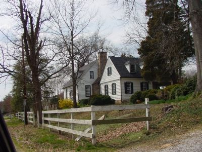
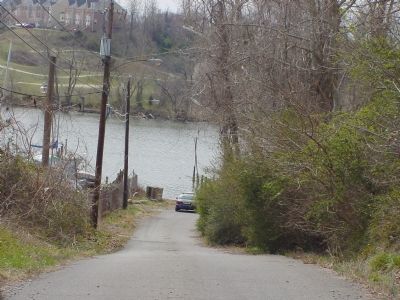
Regarding Colchester. There is not much of Colchester left. There’s just Fairfax Arms, now a private residence on the narrow lane (Old Colchester Road) leading down to the Occoquan river where the ferry used to cross.
Also see . . . A Brief History of Mason Neck. Excerpt from link concerning Colchester: “Colchester was the first town established within the borders of present-day Fairfax County. Chartered in 1753, the site was chosen by virtue of the topography of the land as the most accessible spot for a ferry crossing of the Occoquan River. The road north of Colchester was part of the great path linking Boston and Charleston, S.C. It was over this part of the road that troops under the command of Generals Washington and Rochambeau marched southward from Pennsylvania ... to Yorktown for the climactic battle ending the American Revolutionary War. However, siltation of the Occoquan River, along with the construction of a bridge up river effectively put an end to Colchester’s function as a port town. Today the old ordinary known as the Fairfax Arms, now a private home, is the only above ground reminder of a town that once rivaled Alexandria in importance.” (Submitted on August 31, 2007, by Kevin W. of Stafford, Virginia.)
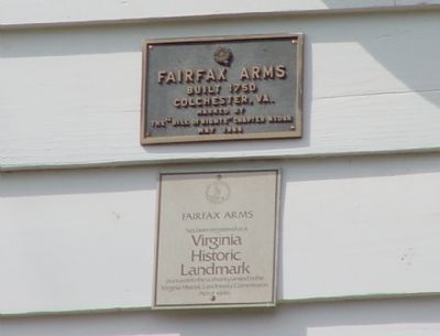
Photographed By J. J. Prats, March 26, 2006
4. Fairfax Arms Markers
The first reads Fairfax Arms. Built 1750, Colchester, VA. Marked by the "Bill of Rights" Chapter, NSDAR. May 1966. The second Fairfax Arms has been registered as a Virginia Historic Landmark pursuant to the authority vested in the Virginia Historic Landmarks Commission, Act of 1966.
Credits. This page was last revised on October 30, 2021. It was originally submitted on March 26, 2006, by J. J. Prats of Powell, Ohio. This page has been viewed 6,053 times since then and 108 times this year. Photos: 1, 2, 3, 4, 5. submitted on March 26, 2006, by J. J. Prats of Powell, Ohio.
