Near Quantico in Prince William County, Virginia — The American South (Mid-Atlantic)
Prince William County / Stafford County
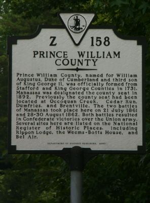
Prince William County. Prince William County, named for William Augustus, Duke of Cumberland and third son of King George II, was officially formed from Stafford and King George Counties in 1731. Manassas was designated the county seat in 1892. Previously the county seat had been located at Occoquan Creek, Cedar Run, Dumfries, and Brentville. The two battles of Manassas took place here on 21 July 1861 and 28-30 August 1862. Both battles resulted in Confederate victories over the Union army. Several sites here are listed on the National Register of Historic Places, including Rippon Lodge, the Weems-Botts House, and Bel Air.
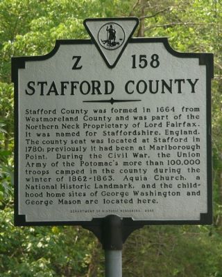
Stafford County. Stafford County was formed in 1664 from Westmoreland County and was part of the Northern Neck Proprietary of Lord Fairfax. It was named for Staffordshire, England. The county seat was located at Stafford in 1780; previously it had been at Marlborough Point. During the Civil War, the Union Army of the Potomac’s more than 100,000 troops camped in the county during the winter of 1862-1863. Aquia Church, a National Historic Landmark, and the childhood home sites of George Washington and George Mason are located here.
Erected 2000 by Department of Historic Resources. (Marker Number Z-158.)
Topics and series. This historical marker is listed in these topic lists: Notable Buildings • Notable Events • Political Subdivisions • War, US Civil. In addition, it is included in the Virginia Department of Historic Resources (DHR) series list. A significant historical date for this entry is July 21, 1861.
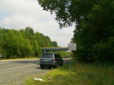
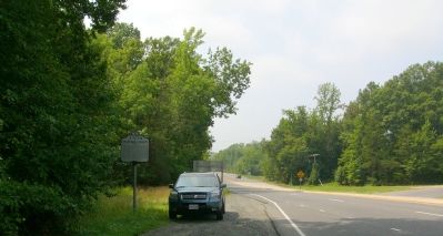
Location. 38° 31.317′ N, 77° 21.548′ W. Marker is near Quantico, Virginia, in Prince William County. Marker is on Jefferson Davis Highway (U.S. Rt 1) 0.1 miles south of Russell Road, on the right when traveling north. Touch for map. Marker is in this post office area: Stafford VA 22554, United States of America. Touch for directions.
Other nearby markers. At least 8 other markers are within 2 miles of this marker, measured as the crow flies. Gracias (approx. 0.8 miles away); Nolan H. Gray Reservoir (approx. 1.2 miles away); Fourth Marine Division Association Memorial (approx. 1.3 miles away); The ‘Striking Sixth’ Memorial (approx. 1.3 miles away); Edson's Raiders (approx. 1.3 miles away); U.S. Servicemen and Women Held Prisoner by Terrorists Memorial (approx. 1.4 miles away); Commonwealth of Virginia Memorial (approx. 1.4 miles away); Purple Heart Memorial (approx. 1.4 miles away).
More about this marker. The Marker identifies Prince William County on its south face, and Stafford County on its north face.
Credits. This page was last revised on October 7, 2023. It was originally submitted on August 24, 2007, by Kevin W. of Stafford, Virginia. This page has been viewed 1,546 times since then and 50 times this year. Last updated on October 3, 2023, by N. Jozsa of Woodbridge, Virginia. Photos: 1, 2, 3, 4. submitted on August 24, 2007, by Kevin W. of Stafford, Virginia. • Bill Pfingsten was the editor who published this page.


