Near Kermit in Winkler County, Texas — The American South (West South Central)
Blue Mountain
(Elevation 3,500 ft.)
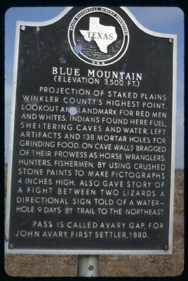
Original Marker – See photo #1
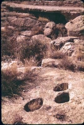
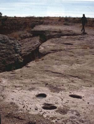
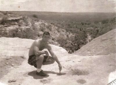
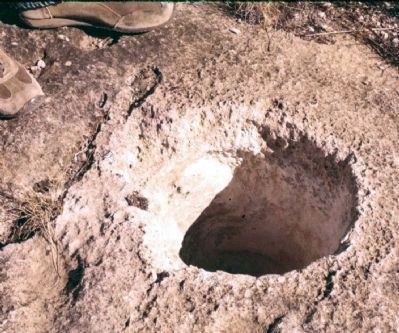
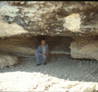
Projection of Staked Plains. Winkler County's highest point. Lookout and landmark for red men and whites. Indians found here fuel, sheltering caves and water. Left artifacts and 138 mortar holes for grinding food. On cave walls bragged of their prowess as horse wranglers, hunters, fishermen by using crushed stone paints to make pictographs 4 inches high. Also gave story of a fight between two lizards. A directional sign told of a water-hole 9 days by trail to the northeast. Pass is called Avary Gap, for John Avary, first settler, 1880.
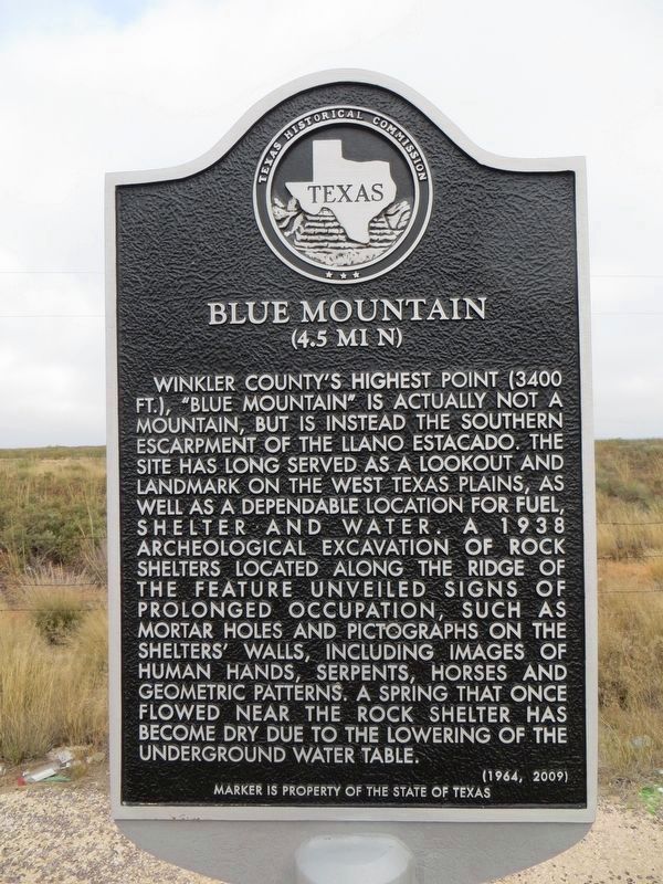
Replacement Marker – See photo #2
Blue Mountain
(4.5 mi N)
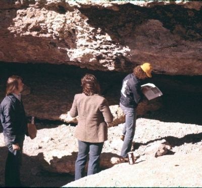
Winkler County's highest point (3400 Ft.), “Blue Mountain” is actually not a mountain, but is instead the southern escarpment of the Llano Estacado. The site has long served as a lookout and landmark on the west Texas plains, as well as a dependable location for fuel, shelter and water. A 1938 Archeological excavation of rock shelters located along the ridge of the feature unveiled signs of prolonged occupation, such as mortar holes and pictographs on the shelters' walls, including images of human hands, serpents, horses and geometric patterns. A spring that once flowed near the rock shelter has become dry due to the lowering of the underground water table.
Erected 1964 by State Historical Survey Committee. (Marker Number 439.)
Topics. This historical marker is listed in these topic lists: Anthropology & Archaeology • Native Americans • Notable Places. A significant historical year for this entry is 1880.
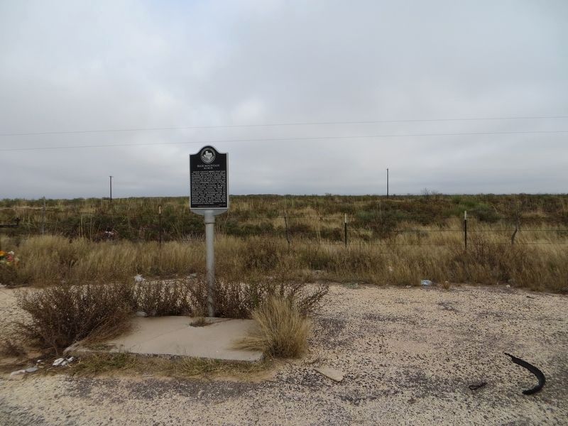
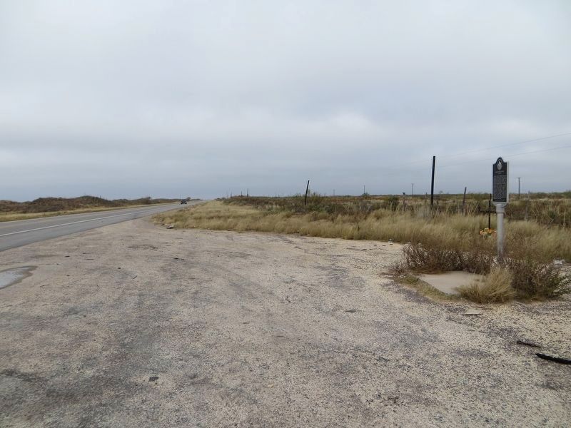
Location. 31° 53.587′ N, 102° 51.456′ W. Marker is near Kermit, Texas, in Winkler County. Marker is on State Highway 302, 14 miles State Route 18, on the left when traveling east. From Kermit, take SH 302 East about 14 miles. Touch for map. Marker is in this post office area: Kermit TX 79745, United States of America. Touch for directions.
Other nearby markers. At least 2 other markers are within 8 miles of this marker, measured as the crow flies. Notrees (approx. 6.2 miles away); The Sand Hills (approx. 7.9 miles away).
More about this marker. Photo of marker was taken in 1980. That marker has, I believe, been replaced with a new marker, sans bullet holes, and with slightly re-worded text that reads: "Blue Mountain (4.5 Mi. North), Winkler County's highest point (3500 ft.), Blue Mountain has long served as a lookout and landmark on the west Texas plains. Here Indians found fuel, sheltering caves, and water. They left artifacts in the caves and pictographs on the cave walls that boasted their prowess as horse wranglers, hunters, and fishermen. A directional sign told of a water hole nine days by trail to the northeast. Pictographs also told the story of a fight between two lizards.
The pass is called Avary Gap for John Avary, who first settled the area in 1880."
Additional commentary.
1. State of pictographs
Even in 1980 the pictographs were in very bad condition. Those interested are referred to Kirkland & Newcomb's book, "The Rock Art of Texas Indians" which includes watercolors of the pictographs done in the 1930s.
— Submitted August 16, 2009, by Richard Denney of Austin, Texas.
2. Camping memories from Blue Mountain
My buddies and I camped under the main overhang six or seven times between 1967 and 1970. We were very careful to not harm the petroglyphs--we stood in awe of them and wondered what the meant. A couple of morons had already spray painted their names on top of the Indian's paintings. We called the mortar holes metate holes, the Spanish name. Where a big chunk of rock broke off centuries ago there is an easy stepdown to the camping area under the overhang. The flint knappers would sit and look over the lowland watching for game and manufacturing new projectile points. There is no natural flint close by, but that spot was ankle deep in flint flakes. Most people don't know it, but their is a second smaller campsite and overhang not quite a mile around the curve of the caprock. From the top of the first site, on a clear day you can see the mountains in Mexico to the south.
— Submitted May 9, 2014, by Doug Macfarline of Fort Worth, Texas.
3. Private Property
Blue Mountain sits on private property. It is not for public use and is monitored by satellite and drones regularly.
— Submitted June 30, 2023.
Additional keywords. Pictographs Llano Estacado (or Staked Plains)
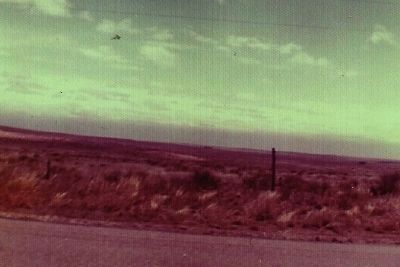
Photographed By Doug Macfarline, June 4, 1969
7. Blue Mountain Marker
This is about 10 miles from Blue Mountain. Note the blue line at the horizon, that is Blue Mountain looming up in the summer haze. Thus the name. The caprock (that high ground) at it's maximum is only 300 feet higher than the basin floor.
Credits. This page was last revised on July 1, 2023. It was originally submitted on August 16, 2009, by Richard Denney of Austin, Texas. This page has been viewed 3,275 times since then and 189 times this year. Photos: 1. submitted on August 16, 2009, by Richard Denney of Austin, Texas. 2, 3, 4. submitted on November 16, 2017, by Bill Kirchner of Tucson, Arizona. 5, 6. submitted on August 16, 2009, by Richard Denney of Austin, Texas. 7. submitted on July 20, 2015, by Doug Macfarline of Fort Worth, Texas. 8. submitted on September 27, 2015, by Doug Macfarline of Fort Worth, Texas. 9, 10, 11. submitted on August 16, 2009, by Richard Denney of Austin, Texas. • Bill Pfingsten was the editor who published this page.
