Fort Story in Virginia Beach, Virginia — The American South (Mid-Atlantic)
Battle of the Capes
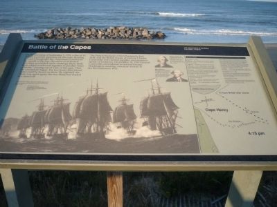
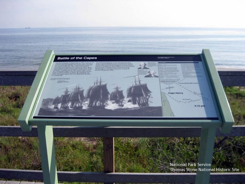
On the morning of September 5, 1781, a line of 19 British warships appeared off this cape, headed for Chesapeake Bay. Surprised at anchor in the mouth of the bay, the crews of 24 French warships scrambled out to challenge them. Both fleets sailed southward together in parallel “lines of battle,” passing out of view of the cape. Then the cannonade began. For two hours, their broadsides could be heard on shore. By nightfall, the shore was quiet again; the two fleets had dueled to a stand-off.
The French blockade of the Chesapeake had held, and the British troops of General Charles Cornwallis were denied supplies and reinforcements at Yorktown. On October 19, 1781, General Cornwallis surrendered to General George Washington, assuring America victory in the Revolutionary War.
“If the enemy remain only a few Weeks superior at sea, our insular and detached situation will become very critical,” Sir Henry Clinton, Commander in chief of British forces in North America, September, June 9, 1781.
[Background image of ships in line taken from the Second Battle of the Virginia Capes painting by Wladimir Zveguintzoff, aka V. Zveg, U.S. Naval Historical Center, Washington, DC.]
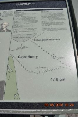
[Time line, with a chart of the waters off Cape Henry showing the relative positions of the French and British fleets on October 5, 1781.]
“A Line of Battle:”
November 5, 1781
9:30 a.m. The British lookout ship Solebay sites the French at anchor at the mouth of the Chesapeake.
11:00 a.m. The French identify the British.
12:00 noon. With 1,900 sailors still unloading troops and supplies on the James River, the French put to sea short-handed.
2:00 p.m. As the British approach the shoals of the Middle Ground, Admiral Graves orders the fleet to turn in unison, maintaining a line of battle parallel to the British.
2:30 p.m. From mid-formation Graves signals for the front of his line to angle towards the French.
4:03 p.m. Graves signals attack, and veers his flagship London toward the French.
4:15 p.m. The leading ships of both fleets open fire.
4:15 to 6:30 p. m. Before the British can bring their cannon to bear, French seaman gunners fire diagonally into their masts and rigging. The French Diademe, fourth in line nearly succeeds in boarding the British Princess but is repelled. The captain of the French Reflechi, fifth in line, dies in a broadside. The British Terrible is damaged beyond repair.
6:30 p.m. With the rear squadrons still too far apart to exchange fire, the cannonade ends.
September 6-9, 1781
The fleets feint southward without further battle. French Admiral de Grasse slips from the British and heads back north to the Chesapeake.
September 13, 1781
The British fleet returns to the Chesapeake to find it blocked by the French. Admiral Graves orders a return to New York.
[Portrait of de Grasse.] Admiral Comte de Grasse sails north in aid of the Americans at Yorktown with cash, ground troops, and the entire fleet of the French West Indies.
[Portrait of Graves.] Rear Admiral Charles Graves passed up chances to attack the French at anchor and waited for both fleets to get into position before beginning the battle.
Erected by U.S. Department of the Army, Fort Story, Virginia.
Topics and series. This historical marker is listed in these topic lists: Military • Notable Events • War, US Revolutionary • Waterways & Vessels. In addition, it is included in the Former U.S. Presidents: #01 George Washington, and the The Washington-Rochambeau Route series lists. A significant historical date for this entry is June 9, 1861.
Location. 36° 55.711′ N, 76° 0.543′ W. Marker is in Virginia Beach, Virginia. It is in Fort Story. Follow U.S. 60 (Atlantic Avenue/Shore Road) into the First Landing State Park
and enter the Fort Story military compound. Obtain directions at gate and proceed to the Cape Henry Memorial parking lot - corner of Atlantic Avenue and New Guinea Road on Fort Story. The marker is on the foot path to the beach, north of the Memorial. Touch for map. Marker is at or near this postal address: 600 Atlantic Ave, Virginia Beach VA 23459, United States of America. Touch for directions.
Other nearby markers. At least 8 other markers are within walking distance of this marker. French British Naval Engagement Off the Virginia Capes (a few steps from this marker); François Joseph Paul de Grasse (within shouting distance of this marker); Cape Henry Memorial (within shouting distance of this marker); Battle of the Capes 1781 (within shouting distance of this marker); First Landing (approx. 0.2 miles away); First Public Works Project of the United States Government (approx. 0.2 miles away); History of Cape Henry Lighthouse (approx. 0.2 miles away); British Naval Blockade and Cape Henry Lighthouse / The War of 1812 (approx. 0.2 miles away). Touch for a list and map of all markers in Virginia Beach.
Also see . . .
1. Washington-Rochambeau National Historic Trail, National Park Service. (Submitted on August 19, 2019.)
2. Washington-Rochambeau Revolutionary Route Association, Inc. (Submitted on August 19, 2019.)
Additional keywords. Cape
Henry Memorial; Marine Royal; La Marine militaire de la France; Ville de Paris; Royal Navy; Second Battle of the Virginia Capes; Battle of the Chesapeake.
Photographed By Richard E. Miller, September 27, 2009
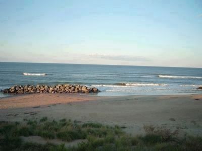
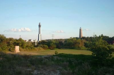
5. View from the beach pathway - toward the Cape Henry Memorial with its monuments
Credits. This page was last revised on February 1, 2023. It was originally submitted on October 9, 2009, by Richard E. Miller of Oxon Hill, Maryland. This page has been viewed 1,954 times since then and 39 times this year. Photos: 1. submitted on October 9, 2009, by Richard E. Miller of Oxon Hill, Maryland. 2. submitted on December 22, 2010, by Sandra Hughes Tidwell of Killen, Alabama, USA. 3. submitted on August 19, 2019. 4, 5. submitted on October 9, 2009, by Richard E. Miller of Oxon Hill, Maryland. • Kevin W. was the editor who published this page.
