St. Marys in Auglaize County, Ohio — The American Midwest (Great Lakes)
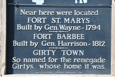
Fort St. Marys / Fort Barbee / Girty Town
Ohio Revolutionary Memorial Trail
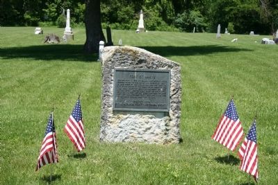
Inscription.
Fort St. Marys
Built by Gen. Wayne-1794
»»««
Fort Barbee
Built by Gen. Harrison-1812
»»««
Girty Town
So named for the renegade
Girtys, whose home it was.
Erected 1930 by Ohio Revolutionary Memorial Commission. (Marker Number C18.)
Topics and series. This historical marker is listed in these topic lists: Forts and Castles • Settlements & Settlers • War of 1812 • Wars, US Indian. In addition, it is included in the Ohio Revolutionary Memorial Commission series list.
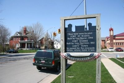
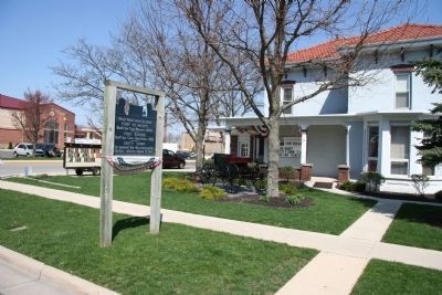
Location. 40° 32.494′ N, 84° 23.491′ W. Marker is in St. Marys, Ohio, in Auglaize County. Marker is on West Spring Street (Ohio Route 703) east of South Wayne Street. Touch for map. Marker is at or near this postal address: 381 West Spring Street, Saint Marys OH 45885, United States of America. Touch for directions.
Other nearby markers. At least 8 other markers are within walking distance of this marker. History of Roof Shingles on Memorial Bridge (approx. ¼ mile away); Memorial Park (approx. ¼ mile away); The headwaters of the St. Marys River lie just southeast of the City of St. Marys. (approx. ¼ mile away); Transportation (approx. ¼ mile away); Saint Marys River (approx. ¼ mile away); Lock 13 Rehabilitation Project (approx. ¼ mile away); The "Short Level" of the Miami and Erie Canal (approx. ¼ mile away); With Honor and Remembrance (approx. ¼ mile away). Touch for a list and map of all markers in St. Marys.
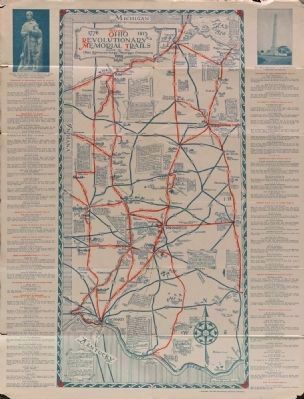
More about this marker. This historical marker is part of the Ohio Revolutionary Memorial Trail series (type C) which was put in place in 1930 to celebrate the 150th anniversary of the Ohio's Revolutionary War era Battle of Piqua, by the Ohio Revolutionary Memorial Commission.
In order to accomplish this, in 1929 the state of Ohio created the Ohio Revolutionary Memorial Commission, and then in 1930 this commission created 22 military trails, throughout western Ohio, between Cincinnati, Ohio on the state's southern border and Toledo, Ohio on the state's northern border. Each of these military trails represented the routes, or trails, used by military leaders during either the Revolutionary War, the Indian Wars of 1790 to 1795, or the War of 1812. Each of these military routes connected various related historical sites, that were marked with Ohio Revolutionary Memorial Commission (type C) markers, along each of the military
trails.
The routes of these military trails were in turn marked by type A and type B Ohio Revolutionary Memorial Commission markers that served as directional (type B) and distance (type A) markers.
Originally, back in 1930, there were erected 70 some of these Ohio Revolutionary Memorial
Commission, type C, markers. To date, there are only 20 some of them that have been located and posted on the Historical Marker database. A number of them are presently missing, but not this marker.
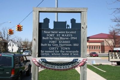
Of the 20 some original markers that have been included in the historical marker database only a small number of them have the original art work, sometimes referred to as silhouettes, across the top of the historical marker. This is a feature that makes these markers quite unique from most other historical markers. This marker is one of those very few markers.
Regarding Fort St. Marys / Fort Barbee / Girty Town. In his book, "The Forts of Ohio" (copyright 2005), author Gary S. Williams states the following:
"The northernmost post on Anthony Wayne's water-based supply route was also selected because the site had been used previously. The current site of the Auglaize County town of St. Marys had been a trading post and village headed by James Girty, a brother of the notorious renegade, Simon Girty. James had been a partner
of Peter Loramie, and had fled to the banks of the St.Mary's River after George Roger Clark's men had destroyed Loramie's Store in 1782."
"From 1783 to 1790, Girty maintained his trading post. He was married to a Shawnee woman, but the village around his post that came to be called Girty's Town was home to members of assorted tribes. Within his palisaded post, Girty traded for furs which he sent up the Maumee Rivers to Detroit. He also served as an unofficial representative of the British, so when Harmar's army approached in 1790, he fled the area."
"When Wayne had Fort St. Marys built on the site in 1795, many referred to it as Fort Girty Town. Fort names were sometimes a generation behind in St. Marys, because when Fort Barbee was built during the War of 1812, many referred to that post as Fort St. Marys."
"Wayne had considered a water route for supplies during the summer of 1794, but it wasn't until a year later that he authorized Henry Burbeck to build a blockhouse to store building supplies at St. Marys. The actual construction of the fort was done in October, 1795, by a detail under the Lieutenant John Michael. After the small fort was completed, the officer in charge was a Lieutenant John Whistler. Whistler had come to America with the British Army during the Revolution and was captured when Burgoyne surrendered at Saratoga. He returned to this
country and took up a military career, as did his son. His grandson, however, took a different path as the painter, James Abbot McNeil Whistler."
"As the first fort on the Lake Erie watershed, Fort St. Marys was where the military stores were transferred from wagons to boats. A crude road was built between Forts Loramie and St. Marys, and at St. Marys boat building became a major activity. Once the new boats were launched they could float to Fort Wayne in seven days in moderate waters, although they tied up at night. At low water, navigation was more difficult, but the issue became moot after the fall of Detroit in 1796."
"The fort was abandoned in 1796. When a new fort was built in 1812, it was located slightly closer to downtown St. Marys, almost adjacent to the old grounds. There is a marker in the Lutheran Cemetery noting the location of Fort St. Marys and an archaeological dig has uncovered several artifacts from the era."
Also see . . . Ohio Revolutionary Memorial Trail System. A description of the Revolutionary Memorial Trail System developed by the state of Ohio in 1929 - 1930. (Submitted on June 30, 2011, by Dale K. Benington of Toledo, Ohio.)
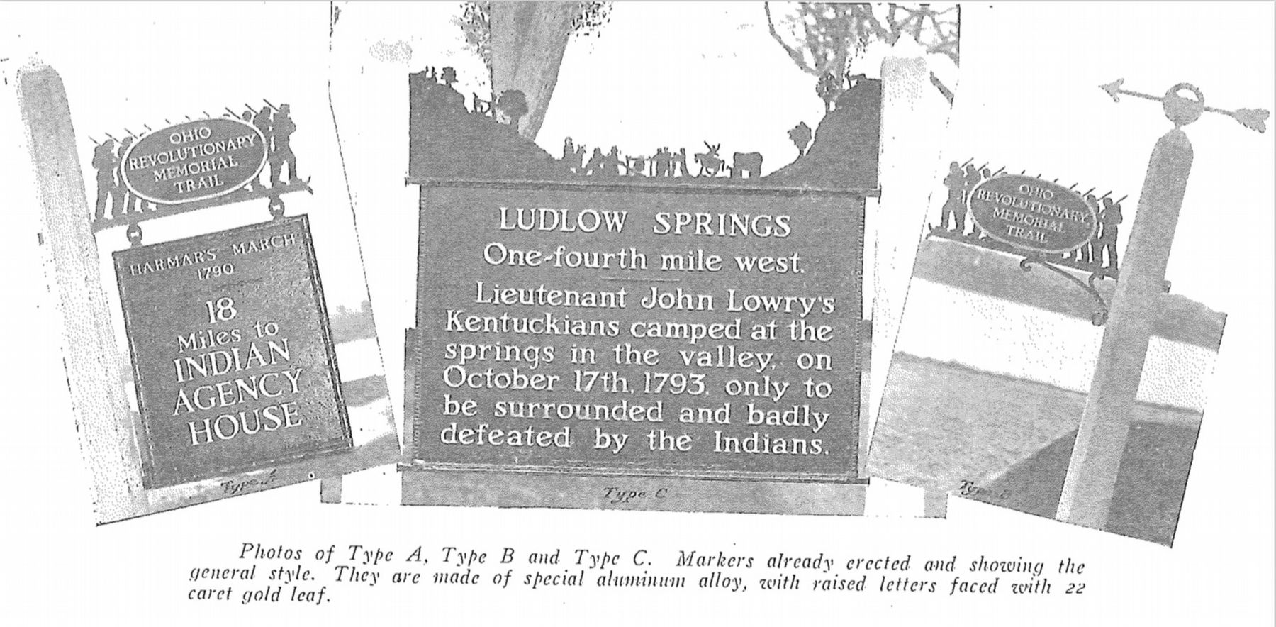
Image provided by Ohio Revolutionary Memorial Commission publication, dated 1931.
8. Ohio Revolutionary Memorial Commission Marker Types
View of the three types of markers used by the Ohio Revolutionary Memorial Commission. The marker on the left is a type A marker, the marker in the middle is a type C (just like our featured marker), and the marker on the right is a type B. For a better view double click on this picture.
Credits. This page was last revised on December 2, 2023. It was originally submitted on April 8, 2010, by Dale K. Benington of Toledo, Ohio. This page has been viewed 4,724 times since then and 105 times this year. Last updated on November 19, 2023, by Craig Doda of Napoleon, Ohio. Photos: 1, 2, 3, 4, 5, 6. submitted on April 8, 2010, by Dale K. Benington of Toledo, Ohio. 7. submitted on September 2, 2014, by Dale K. Benington of Toledo, Ohio. 8. submitted on June 25, 2019, by Dale K. Benington of Toledo, Ohio. • Bill Pfingsten was the editor who published this page.
