Brightwood in Northwest Washington in Washington, District of Columbia — The American Northeast (Mid-Atlantic)
Fort Stevens
Civil War Defenses of Washington
1861-1865
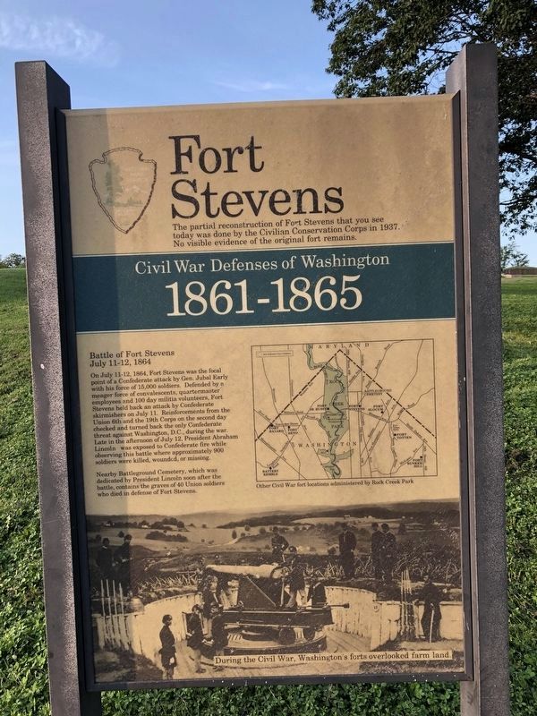
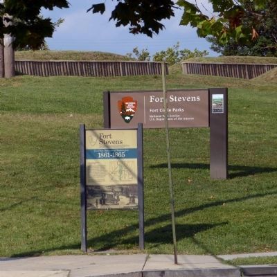
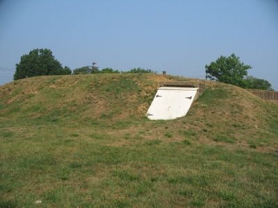
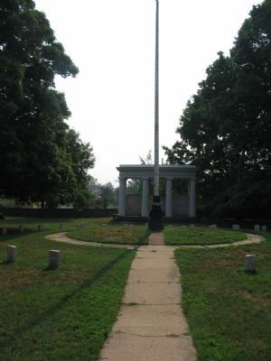
The partial reconstruction of Fort Stevens that you see today was done by the Civilian Conservation Corps in 1937. No visible evidence of the original fort remains.
Battle of Fort Stevens
July 11-12, 1864
On July 11-12, 1864, Fort Stevens was the focal point of a Confederate attack by Gen. Jubal Early with his force of 15,000 soldiers. Defended by a meager force of convalescents, quartermaster employees and 100 day militia volunteers, Fort Stevens held back an attack by Confederate skirmishers on July 11. Reinforcements from the Union 6th and the 19th Corps on the second day checked and turned back the only Confederate threat against Washington, D.C., during the war. Late in the afternoon of July 12, President Abraham Lincoln was exposed to Confederate fire while observing this battle where approximately 900 soldiers were killed, wounded, or missing.
Nearby Battleground Cemetery, which was dedicated by President Lincoln soon after the battle, contains the graves of 40 Union soldiers who died in defense of Fort Stevens.
Erected by National Park Service, U.S. Department of the Interior.
Topics and series. This historical marker is listed in these topic lists: Forts and Castles • War, US Civil. In addition, it is included in the Battlefield Trails - Civil War, the Civilian Conservation Corps (CCC), the Defenses of Washington, and the Former U.S. Presidents: #16 Abraham Lincoln series lists. A significant historical month for this entry is July 1897.
Location. 38° 57.832′ N, 77° 1.774′ W. Marker is in Northwest Washington in Washington, District of Columbia. It is in Brightwood. Marker is at the intersection of 13th Street Northwest and Quakenbos Street Northwest, on the right when traveling north on 13th Street Northwest. Touch for map. Marker is at or near this postal address: 6040 13th Street Northwest, Washington DC 20011, United States of America. Touch for directions.
Other nearby markers. At least 8 other markers are within walking distance of this marker. Aunt Betty's Story (within shouting distance of this marker); “Get Down You Fool” (within shouting distance of this marker); Scale Model of Fort Stevens (within shouting distance of this marker); Lincoln Under Fire at Fort Stevens (about 300 feet away, measured in a direct line); a different marker also named Fort Stevens (about 300 feet away); The Rock on Brightwood Avenue (about 500 feet away); A Streetcar Named Brightwood (about 600 feet away); School Days (approx. 0.2 miles away). Touch for a list and map of all markers in Northwest Washington.
More about this marker. On the right side of the marker is a map showing "Other Civil War fort locations administered by Rock Creek Park." The lower portion of the marker is a photograph from the war of a cannon mounted at one of Washington, DC's forts, "During the Civil War, Washington's forts overlooked farm land." The photograph is of a 100-pdr Parrott Rifled Cannon in place at the nearby Fort Totten during the war.
Related markers. Click here for a list of markers that are related to this marker. Markers for Fort Stevens and related sites.
Also see . . .
1. Battle of Fort Stevens. Battle summary. (Submitted on October 17, 2007, by Craig Swain of Leesburg, Virginia.)
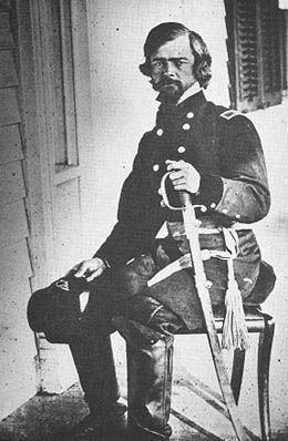
2. Isaac Stevens. (Submitted on March 13, 2011, by Richard E. Miller of Oxon Hill, Maryland.)
Additional commentary.
1. Sharpshooter Tree and Confederate Monument
In addition to the reconstructed Fort Stevens and the Battlefield Cemetery, two other sites related to the battle are worthy of note. Inside Walter Reed Army Medical Center is a stone marker commemorating the site of a tree used by Confederate sharpshooters to fire upon Fort Stevens. Further north on Georgia Avenue at the corner of Grace Church Road, in Silver Spring is a simple granite memorial to honor seventeen Confederates who were killed in the battle.
— Submitted October 17, 2007, by Craig Swain of Leesburg, Virginia.
2. Fort Stevens Particulars
From "Mr. Lincoln's Forts: A Guide to the Civil War Defenses of Washington," by Benjamin Franklin Cooling III and Walton H. Owen II:
Originally built in the late summer of 1861 and named Fort Massachusetts, it had a perimiter of 168 yards with 10 cannon and a 200 man garrison. In September 1862, in the wake of the Confederate invasion of Maryland, the fort was expanded with an additional lunette and a stockaded rear face. The fort was then renamed in honor of General Isaac Stevens, who was killed in action at the Battle of Chantilly.
As expanded the fort was armed with two 8-inch siege howitzers, six 24-pdr siege guns, four 24-pdr seacoast guns, five 30-pdr Parrott rifled cannon, one 10-inch mortar, and one 24-pdr Coehorn mortar. The garrison then numbered 423.
— Submitted October 17, 2007, by Craig Swain of Leesburg, Virginia.
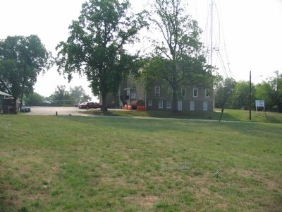
Photographed By Craig Swain, August 4, 2007
5. Location of Original Sections of the Fort
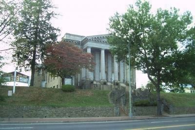
Fort Stevens was originally Fort Massachusetts, constructed in 1861. Later the fort was expanded in September 1862 and renamed Fort Stevens. That original section stood where portions of a United Methodist Church stand today.
Credits. This page was last revised on January 30, 2023. It was originally submitted on October 17, 2007, by Craig Swain of Leesburg, Virginia. This page has been viewed 5,289 times since then and 50 times this year. Photos: 1. submitted on September 19, 2020, by Devry Becker Jones of Washington, District of Columbia. 2. submitted on May 1, 2013, by Allen C. Browne of Silver Spring, Maryland. 3, 4, 5. submitted on October 17, 2007, by Craig Swain of Leesburg, Virginia. 6. submitted on September 24, 2008, by Richard E. Miller of Oxon Hill, Maryland. 7. submitted on March 13, 2011, by Richard E. Miller of Oxon Hill, Maryland. 8. submitted on October 17, 2007, by Craig Swain of Leesburg, Virginia.
