Near El Reno in Canadian County, Oklahoma — The American South (West South Central)
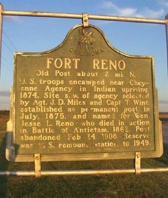
Fort Reno
Old Post about 2 mi. N.
Erected 1950 by Oklahoma Historical Society and State Highway Commission.
Topics and series. This historical marker is listed in this topic list: Forts and Castles. In addition, it is included in the Buffalo Soldiers, and the Oklahoma Historical Society series lists. A significant historical month for this entry is July 1875.
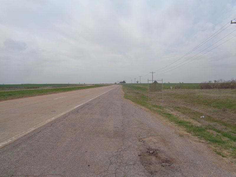
Location. 35° 32.242′ N, 98° 1.566′ W. Marker is near El Reno, Oklahoma, in Canadian County. Marker is on Business Interstate 40 east of Old U.S. 66, on the right when traveling west. Marker is on a roadside pullout, about two miles from Fort Reno (from the east, take old Highway 66 and soon after you'll see the entrance to the Fort Reno site). Touch for map. Marker is in this post office area: El Reno OK 73036, United States of America. Touch for directions.
Other nearby markers. At least 8 other markers are within 2 miles of this marker, measured as the crow flies. The Chisholm Trail and Fort Reno (approx. 1.7 miles away); a different marker also named Fort Reno (approx. 1.7 miles away); School and Chapel/Home of Ben & Moka Clark (approx. 1.7 miles away); 1876 Officers' Quarters (approx. 1.7 miles away); a different marker also named Fort Reno (approx. 1.7 miles away); Commanding Officer's Quarters/BlueSTEM AgriLearning Center (approx. 1.8 miles away); Hospital/USDA ARS Grazinglands Research Laboratory Administration Building (approx. 1.8 miles away); Adjutant Office (approx. 1.8 miles away). Touch for a list and map of all markers in El Reno.
More about this marker. Marker repeats on both sides.
Regarding Fort Reno. Fort Reno, a military camp in 1874, was established to protect the personnel at the Cheyenne & Arapaho Agency. In 1875, the commanding officer was authorized to select a site for a military post. First known as the "Camp Near Cheyenne Agency," the location was named Fort Reno in honor of Major Jesse Reno in 1876. The cavalry and infantry stationed at Fort Reno played an important role in the transition of the area from Indian Territory status through Oklahoma statehood. United States Cavalry units, including the Buffalo Soldiers (the 9th and 10th U.S. Cavalry), and the Cheyenne & Arapaho
Indian Scouts maintained the peace on the central plains until the turn of the century. The Fort Reno troops helped extract the "Boomers" from the Unassigned Lands of Indian Territory prior to their opening for settlement through the 1889 land run. The Fort Reno soldiers also assisted with other land runs in 1892 and 1894.

Internet Archive
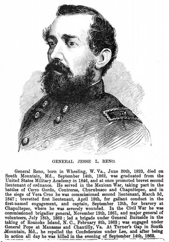
3. General Jesse L. Reno
General Reno, born in Wheeling, W. Va., June 20th, 1823, died on South Mountain, Md., September 14th, 1862, was graduated from the United States Military Academy in 1846, and at once promoted brevet second lieutenant of ordnance. He served in the Mexican War, taking part in the battles of Cerro Gordo, Contreras, Churubusco and Chapultepec, and in the siege of Vera Cruz he was commissioned second lieutenant, March 3d, 1847; brevetted first lieutenant, April 18th, for gallant conduct in the first-named engagement, and captain, September 13th, for bravery at
Chapultepec, where he was severely wounded. In the Civil War he was commissioned brigadier general, November 12th, 1861, and major general of volunteers, July 18th, 1862; led a brigade under General Burnside in the taking of Roanoke Island, N. C., February 8th, 1862; was engaged under General Pope at Manassas and Chantilly, Va. At Turner's Gap in South Mountain, Md., he repelled the Confederates under Lee, and after being in action all day he was killed in the evening of September 14th, 1862.
— Frank Leslie's Scenes and Portraits of the Civil War... by Frank Leslie, 1846, Page 246.
— Frank Leslie's Scenes and Portraits of the Civil War... by Frank Leslie, 1846, Page 246.
Credits. This page was last revised on March 23, 2024. It was originally submitted on January 19, 2011, by Christopher Suttle of Norman, Oklahoma. This page has been viewed 1,464 times since then and 51 times this year. Photos: 1. submitted on January 19, 2011, by Christopher Suttle of Norman, Oklahoma. 2. submitted on April 10, 2021, by Jason Voigt of Glen Carbon, Illinois. 3. submitted on March 23, 2024, by Allen C. Browne of Silver Spring, Maryland. • Bill Pfingsten was the editor who published this page.

