Near Duffield in Scott County, Virginia — The American South (Mid-Atlantic)
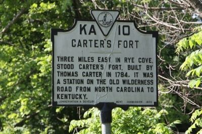
Carterís Fort
Erected 1930 by Conservation & Development Commission. (Marker Number KA-10.)
Topics and series. This historical marker is listed in this topic list: Settlements & Settlers. In addition, it is included in the Virginia Department of Historic Resources (DHR) series list. A significant historical year for this entry is 1784.
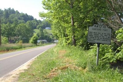
Location. 36° 43.21′ N, 82° 45.182′ W. Marker is near Duffield, Virginia, in Scott County. Marker is on Sunbright Highway (County Route 871) just north of County Route 650, on the right when traveling north. Approaching from the east on U.S 58/23/421, take Route 871 at Glenita to Natural Tunnel. It is a ways beyond the entrance to Natural Tunnel State Park. Touch for map. Marker is in this post office area: Duffield VA 24244, United States of America. Touch for directions.
Other nearby markers. At least 8 other markers are within 7 miles of this marker, measured as the crow flies. The Natural Tunnel Route (approx. 1.4 miles away); a different marker also named Carterís Fort (approx. 1.8 miles away); Speers Ferry (approx. 4Ĺ miles away); Natural Tunnel: Railroading and Recreation (approx. 4.6 miles away); The Copper Creek Railroad Trestles (approx. 4.6 miles away); The Wilderness Road Crossing of the Clinch River (approx. 4.6 miles away); Lee County / Scott County (approx. 4.6 miles away); Donelsonís Indian Line (approx. 6.6 miles away).
More about this marker. What is this 1930 marker doing on a secondary road? Until recently, official Virginia historical markers were only placed on primary roads such as U.S. and Virginia routes. The marker has not been moved. When this marker was placed, this roadway was U.S. 58. It was not until the 1960s that a bypass from Glenita to Dufields straightened out this dogleg, changing this roadway to a secondary road. A marker with this same title, KA-7, is on that bypass, todayís U.S. 23/58/421.
Credits. This page was last revised on January 9, 2022. It was originally submitted on July 10, 2011, by J. J. Prats of Powell, Ohio. This page has been viewed 1,293 times since then and 45 times this year. Photos: 1, 2. submitted on July 10, 2011, by J. J. Prats of Powell, Ohio.

