Near Carlton in Carlton County, Minnesota — The American Midwest (Upper Plains)
Geology of Minnesota
Jay Cooke State Park
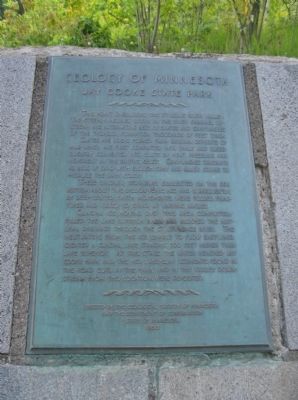
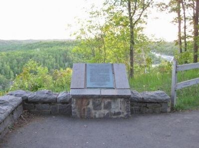
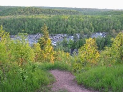
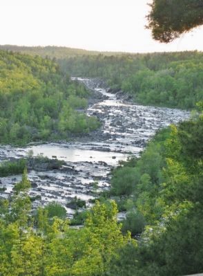
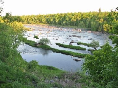
This point overlooks the St. Louis River Valley. The steeply inclined rocks in the river channel upstream are alternating beds of slates and graywackers of the Thompson Formation thousands of feet thick.
Slates are rocks formed from original deposits of mud which are first compacted into shale and subsequently converted into slate by heat, pressure, and movement in the Earth's crust. Graywackers originate as beds of sand with enough gray and black grains to produce the dark color.
These original sediments collected on the sea bottom about two billion years ago and subsequently, by deep-seated Earth movements, were folded, fractured, and tilted to stand at varying angles.
Glacial ice, moving over this area, completely filled the Lake Superior Basin and blocked the natural drainage through the St. Lawrence River. The meltwaters from the ice, unable to flow eastward, created a glacial lake standing 500 feet higher than Lake Superior. At this stage the water reached Jay Cooke Park and the Red Lake-Clay sediments, found in the road cuts in the park and in the valley downstream from this location, were deposited.
and the Department of Conservation
State of Minnesota
1960
Erected 1960 by the Geological Society of Minnesota and the Department of Conservation, State of Minnesota.
Topics and series. This historical marker is listed in this topic list: Natural Features. In addition, it is included in the Minnesota: Geological Society of Minnesota series list. A significant historical year for this entry is 1960.
Location. 46° 39.215′ N, 92° 21.12′ W. Marker is near Carlton, Minnesota, in Carlton County. Marker can be reached from State Highway 210, 3.9 miles east of State Highway 45, on the right when traveling east. Marker is in Jay Cooke State Park; vehicle permit (fee) required. Marker is along a walking trail near the rustic picnic grounds southeast of Forbay Lake. Touch for map. Marker is at or near this postal address: 500 East State Highway 210, Carlton MN 55718, United States of America. Touch for directions.
Other nearby markers. At least 8 other markers are within 9 miles of this marker, measured as the crow flies. Henry C. Hornby (here, next to this marker); Josiah B. Scovell (here, next to this marker); Evergreen Memorial Drive (approx. 2 miles away); Geology of the St. Louis River (approx. 2 miles away); Fond du Lac – Minnesota (approx. 3˝ miles away); Fond du Lac (approx. 3.8 miles away); Gonyea, Verville and National Guardsmen Memorial (approx. 8.6 miles away); Engine 225 (approx. 8.6 miles away). Touch for a list and map of all markers in Carlton.
Also see . . .
1. Jay Cooke State Park. Wikipedia entry. "The river washed away the red clay topsoil and caused this bedrock to become exposed. Underground movements also caused the bedrock to bulge and break, making large protrusions of shale, often at more than 45 degree angles to the ground. Wherever the red clay topsoil has not been eroded, it is almost entirely covered with brush and dense forests." (Submitted on July 16, 2011.)
2. Geology of Minnesota. Wikipedia entry. (Submitted on July 16, 2011.)
Credits. This page was last revised on November 16, 2020. It was originally submitted on July 16, 2011, by Keith L of Wisconsin Rapids, Wisconsin. This page has been viewed 1,109 times since then and 11 times this year. Photos: 1, 2, 3, 4, 5. submitted on July 16, 2011, by Keith L of Wisconsin Rapids, Wisconsin.
