Chilhowie in Smyth County, Virginia — The American South (Mid-Atlantic)
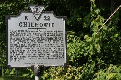
Chilhowie
Erected 2000 by Department of Historic Resources. (Marker Number K-22.)
Topics and series. This historical marker is listed in these topic lists: Colonial Era • Settlements & Settlers. In addition, it is included in the Virginia Department of Historic Resources (DHR) series list. A significant historical year for this entry is 1748.
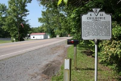
Location. 36° 47.837′ N, 81° 41.064′ W. Marker is in Chilhowie, Virginia, in Smyth County. Marker is on West Lee Highway (U.S. 11) just west of Whitetop Road (Virginia Route 107), on the right when traveling south. Interstate 81’s Exit 35 is Whitetop Road, a couple of blocks from the marker. Touch for map. Marker is at or near this postal address: 276 W Lee Hwy, Chilhowie VA 24319, United States of America. Touch for directions.
Other nearby markers. At least 8 other markers are within 3 miles of this marker, measured as the crow flies. Farthest West, 1750 (here, next to this marker); Town House (a few steps from this marker); a different marker also named Chilhowie (approx. 0.2 miles away); Transportation Through the Ages (approx. 0.2 miles away); Chilhowie Methodist Episcopal Church (approx. 0.4 miles away); Sulphur Springs Church and Campground (approx. ¾ mile away); Smyth County / Washington County (approx. 1.1 miles away); William Campbell’s Grave (approx. 2½ miles away). Touch for a list and map of all markers in Chilhowie.
More about this marker. This marker replaced a 1940 marker with the same name and number which read, “An Indian name meaning ‘Valley of Many Deer.’ Land was patented here by Colonel James Patton, 1746; Samuel Stalnaker, first settler, built a home here in 1750. In 1804 Robert Gannaway came here and in 1815 opened Chilhowie Springs. When the railroad came the town was called Greever’s Switch, later changed to Chilhowie. It was incorporated, 1913.”
Credits. This page was last revised on July 9, 2021. It was originally submitted on August 7, 2011, by J. J. Prats of Powell, Ohio. This page has been viewed 1,229 times since then and 78 times this year. Photos: 1, 2. submitted on August 7, 2011, by J. J. Prats of Powell, Ohio.

