Marker Logo HMdb.org THE HISTORICAL
MARKER DATABASE
“Bite-Size Bits of Local, National, and Global History”
Near Capitan in Lincoln County, New Mexico — The American Mountains (Southwest)
 

Capitán

Population 1400 -- Elevation 6350 Ft.


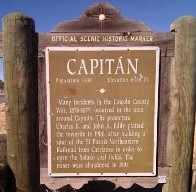
Capitán Marker image. Click for full size.
Photographed By Gregory Walker, November 23, 2010
1. Capitán Marker
Inscription. Many incidents in the Lincoln County War, 1876-1879, occurred in the area around Capitan. The promoters Charles B. and John A. Eddy platted the townsite in 1900, after building a spur of the El Paso & Northeastern Railroad from Carrizozo in order to open the Salado coal fields. The mines were abandoned in 1901.
 
Topics. This historical marker is listed in these topic lists: Railroads & StreetcarsSettlements & Settlers. A significant historical year for this entry is 1900.
 
Location. 33° 32.706′ N, 105° 33.983′ W. Marker is near Capitan, New Mexico, in Lincoln County. Marker is on Smokey Bear Boulevard (U.S. 380 at milepost 85.5), on the right when traveling west. Touch for map. Marker is in this post office area: Capitan NM 88316, United States of America. Touch for directions.
 
Other nearby markers. At least 8 other markers are within 5 miles of this marker, measured as the crow flies. Smokey Bear Historical Park (approx. 0.4 miles away); Smokey Bear (approx. half a mile away); a different marker also named Capitán (approx. 1.1 miles away); a different marker also named Capitán (approx. 2 miles away); Japanese Segregation Camp No. 1 (approx. 4 miles away); CCC Camp/German Internment Camp (approx. 4.1 miles away); Chapel (approx. 4.1 miles away); Officer's Quarters (approx. 4.1 miles away). Touch for a list and map of all markers in Capitan.
 
Paid Advertisement
Click on the ad for more information.
Please report objectionable advertising to the Editor.
Click or scan to see
this page online
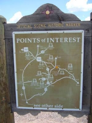
<i>Back of</i> Capitán Marker image. Click for full size.
Photographed By Bill Kirchner, July 24, 2011
2. Back of Capitán Marker
Points of Interest
New Mexico's Historic Markers typically have a map on the back side showing the location of other OSHM's. This is an excellent source of information when exploring for other Historical Markers and locations.
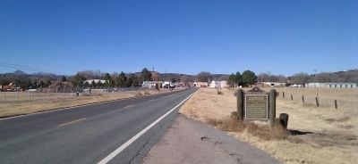
Location of Capitan Marker image. Click for full size.
Photographed By Gregory Walker, November 23, 2010
3. Location of Capitan Marker
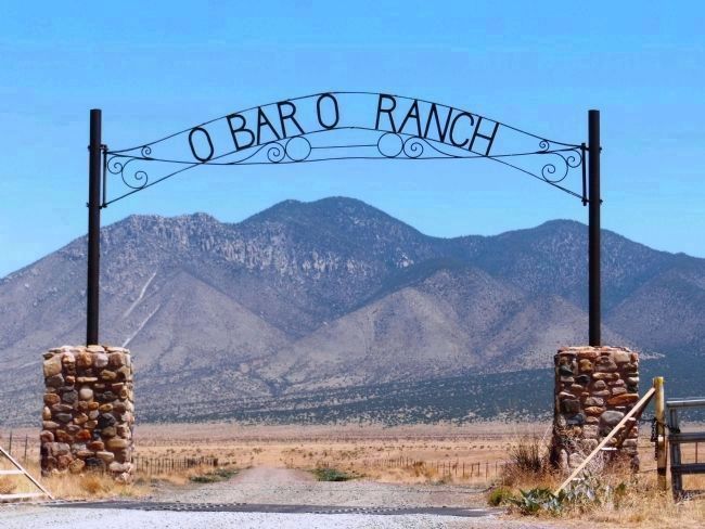
Carrizo Peak, framed by O-Bar-O Ranch Entrance, Capitan, New Mexico image. Click for full size.
Photographed By Cosmos Mariner, June 10, 2013
4. Carrizo Peak, framed by O-Bar-O Ranch Entrance, Capitan, New Mexico

Carrizo Peak is the dominating landmark in the area. It is the highest mountain in the Sacramento Mountains north of US 380, and is within the Lincoln National Forest.
 
 
Credits. This page was last revised on June 16, 2016. It was originally submitted on November 27, 2010, by Gregory Walker of La Grange, Texas. This page has been viewed 1,050 times since then and 92 times this year. Last updated on August 10, 2011, by Bill Kirchner of Tucson, Arizona. Photos:   1. submitted on November 27, 2010, by Gregory Walker of La Grange, Texas.   2. submitted on August 10, 2011, by Bill Kirchner of Tucson, Arizona.   3. submitted on November 27, 2010, by Gregory Walker of La Grange, Texas.   4. submitted on November 25, 2014, by Cosmos Mariner of Cape Canaveral, Florida. • Syd Whittle was the editor who published this page.
Share this page.  
Share on Tumblr
m=45949

CeraNet Cloud Computing sponsors the Historical Marker Database.
This website earns income from purchases you make after using our links to Amazon.com. We appreciate your support.
Paid Advertisement
Apr. 19, 2024