Ashland in Ashland County, Wisconsin — The American Midwest (Great Lakes)
Schooner Lucerne
Historic Shipwreck
— Wisconsin’s Maritime Trails —
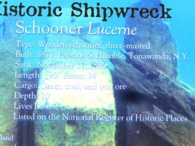
Type: Wooden Schooner, three-masted
Built: 1873, Parsons & Humble, Tonawanda, N.Y.
Sank: November 17, 1886
Length: 195’ Beam: 34’
Cargo: Grain, coal, and iron ore
Depth: 20’
Lives Lost: 9
Listed on the National Register of Historic Places
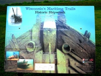
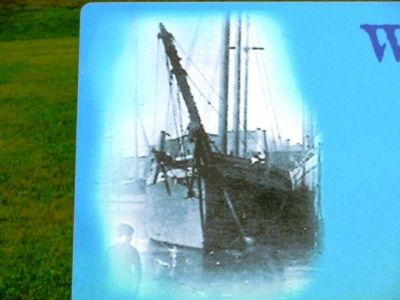
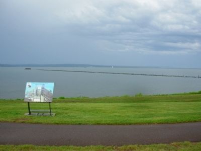
About 200 yards off Long Island, in 20 feet of water, lies the wreck of the Lucerne. In her day, the three-masted wooden schooner was one of the largest and sturdiest vessels on the Great Lakes.
The barometer indicated good weather when the Lucerne left Ashland the night of Nov. 15, 1886. The big ship was loaded with 1,256 tons of Gogebic ore and bound for Cleveland. It was supposed to be her last run of the season. It turned out to be her last run ever.
The Lucerne was well on her way along the hazardous coastline of Michigan’s Upper Peninsula when a vicious northeast gale swept across the lake. The following day, she was spotted rolling and pitching under full sail off Ontonagon, Mich., about halfway to Copper Harbor at the tip of the Keweenaw Peninsula. Around dusk that day, in heavy snow squalls and gale-force winds, Captain George L. Lloyd gave the command to turn back toward the shelter of Chequamegon Bay.
She nearly made it. On the morning of November 19, 1886, the keeper of the La Pointe Lighthouse discovered the Lucerne's masts jutting out of the water near shore. Three bodies were lashed to the rigging and covered in ice. Captain Lloyd had been unable to find the entrance to Chequamegon Bay and dropped anchor, hoping to ride out the blinding storm. The men had climbed the masts to escape Lake Superior’s freezing water. Two other bodies washed ashore. No one survived, and several crew members were never found.
Erected by Wisconsin Historical Society.
Topics and series. This historical marker is listed in this topic list: Waterways & Vessels. In addition, it is included in the Wisconsin’s Maritime Trails series list. A significant historical date for this entry is November 17, 1886.
Location. 46° 36.114′ N, 90° 51.947′ W. Marker is in Ashland, Wisconsin, in Ashland County. Marker can be reached from Lake Shore Drive East (U.S. 2) 0.1 miles east of 15th Avenue East. Located in the park on the north side of U.S. 2. Touch for map. Marker is at or near this postal address: 1600 E US Hwy 2, Ashland WI 54806, United States of America. Touch for directions.
Other nearby markers. At least 8 other markers are within 5 miles of this marker, measured as the crow flies. Fleet Admiral William D. Leahy (about 700 feet away, measured in a direct line); Doctor Edwin Ellis (approx. 0.7 miles away); Security Savings Bank (approx. 1.2 miles away); Northland College (approx.
1˝ miles away); Radisson-Groseilliers Fort (approx. 2.9 miles away); Voices in the Mist (approx. 3˝ miles away); Lands Along the Lake (approx. 3˝ miles away); Washburn Historic Waterfront (approx. 4.8 miles away). Touch for a list and map of all markers in Ashland.
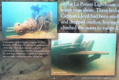
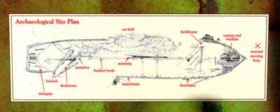
More about this marker. On the lower left are an "Archaeological Site Plan" and photos of the "Capstan" and "Lucerne’s bow" with the caption, "Underwater archaeologists prepare detailed drawings of the Lucerne during an investigation of the site. This study provides a wealth of information about nineteenth-century maritime life and ship construction, while assisting in the management and preservation of the site." Underwater photos by Tamara Thomsen
Additional keywords. Shipwrecks Schooner Lucerne | Schooner Lucerne
Credits. This page was last revised on November 12, 2022. It was originally submitted on September 7, 2011, by Paul Fehrenbach of Germantown, Wisconsin. This page has been viewed 1,329 times since then and 34 times this year. Last updated on November 12, 2022, by Devon Polzar of Port Washington, Wisconsin. Photos: 1, 2, 3, 4, 5, 6, 7. submitted on September 7, 2011, by Paul Fehrenbach of Germantown, Wisconsin. • J. Makali Bruton was the editor who published this page.
