Wrightsville in York County, Pennsylvania — The American Northeast (Mid-Atlantic)
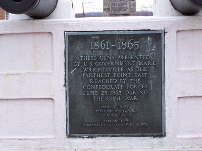
1861 - 1865
Dedicated by Post No. 270 G.A.R. July 4, 1900
Replaced by Wrightsville Rotary Club 1954
Topics and series. This historical marker is listed in these topic lists: Landmarks • Military • Notable Events • War, US Civil. In addition, it is included in the Rotary International series list. A significant historical date for this entry is June 28, 1863.
Location. 40° 1.502′ N, 76° 32.03′ W. Marker is in Wrightsville, Pennsylvania, in York County. Marker is at the intersection of N. Fourth Street and Lincoln Highway (Pennsylvania Route 462), in the median on N. Fourth Street. Touch for map. Marker is in this post office area: Wrightsville PA 17368, United States of America. Touch for directions.
Other nearby markers. At least 8 other markers are within walking distance of this marker. Flame of Freedom (a few steps from this marker); U.S.S. Maine Memorial (a few steps from this marker); Ham, Eggs, and Confederates (about 500 feet away, measured in a direct line); The Union Cemetery (approx. 0.2 miles away); Veterans Memorial (approx. 0.2 miles away); Springetsbury Manor (approx. ¼ mile away); Wrightsville (approx. ¼ mile away); American Legion Monument (approx. ¼ mile away). Touch for a list and map of all markers in Wrightsville.
Also see . . . A Tour of Wrightsville. Historian Scott Mingus hosts a tour of Wrightsville discussion the battle fought there on June 28, 1863. In this, part 4 of 7, he provides details of the artillery used in the battle. Note the memorial seen in the background of his videos. (Submitted on June 12, 2010, by Craig Swain of Leesburg, Virginia.)

Photographed By Beverly Pfingsten, January 26, 2008
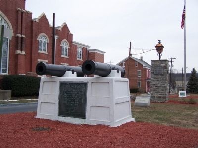
2. Full view of monument.
Flame of Freedom and USS Maine markers in the background. The cannons on the monument are 24-pdr Flank Defense Howitzers, Model 1844. These were typically used only in fortifications to guard entrance ways and side approaches.
Credits. This page was last revised on May 10, 2021. It was originally submitted on January 30, 2008, by Bill Pfingsten of Bel Air, Maryland. This page has been viewed 1,437 times since then and 16 times this year. Last updated on May 9, 2021, by Carl Gordon Moore Jr. of North East, Maryland. Photos: 1, 2. submitted on January 30, 2008, by Bill Pfingsten of Bel Air, Maryland. 3. submitted on July 13, 2010, by Eric Milask of Cherry Hill, New Jersey. • J. Makali Bruton was the editor who published this page.

