California Hill
Nebraska Historical Marker
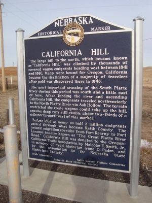
The large hill to the north, which became known as “California Hill,” was climbed by thousands of covered wagon emigrants heading west between 1841 and 1860. Many were bound for Oregon. California became the destination of the majority of travelers after gold was discovered there in 1848.
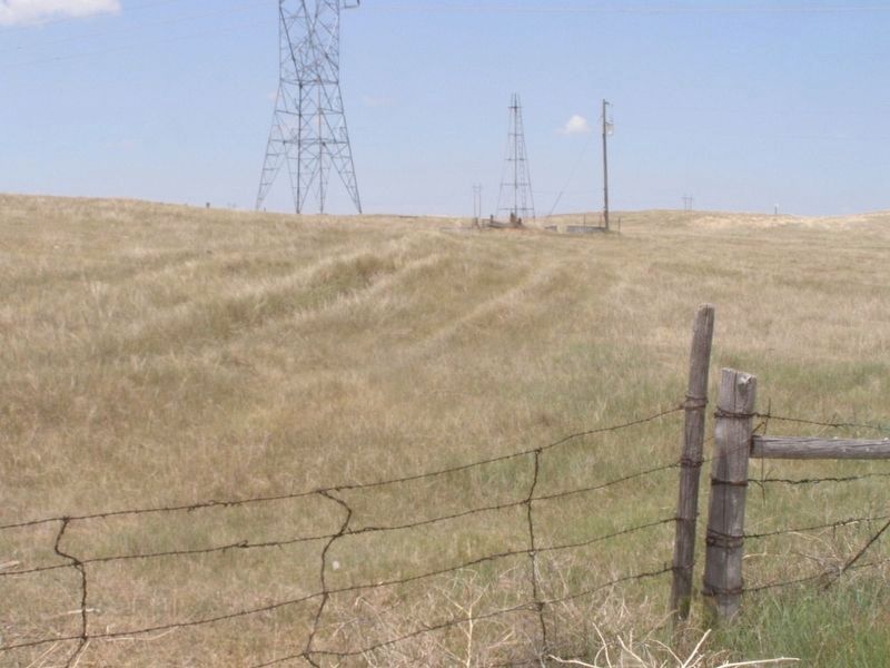
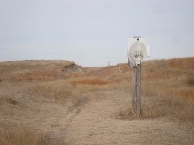
The most important crossing of the South Platte River during this period was south and a little east of here. After fording the river and ascending California Hill, the emigrants traveled northwesterly to the North Platte River via Ash Hollow. The terrain restricted the route wagons could take up the hill, causing deep ruts still visible about two-thirds of a mile north-northwest of this marker.
Before 1867 as many as half a million emigrants passed through what became Keith County. The natural migration corridor from Fort Kearney to Fort Larimie became known as “The Great Platte River Road.” California Hill was donated to the Oregon-California Trails Association by Malcolm E. Smith, Jr. in memory of trail historian Irene D. Paden, and by the association to the Nebraska Historical Society.
Erected by Brule Community/Keith County Visitors Committee/Nebraska State Historical Society. (Marker Number 313.)
Topics and series. This historical marker is listed in this topic
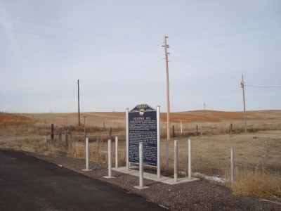
Location. 41° 5.46′ N, 101° 58.732′ W. Marker is in Brule, Nebraska, in Keith County. Marker is at the intersection of U.S. 30 and Road West Mn on U.S. 30. This marker is approximately 4 miles west of Brule. Touch for map. Marker is in this post office area: Brule NE 69127, United States of America. Touch for directions.
Other nearby markers. At least 8 other markers are within 6 miles of this marker, measured as the crow flies. Oregon Trail (approx. half a mile away); Diamond Springs Station (approx. 3.9 miles away); The Pony Express (approx. 5.3 miles away); Phelps Hotel (approx. 5.3 miles away); Waterman Sod House (approx. 5.4 miles away); Sam Bass and the Big Springs Robbery (approx. 5.4 miles away); The Big Spring (approx. 5.4 miles away); The Lone Tree (approx. 5½ miles away). Touch for a list and map of all markers in Brule.
Also see . . .
1. California Hill. Wikipedia entry (Submitted on March 28, 2021, by Larry Gertner of New York, New York.)
2. The Oregon-California Trails Association. Accociation Website homepage (Submitted on January 1, 2012, by Barry Swackhamer of Brentwood, California.)
Additional keywords. Oregon/California Trail
Credits. This page was last revised on March 28, 2021. It was originally submitted on January 1, 2012, by Barry Swackhamer of Brentwood, California. This page has been viewed 1,490 times since then and 89 times this year. Photos: 1, 2. submitted on January 1, 2012, by Barry Swackhamer of Brentwood, California. 3. submitted on March 28, 2021, by Larry Gertner of New York, New York. 4. submitted on January 1, 2012, by Barry Swackhamer of Brentwood, California. • Bill Pfingsten was the editor who published this page.


