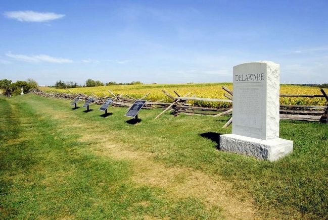
Near Sharpsburg in Washington County, Maryland — The American Northeast (Mid-Atlantic)
Richardson's Division, Second Army Corps
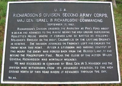
Richardson's Division, Second Army Corps,
Maj. Gen. Israel B. Richardson, commanding
September 17, 1862.
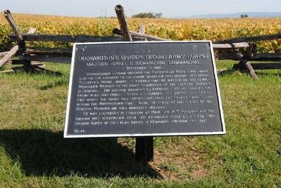
Richardson's Division crossed the Antietam at Pry's Ford about 9:30 a.m. and advanced to the ravine behind the high ground overlooking Roulette's House where it formed line of battle as follows - Meagher's Brigade on the right, Caldwell's on the left and Brooke's in reserve. The division advanced on French's left and engaged the enemy near this point. After a stubborn and varying contest of two hours the enemy was forced back from the Bloody Lane, to and beyond the Hagerstown Pike. Near the close of the action Major General Richardson was mortally wounded.
He was succeeded in command by Brig. Gen. W.S. Hancock and the division was withdrawn, from its advanced position, to the high ground north of this road where it remained through the day.
Erected by Antietam Battlefield Board. (Marker Number 44.)
Topics and series. This historical marker is listed in this topic list: War, US Civil. In addition, it is included in the Antietam Campaign War Department Markers series list. A significant historical date for this entry is September 17, 1862.
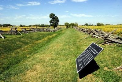
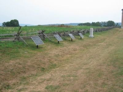
Location. 39° 28.209′ N, 77° 44.246′ W. Marker is near Sharpsburg, Maryland , in Washington County. Marker is on Richardson Avenue, on the left when traveling east. Located at a tablet cluster near the Sunken Road, stop eight on the driving tour of Antietam. Touch for map. Marker is in this post office area: Sharpsburg MD 21782, United States of America. Touch for directions.
Other nearby markers. At least 10 other markers are within walking distance of this marker. Second Army Corps (a few steps from this marker); a different marker also named Second Army Corps (a few steps from this marker); Anderson’s Division, Longstreet’s Command (a few steps from this marker); a different marker also named Second Army Corps (a few steps from this marker); 2nd Delaware (within shouting distance of this marker); Brigadier General George B. Anderson (within shouting distance of this marker); Jackson's Command (about 300 feet away, measured in a direct line); Army of the Potomac (about 400 feet away); September 16, 1862 (about 400 feet away); September 17, 1862 (about 400 feet away). Touch for a list and map of all markers in Sharpsburg.
Regarding Richardson's Division, Second Army Corps. This marker is included on the Sunken Road or Bloody Lane Virtual Tour by Markers see the Virtual tour link below to see the markers in sequence.
Furthermore, all markers and monuments for Richardson's (1st Division, II Army Corps) are grouped under the Related Markers section below.
Related markers. Click here for a list of markers that are related to this marker. Richardson's division markers and monuments
Also see . . .
1. Antietam Battlefield. National Park Service site. (Submitted on February 18, 2008, by Craig Swain of Leesburg, Virginia.)
2. 1st Division, II Corps. The division was composed of three brigades of infantry and three batteries of artillery. (Submitted on February 18, 2008, by Craig Swain of Leesburg, Virginia.)
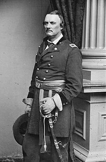
3. Israel B. Richardson. Israel Bush Richardson (December 26, 1815 – November 3, 1862) was a United States Army officer during the Mexican-American War and American Civil War, where he was a major general in the Union Army. Nicknamed "Fighting Dick" for his prowess on the battlefield, he was mortally wounded at the Battle of Antietam near Sharpsburg, Maryland. (Submitted on September 27, 2015, by Brian Scott of Anderson, South Carolina.)
Photographed By Brian Scott
6. Major General Israel B. Richardson (1815-1862)
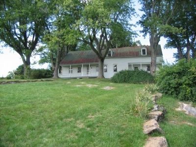
Richardson was treated at a field hospital. His wound was not considered life-threatening, and he was given a room in Maj. Gen. George B. McClellan's headquarters, the Pry House. President Abraham Lincoln paid his respects to the wounded Richardson during a visit to the battlefield in October. However, infection set in, and then pneumonia, which claimed the life of the popular general in early November.
Photographed By Craig Swain, September 17, 2007
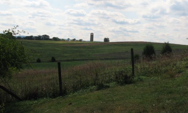
8. Richardson's Division Line of March
Looking south from the Roulette Farm, the observation tower is a reference point indicating the location of the Sunken Road. The division actually swung out to the east to hit the Confederate lines just to the left of, but slightly overlapping the left flank of French's Division.
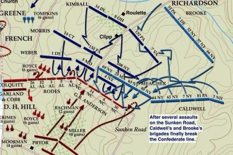
via American Battlefield Trust, unknown
9. Sunken Road or Bloody Lane Virtual Tour by Markers.
A collection of markers interpreting the action of during the Battle of Antietam around the Sunken Road.
(Submitted on February 23, 2008, by Craig Swain of Leesburg, Virginia.)
Click for more information.
(Submitted on February 23, 2008, by Craig Swain of Leesburg, Virginia.)
Click for more information.
Credits. This page was last revised on April 3, 2022. It was originally submitted on February 18, 2008, by Craig Swain of Leesburg, Virginia. This page has been viewed 1,042 times since then and 18 times this year. Photos: 1. submitted on February 18, 2008, by Craig Swain of Leesburg, Virginia. 2, 3. submitted on September 27, 2015, by Brian Scott of Anderson, South Carolina. 4. submitted on February 18, 2008, by Craig Swain of Leesburg, Virginia. 5, 6. submitted on September 27, 2015, by Brian Scott of Anderson, South Carolina. 7, 8. submitted on February 18, 2008, by Craig Swain of Leesburg, Virginia. 9. submitted on April 3, 2022, by Larry Gertner of New York, New York.
