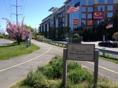
East Falls Church in Arlington in Arlington County, Virginia — The American South (Mid-Atlantic)
East Falls Church
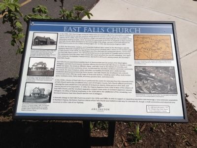
In 1859, the Alexandria, Loudoun, and Hampshire Railroad (later owned by the Washington and Old Dominion Railroad) completed the line from Alexandria to Leesburg with a station on the western edge of Falls Church. In the 1870s, the Washington and Ohio Railroad, the subsequent owners, constructed the East Falls Church station. The railroad provided access to the District of Columbia while insulating the community from the urban lower classes who could not afford the cost of commuting. One upper class residence, the Eastman-Fenwick House, was built in 1876 and is among several still standing in East Falls Church.
East Falls Church experienced another burst of development with the arrival of the Washington, Arlington, and Falls Church electric streetcar offering service from East Falls Church to Rosslyn in 1896. Within ten years, the streetcar offered a cheap, nine-mile route to the District of Columbia, and combined with low land and house prices, transformed the area into a bedroom commuter community. As a result, Isaac Crossman estate and other surrounding farmlands were subdivided into residential developments featuring frame houses. East Falls Church also developed into a vibrant commercial center offering a wide range of shops and services, including a post office, bank, lumber yards, hardware store, livery stable, pharmacy, grocery store, and restaurants.
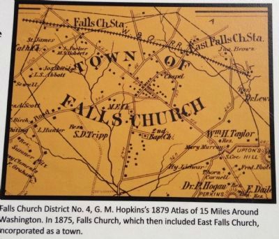
In the 1930s, citizens of East Falls Church petitioned the courts for exclusion from the corporate limits of Falls Church and to be considered only a part of Arlington County. Falls Church officials protested, claiming the town would lose sixty percent of its business district, thirty percent of its land, and twenty percent of its population. In 1936, the Virginia Supreme Court ruled in favor of the citizens of East Falls Church, and the resultant separation created a new sense of eastward expansion towards Arlington. An influx of federal employees in the 1930s led to the subdivision of the remaining rural farmland between East Falls Church and the rest of Arlington.
A dramatic change to East Falls Church
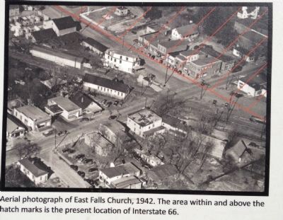
occurred in the 1970s and the 1980s. In order to support an expanding population and encourage a new commuter population in Northern Virginia, the historic business district of East Falls Church was leveled to make way for Interstate 66, though a small automotive and industrial area remained on either side of Lee Highway.
For additional information, visit the Arlington-East Falls Church Civic Association's website.
Erected by Arlington, Virginia.
Topics. This historical marker is listed in these topic lists: Industry & Commerce • Railroads & Streetcars.
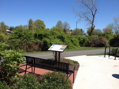
Location. 38° 53.212′ N, 77° 9.661′ W. Marker is in Arlington, Virginia, in Arlington County. It is in East Falls Church. Marker can be reached from the intersection of Langston Boulevard (U.S. 29) and Fairfax Drive, on the right when traveling north. Located near the east end of Washington & Old Dominion Railroad Trail bridge crossing Lee Highway. Touch for map. Marker is in this post office area: Arlington VA 22205, United States of America. Touch for directions.
Other nearby markers. At least 8 other markers are within walking distance of this marker. East Falls Church Station (about 500 feet away, measured in a direct line); Presidential Visit to Falls Church, 1911 (approx. ¼ mile away); Pearson's Funeral Home (approx. ¼ mile away); Original Federal Boundary Stone, District of Columbia, Southwest 9
(approx. 0.3 miles away); Benjamin Banneker Park Playground (approx. 0.3 miles away); Crossman House (approx. 0.4 miles away); Brandymore Castle (approx. half a mile away); Home Hill (approx. half a mile away). Touch for a list and map of all markers in Arlington.
Also see . . . Arlington-East Falls Church Civic Assocition. (Submitted on June 3, 2012, by Craig Swain of Leesburg, Virginia.)
Photographed By Craig Swain, April 7, 2012
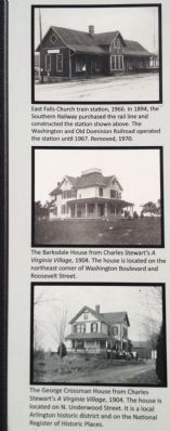
4. Photos on the Left Side of Marker
Top: East Falls Church train station, 1966. In 1894, the Southern Railway purchased the rail line and constructed the station shown above. The Washington and Old Dominion Railroad operated the station until 1967. Removed 1970.
Center: The Barksdale House from Charles Stewart's A Virginia Village, 1904. The house is located on the northeast corner of Washington Boulevard and Roosevelt Street.
Bottom: The George Crossman House from Charles Stewart's A Virginia Village, 1904. The house is located on N. Underwood Street. It is a local Arlington historic district and on the National Register of Historic Places.
Credits. This page was last revised on February 1, 2023. It was originally submitted on June 3, 2012, by Craig Swain of Leesburg, Virginia. This page has been viewed 1,087 times since then and 41 times this year. Photos: 1, 2, 3, 4, 5, 6. submitted on June 3, 2012, by Craig Swain of Leesburg, Virginia.
