Bear Valley in Mariposa County, California — The American West (Pacific Coastal)
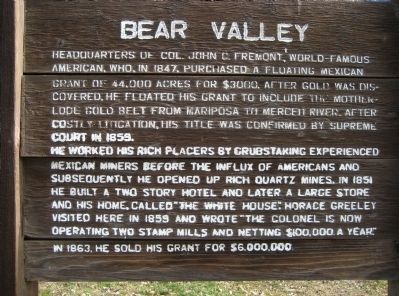
Bear Valley
He worked his rich placers by grubstaking experienced Mexican miners before the influx of Americans and subsequently he opened up rich quartz mines, in 1851. He built a two story hotel and later a large store and his home, called "The White House". Horace Greeley visited here in 1859 and wrote "The colonel is now operating two stamp mills and netting $100,000 a year". In 1863, he sold his grant for $6,000,000.
Topics. This historical marker is listed in these topic lists: Industry & Commerce • Settlements & Settlers. A significant historical year for this entry is 1847.
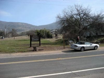
Location. 37° 34.123′ N, 120° 7.132′ W. Marker is in Bear Valley, California, in Mariposa County. Marker is on State Highway 49 south of Bear Valley Road, on the left when traveling south. Touch for map. Marker is in this post office area: Mariposa CA 95338, United States of America. Touch for directions.
Other nearby markers. At least 8 other markers are within 8 miles of this marker, measured as the crow flies. A different marker also named Bear Valley (here, next to this marker); Mrs. E. Trabucco Store (about 500 feet away, measured in a direct line); Fremont’s Fort (approx. 1.4 miles away); May Rock (approx. 2 miles away); Bagby (approx. 3 miles away); La Mineta 1850 - Princeton 1854 - Mount Bullion 1862 (approx. 5.9 miles away); The Townsite of Agua Fria, California (approx. 7.8 miles away); St. Catherine Catholic Church (approx. 7.9 miles away). Touch for a list and map of all markers in Bear Valley.
Credits. This page was last revised on November 6, 2019. It was originally submitted on March 4, 2008, by Richard Wisehart of Sonora, California. This page has been viewed 1,624 times since then and 21 times this year. Photos: 1, 2. submitted on March 4, 2008, by Richard Wisehart of Sonora, California. • Kevin W. was the editor who published this page.

