Near Locust Grove in Orange County, Virginia — The American South (Mid-Atlantic)
“A Wild, Wicked Roar”
The Battle of the Wilderness
— Fredericksburg and Spotsylvania National Military Park —
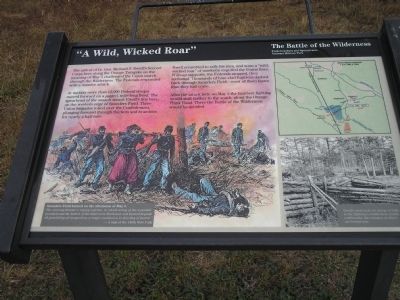
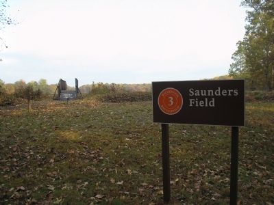
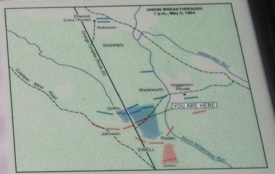
At midday more than 12,000 Federal troops moved forward on a jagged, mile-long front. The spearhead of the assault struck Ewell’s line here, on the western edge of Saunders Field. Three Union brigades rolled over the Confederates, plunging forward through thickets and brambles for nearly a half mile.
Ewell scrambled to rally his men, and soon a “wild, wicked roar” of musketry engulfed the Union lines. Without supports, the Federals stopped, then retreated. Thousands of blue-clad fugitives dashed back through Saunders Field – most of them faster than they had come.
After the attack here on May 5 the heaviest fighting would shift farther to the south, along the Orange Plank Road. There the Battle of the Wilderness would be decided.
Saunders Field burned on the afternoon of May 5.
“The clearing became a raging inferno, in which many of the wounded perished and the bodies of the dead were blackened and burned beyond all possibility of recognition, a tragic conclusion to this day of horror.”
- A man of the 146th New York
Erected by National Park Service, U.S. Department of the Interior.
Topics. This historical marker is listed in this topic list: War, US Civil. A significant historical date for this entry is May 5, 1975.
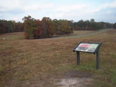
Location. This marker has been replaced by another marker nearby. 38° 18.963′ N, 77° 45.548′ W. Marker is near Locust Grove, Virginia, in Orange County. Marker can be reached from the intersection of Hill-Ewell Drive and Constitution Highway (Virginia Route 20), on the left when traveling south. The marker is in the Wilderness Battlefield, at Stop Three (Saunders Field) on the driving tour. Touch for map. Marker is in this post office area: Locust Grove VA 22508, United States of America. Touch for directions.
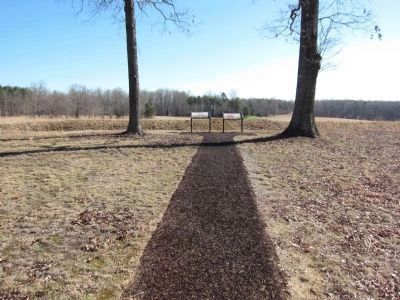
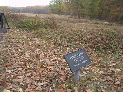
Other nearby markers. At least 8 other markers are within walking distance of this location. The Confederate Line (here, next to this marker); Battle of the Wilderness (a few steps from this marker); a different marker also named "A Wild, Wicked Roar" (about 400 feet away, measured in a direct line); The Confederate Defense (about 400 feet away); 140th New York State Vols. (about 700 feet away); First Blood in Saunders Field (approx. 0.2 miles away); Gordon Flank Attack Trail (approx. 0.2 miles away); a different marker also named The Battle of the Wilderness (approx. 0.2 miles away). Touch for a list and map of all markers in Locust Grove.
More about this marker. In the background
of the marker is a picture of Union soldiers recovering their dead. The upper right of the marker shows a map of the Union Breakthrough of 1 p.m., May 5, 1864. The bottom right of the marker features a photo of an earthwork, with the caption Ewell’s men took advantage of hills in the fighting to build these sturdy earthworks, the remains of which are behind you.
This marker was replaced by a new one also named “A Wild, Wicked Roar” (see nearby markers).
Credits. This page was last revised on September 10, 2020. It was originally submitted on March 6, 2008. This page has been viewed 1,556 times since then and 16 times this year. Last updated on September 5, 2020, by Bradley Owen of Morgantown, West Virginia. Photos: 1, 2. submitted on March 6, 2008, by Bill Coughlin of Woodland Park, New Jersey. 3. submitted on April 7, 2014, by Craig Swain of Leesburg, Virginia. 4, 5, 6, 7. submitted on March 6, 2008, by Bill Coughlin of Woodland Park, New Jersey. • J. Makali Bruton was the editor who published this page.
