Near Spanish Fort in Baldwin County, Alabama — The American South (East South Central)
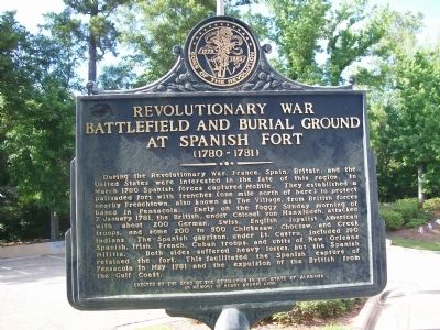
Revolutionary War Battlefield and Burial Ground at Spanish Fort (1780-1781)
Inscription.
During the Revolutionary War, France, Spain, Britain, and the United States were interested in the fate of this region. In March 1780, Spanish forces captured Mobile. They established a palisaded fort with trenches (one mile north of here) to protect nearby Frenchtown, also known as The Village from British forces based in Pensacola. Early on the foggy Sunday morning of 7 January 1781, the British, under Col. von Hanxleden, attacked with about 200 German, Swiss, English, loyalist American troops and some 200 to 500 Chickasaw, Choctaw, and Creek Indians. The Spanish garrison, under Lt. Castro, included 190 Spanish, Irish, French, Cuban troops and units of New Orleans militia. Both sides suffered heavy losses, but the Spanish retained the fort. This facilitated the Spanish capture of Pensacola in May 1781 and the expulsion of the British from the Gulf Coast.
Erected by Sons of the Revolution in the State of Alabama.
Topics. This historical marker is listed in these topic lists: Cemeteries & Burial Sites • Forts and Castles • War, US Revolutionary. A significant historical date for this entry is January 7, 1781.
Location. 30° 39.538′ N, 87° 54.699′ W. Marker is near Spanish Fort, Alabama, in Baldwin County. Marker is at the intersection of Larry Dee Cawyer Drive and Old Spanish Trail (U.S. 98), on the left when traveling north on Larry Dee Cawyer Drive. Located on the grounds of the Eastern Shore Chamber of Commerce. Eastern Shore refers to Eastern Shore of Mobile Bay. Touch for map. Marker is at or near this postal address: 29750 Larry Dee Cawyer Drive, Spanish Fort AL 36527, United States of America. Touch for directions.
Other nearby markers. At least 8 other markers are within walking distance of this marker. “Damn The Torpedoes!” (within shouting distance of this marker); Stop 7 Fort McDermott: (within shouting distance of this marker); Stop 8 The Eighth Iowa Line: (within shouting distance of this marker); Fuller Memorial Park (approx. 0.3 miles away); Union Siege Battery No. 1 (approx. half a mile away); The Eastern Shore Trail (approx. half a mile away); Albert Carey Danner (approx. 0.7 miles away); Confederate Drive (approx. 0.7 miles away). Touch for a list and map of all markers in Spanish Fort.
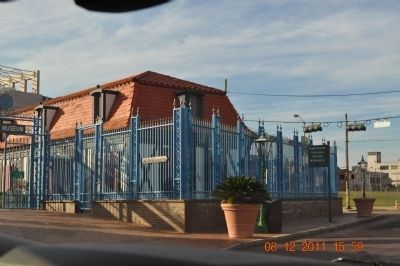
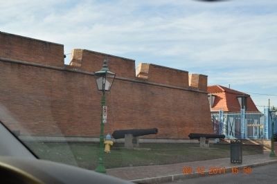
Regarding Revolutionary War Battlefield and Burial Ground at Spanish Fort (1780-1781). Fort Conde is a partial reconstruction of the colonial fort in Mobile.
Photographed By Texmexfla, June 5, 2009
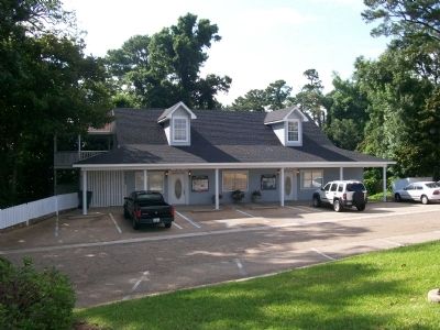
4. Eastern Shore Visitor Center
This photo was taken of the Eastern Shore Visitor Center from the marker location. The visitor center is really the key to finding the location of the marker, because the intersection of a high-speed interstate (I-10) and highway 98/90 is nearby.
Photographed By Texmexfla, June 5, 2009
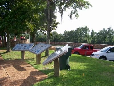
5. Additional Interpretive markers and view of strategic/scenic overlook of Mobile Bay
These interpretive markers relate to the site when the same strategic ground was the scene of conflict between the Union and Confederate armies in the struggle for control of Mobile and Mobile Bay.
Credits. This page was last revised on May 31, 2019. It was originally submitted on June 17, 2009, by Texmexfla of Houston, Texas. This page has been viewed 6,602 times since then and 116 times this year. Last updated on November 28, 2012, by Kevin Vincent of Arlington, Virginia. Photos: 1. submitted on June 18, 2009, by Texmexfla of Houston, Texas. 2, 3. submitted on December 12, 2011, by Sandra Hughes Tidwell of Killen, Alabama, USA. 4, 5. submitted on June 18, 2009, by Texmexfla of Houston, Texas. • Bill Pfingsten was the editor who published this page.
