Near Pine Springs in Culberson County, Texas — The American South (West South Central)
Butterfield Overland Mail
The Pinery Station
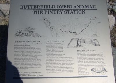
Inscription.
Butterfield Overland Mail
First Overland Mail Route from St. Louis, Missouri to San Francisco, California.
As a forerunner of the Pony Express and Transcontinental Railroad, the Butterfield Overland Mail was the first successful attempt to link East and West with a reliable transportation and communication system. Much of the route in this part of the county followed the well-defined path of thousands of emigrants and gold-seekers traveling westward during the previous decade. The arduous 2,700-mile wilderness journey between St. Louis and San Francisco was always completed within 25 days as stipulated in John Butterfield's federal mail contract.
The six-year federal mail contract awarded to John Butterfield, a wealthy and popular businessman, was cut short by the onset of the Civil War in 1861, yet the Butterfield Overland Mail was heralded by some as one of the "greatest events of the age."
"Remember boys, nothing on God's earth must stop the United States mail!"
-John Butterfield's instructions to his drivers
The Pinery Station
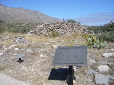
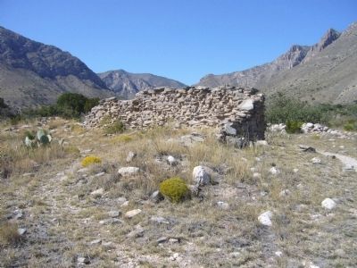
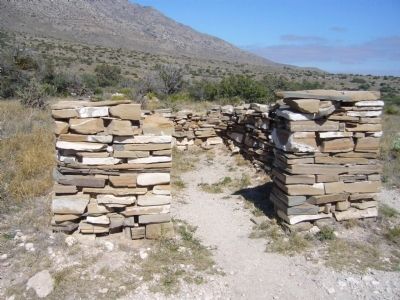
Pinery Station, named for the surrounding stands of pine, has the distinction of being the only ruin of an original company-built, Butterfield station standing in close proximity to a national highway. At 5,700 feet in elevation, it was also the highest, and was especially attractive because of its excellent grazing land and dependable water sources.
Butterfield stations were located an average of 20 miles apart. For eleven months from September 1858 to august 1859, coaches regularly stopped here for water, food, rest, fresh mule teams, and protection. Drivers and passengers kept company with the station keeper, cooks, blacksmith, freighters, gold seekers, adventurers, and settlers. Long after the station was abandoned for a more adequately protected route designed to better serve a chain of forts further south, the limestone walls continued to provide refuge for freighters, soldiers, drovers, outlaws, and emigrants.
The Celerity Coach
Speed was imperative; a Celerity coach traveled day and night averaging 120 miles a day carrying up to nine passengers, essential baggage, and 12,000 letters. Six horses or mules pulled each coach. These coaches, similar to what were later known as mud-wagons due to their low center of gravity, were well adapted to the rough mountains and desert country. They were either painted or varnished red or a dark bottle green. Wire pattern candle lamps provided light inside the leather-lined coaches. One hundred of these wagons were built in 1857 at a cost of $1,500 each and placed in the Butterfield Overland Mail service in 1858.
Topics and series. This historical marker is listed in these topic lists: Communications • Roads & Vehicles. In addition, it is included in the Butterfield Overland Mail series list. A significant historical month for this entry is September 1858.
Location. 31° 53.64′ N, 104° 49.036′ W. Marker is near Pine Springs, Texas, in Culberson County. Marker can be reached from U.S. 62/180, 0.2 miles east of Entrace to Guadalupe Mountains National Park, on the left when traveling east. Marker is a short walk (220 feet) up a path from the parking lot along highway 62. Touch for map. Marker is in this post office area: Salt Flat TX 79847, United States of America. Touch for directions.
Other nearby markers. At least 8 other markers are within 4 miles of this marker, measured as the crow flies. The Airmen (within shouting distance of this marker); Ruins of "The Pinery" or "Pine Spring" Stage Stand (within shouting distance of this marker); Groundbreaking for the Pine Springs Visitor Center (approx. ¼ mile away); The "Committee of Five" (approx. 0.3 miles away); Stephen Tyng Mather (approx. 0.3 miles away); Frijole Historic Site (approx. 1.3 miles away); Frijole School House (approx. 1.3 miles away); Guadalupe Peak (approx. 3.2 miles away). Touch for a list and map of all markers in Pine Springs.
Photographed By Bill Kirchner, October 26, 2012
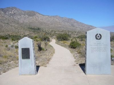
3. The Airmen marker side-by-side with the Pinery marker.
Butterfield Overland Mail / The Pinery Station Marker is a short walk (220 feet) up the path from the Airmen and The Pinery markers. If you look close you can see the marker where the path makes a bend to the left.
Credits. This page was last revised on June 16, 2016. It was originally submitted on November 30, 2012, by Bill Kirchner of Tucson, Arizona. This page has been viewed 735 times since then and 22 times this year. Photos: 1, 2, 3, 4, 5. submitted on November 30, 2012, by Bill Kirchner of Tucson, Arizona. • Bernard Fisher was the editor who published this page.
