Greensboro in Henry County, Indiana — The American Midwest (Great Lakes)
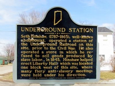
Underground Station
Erected 1976 by Greensboro Women's Auxiliary and Greensboro Corporation. (Marker Number 33.1976.1.)
Topics and series. This historical marker is listed in this topic list: Abolition & Underground RR. In addition, it is included in the Indiana Historical Bureau Markers series list. A significant historical year for this entry is 1843.
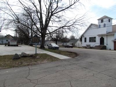
Location. 39° 52.648′ N, 85° 27.875′ W. Marker is in Greensboro, Indiana, in Henry County. Marker is at the intersection of S. High St and E. Main St, on the right when traveling north on S. High St. Touch for map. Marker is in this post office area: Greensboro IN 47344, United States of America. Touch for directions.
Other nearby markers. At least 8 other markers are within 7 miles of this marker, measured as the crow flies. Persian Gulf War Memorial (approx. 6 miles away); William Grose (approx. 6.1 miles away); Gen. William Grose House (approx. 6.1 miles away); USS Hyman DD732 (approx. 6.1 miles away); Judge Joshua H. Mellett (approx. 6.2 miles away); Glen Cove IOOF Cemetery (approx. 6.2 miles away); Civil War Memorial - Henry County Indiana (approx. 6.2 miles away); Henry County Courthouse 1869 / Raintree County (approx. 6.2 miles away).
Also see . . . IHB Review of Marker. The Indiana Historical Bureau in 2010 prepared a preliminary report on the marker for accuracy and relevance. Their preliminary report states, "... while this marker has problems, overall it is significant and much of it is correct. However, it needs much more in-depth research." (Submitted on March 17, 2013, by Duane Hall of Abilene, Texas.)
Credits. This page was last revised on June 16, 2016. It was originally submitted on March 17, 2013, by Duane Hall of Abilene, Texas. This page has been viewed 949 times since then and 26 times this year. Photos: 1, 2. submitted on March 17, 2013, by Duane Hall of Abilene, Texas. • Bill Pfingsten was the editor who published this page.

