Gainesboro in Jackson County, Tennessee — The American South (East South Central)
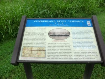
Cumberland River Campaign
Burning of Old Columbus
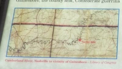
Late in December 1863, Gen. Ulysses S. Grant sent a naval convoy up the river from Nashville to Creelsboro, Ky., on a reconnaissance and supply mission. The U.S. gunboats Reindeer and Silver Lake No. 2 under U.S. Navy Lt. Henry A. Glassford accompanied three transports carrying a detachment of 140 sharpshooters from the 129th Illinois Infantry, under the command of Col. Andrew J. Cropsey. At five locations including Gainesboro, the county seat, Confederate guerrilla bands fired on the convoy as it headed upriver. Tennessee military governor Andrew Johnson had decided to establish a Federal army post there because the town was a base of operations for Confederate partisans in the region. He ordered gunboat commanders not to destroy the town so that the buildings could be used for military purposes. After the Federals occupied Gainesboro, Union forces began to suppress partisan warfare. During a February 1864 raid into the countryside, Col. Henry K. McConnell’s 71st Ohio Infantry pursued two companies of Confederate rangers led by Cols. Oliver P. Hamilton and John M. Hughs. The Federal force arrived at Columbus, where many of the partisans lived and kept their horses. After removing the women, children, and livestock, the Federals burned the village to the ground.
“The country between Carthage and the Cumberland Mountains through which we passed is bordering upon famine. Families without regard to politics are eaten out and plundered by those common enemies of mankind (rangers) until even those formerly wealthy are utterly reduced, and many of the poorer are now actually starving.”
— Col. Henry K. McConnell, 71st Ohio Infantry
“Jackson County was represented to me as the seat of operations of several guerilla bands, and it fully merits its reputation, for we had scarcely touched the county line before guerillas were discovered on the lookout for us.”
— Lt. Henry A. Glassford, USN
(Inscription under the photo in the upper center)
USS Gunboat Silver Lake No. 2, from The Photographic History of the Civil War (1911)
Erected by Tennessee Civil War Trails.
Topics and series. This historical marker is listed in this topic list: War, US Civil. In addition, it is included in the Former U.S. Presidents: #17 Andrew Johnson, and the Tennessee Civil War Trails series lists. A significant historical month for this entry is February 1864.
Location. 36°
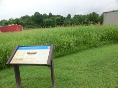
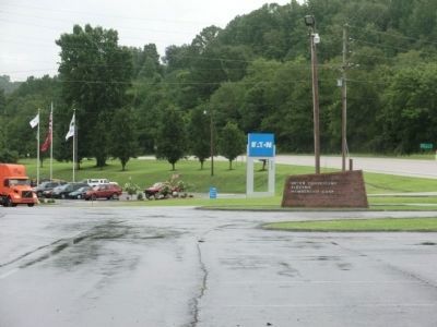
22.667′ N, 85° 38.45′ W. Marker is in Gainesboro, Tennessee, in Jackson County. Marker is on North Grundy Highway north of Dodson Branch Highway, on the left when traveling north. The marker is on the grounds of the Upper Cumberland Electric Membership Corp. Touch for map. Marker is in this post office area: Gainesboro TN 38562, United States of America. Touch for directions.
Other nearby markers. At least 8 other markers are within 7 miles of this marker, measured as the crow flies. The Austin Peay Bridge (approx. ¾ mile away); Confederate Field Hospital (approx. 1.7 miles away); Jamie Dailey (approx. 1.8 miles away); Alvan Cullen Gillem (approx. 1.8 miles away); Michaux's Discovery (approx. 1.9 miles away); Orion Clemens (approx. 1.9 miles away); Judge John Jordan Gore (approx. 2.7 miles away); Flynn Creek Impact Crater (approx. 6.9 miles away). Touch for a list and map of all markers in Gainesboro.
Credits. This page was last revised on June 16, 2016. It was originally submitted on September 2, 2013, by Don Morfe of Baltimore, Maryland. This page has been viewed 1,083 times since then and 33 times this year. Photos: 1, 2, 3, 4. submitted on September 2, 2013, by Don Morfe of Baltimore, Maryland. • Al Wolf was the editor who published this page.


