Bloomingdale in Van Buren County, Michigan — The American Midwest (Great Lakes)
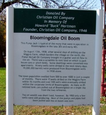
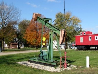
Bloomingdale Oil Boom
On August 13th, 1938, after several days of drilling on the Wiggins Farm, which borders the village on the north, the Fisher McCall Oil Company brought in a gusher and oil flew in the air. There was a scramble to rent land on which to park house cars or pitch tents. Some dwellings were converted into apartments. Ninety wells were drilled in the next ninety days. 19,000,000 barrels were produced from Bloomingdale wells in 1938 alone.
The town population swelled from 500 to over 1000 in just a couple of months. There were 15 wells drilled on the Wiggins Farm within 16 months and over 108 wells were eventually drilled within the corporate limits of Bloomingdale. As many as 85 railroad tank cars pulled out of Bloomingdale on a single day from the two refineries.
The oil wealth was short lived, however. By 1950 only a few wells were still producing. Most of the pumps and pipes had been pulled out and the oil boom was over.
Donated by Christian Oil Company in memory of Howard "Buck" Hartman, founder, Christian Oil Company, 1946
Topics. This historical marker is listed in these topic lists: Industry & Commerce • Settlements & Settlers. A significant historical year for this entry is 1938.
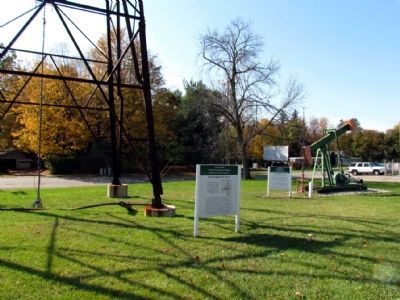
Location. 42° 22.989′ N, 85° 57.5′ W. Marker is in Bloomingdale, Michigan, in Van Buren County. Marker can be reached from the intersection of W. Kalamazoo Street and Oak Street, on the right when traveling west. Marker is located in Augustus Haven Park near the Bloomingdale Depot Museum. Touch for map. Marker is in this post office area: Bloomingdale MI 49026, United States of America. Touch for directions.
Other nearby markers. At least 8 other markers are within 12 miles of this marker, measured as the crow flies. Bloomingdale Oil Boom / Statewide Effect of Bloomingdale Oil Boom (a few steps from this marker); Kalamazoo and South Haven Railroad / Bloomingdale Depot (within shouting distance of this marker); Bloomingdale Veterans Memorial (within shouting distance of this marker); Grand Army of the Republic (approx. 9.1 miles away); The Second Street Bridge (approx. 11.4 miles away); Episcopal Church of Good Shepherd (approx. 11.4 miles away); Welcome to Allegan (approx. 11.4 miles away); James E. Mahan Park (approx. 11.4 miles away). Touch for a list and map of all markers in Bloomingdale.
Credits. This page was last revised on June 16, 2016. It was originally submitted on November 4, 2013, by Duane Hall of Abilene, Texas. This page has been viewed 544 times since then and 30 times this year. Photos: 1. submitted on November 4, 2013, by Duane Hall of Abilene, Texas. 2. submitted on November 3, 2013, by Duane Hall of Abilene, Texas. 3. submitted on November 4, 2013, by Duane Hall of Abilene, Texas.


