Mechanicsville in Hanover County, Virginia — The American South (Mid-Atlantic)
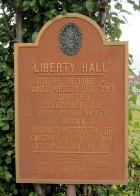
"Liberty Hall"
Samuel Merdith, Sr., Gent.
(1689-1762)
Processioner-1708
St. Pauls Parish, Hanover Co.
A grandson of
Thomas Meredith, Sr.
Emigrant in 1636, Virginia
His land grant in 1661
Erected 1978 by Thomas Meredith Chapter, Colonial Dames XVII Century.
Topics and series. This historical marker is listed in these topic lists: Churches & Religion • Settlements & Settlers. In addition, it is included in the The Colonial Dames XVII Century, National Society series list. A significant historical year for this entry is 1636.
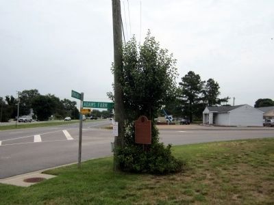
Location. 37° 36.884′ N, 77° 19.535′ W. Marker is in Mechanicsville, Virginia, in Hanover County. Marker is at the intersection of Mechanicsville Turnpike (U.S. 360) and Adams Farm Road on Mechanicsville Turnpike. Touch for map. Marker is at or near this postal address: 6425 Mechanicsville Turnpike, Mechanicsville VA 23111, United States of America. Touch for directions.
Other nearby markers. At least 8 other markers are within 2 miles of this marker, measured as the crow flies. Battle of Cold Harbor (approx. 0.4 miles away); Seven Days' Battles (approx. 0.8 miles away); a different marker also named Battle of Cold Harbor (approx. one mile away); Cold Harbor Campaign (approx. one mile away); Walnut Grove Church (approx. 1.1 miles away); a different marker also named Seven Days Battles (approx. 1.1 miles away); a different marker also named Cold Harbor Campaign (approx. 1.4 miles away); a different marker also named Battle of Cold Harbor (approx. 1.4 miles away). Touch for a list and map of all markers in Mechanicsville.
Credits. This page was last revised on June 16, 2016. It was originally submitted on June 18, 2012, by Bernard Fisher of Richmond, Virginia. This page has been viewed 1,338 times since then and 45 times this year. Last updated on November 27, 2013, by Art Taylor of Beaverdam, Va 23015. Photos: 1, 2. submitted on June 18, 2012, by Bernard Fisher of Richmond, Virginia.

