Sycamore in Allendale County, South Carolina — The American South (South Atlantic)
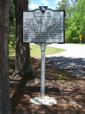
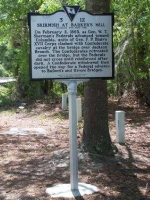
Barker's Mill / Skirmish at Barker's Mill
Barker's Mill, which stood here on Jackson Branch, was a grist mill owned by William Ransome Barker (1816-1869), a planter in what was then Barnwell District. Barker moved to this are in the 1850s,built a house about 2 mi. N. and established a cotton plantation of 2,000~3,000 acres which he named "Sycamore." The town of Sycamore, chartered in 1891, was named for the plantation.
(Skirmish at Barker's Mill side of marker):
On February 2, 1865, as Gen. W.T. Sherman's Federals advanced toward Columbia, units of Gen.F.P. Blair's XVII Corps clashed with the Confederate cavalry at the bridge over Jackson Branch.The Confederates retreated over the bridge, but the Federals did not cross until reinforced after dark. A Confederate withdrawal then opened the way for a Federal advance to Buford's and Rivers Bridge.
Erected 2005 by The Rivers Bridge Camp No. 842 Sons Of Confederate Veterans. (Marker Number 3-12.)
Topics and series. This historical marker is listed in this topic list: War, US Civil. In addition, it is included in the Sons of Confederate Veterans/United Confederate Veterans series list. A significant historical date for this entry is February 2, 1865.
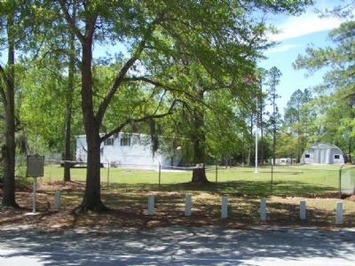
Location. 33° 0.897′ N, 81° 12.904′ W. Marker is in Sycamore, South Carolina, in Allendale County. Marker is on Buford's Bridge Highway (U.S. 321), on the left when traveling north. Touch for map. Marker is in this post office area: Sycamore SC 29846, United States of America. Touch for directions.
Other nearby markers. At least 8 other markers are within 6 miles of this marker, measured as the crow flies. Harmony Baptist Church (approx. 2.7 miles away); Bethel Baptist Church (approx. 3.6 miles away); Bethlehem Church (approx. 3.6 miles away); Allendale County War Memorial (approx. 4 miles away); Fairfax (approx. 4.1 miles away); Old St. Nicholas Cemetery (approx. 5.1 miles away); Happy Home Baptist Church (approx. 5˝ miles away); Town of Allendale (approx. 5.9 miles away). Touch for a list and map of all markers in Sycamore.
Regarding Barker's Mill / Skirmish at Barker's Mill. “Sycamore,”
1865 – The plantation was used by General Sherman on his march to Columbia. He burned the house when he left.
Credits. This page was last revised on June 16, 2016. It was originally submitted on April 17, 2008, by Mike Stroud of Bluffton, South Carolina. This page has been viewed 4,555 times since then and 1,193 times this year. Photos: 1, 2, 3. submitted on April 17, 2008, by Mike Stroud of Bluffton, South Carolina. • Craig Swain was the editor who published this page.


