Near Atmore in Escambia County, Alabama — The American South (East South Central)
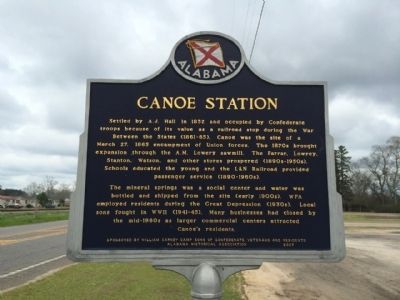
Canoe Station
The mineral springs was a social center and water was bottled and shipped from the site (early 1900s). WPA employed residents during the Great Depression (1930s). Local sons fought in WWII (1941-45). Many businesses had closed by the mid-1960s as larger commercial centers attracted Canoe’s residents.
Erected 2007 by the William Carney Camp Sons of Confederate Veterans & Residents and the Alabama Historical Association.
Topics and series. This historical marker is listed in these topic lists: Industry & Commerce • Railroads & Streetcars • Settlements & Settlers • War, US Civil. In addition, it is included in the Alabama Historical Association, and the Sons of Confederate Veterans/United Confederate Veterans series lists. A significant historical month for this entry is March 1800.
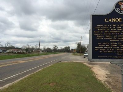
Location. 31° 1.581′ N, 87° 24.568′ W. Marker is near Atmore, Alabama, in Escambia County. Marker is at the intersection of U.S. 31 and Baker Street, on the right when traveling east on U.S. 31. Touch for map. Marker is at or near this postal address: 12250 US 31, Atmore AL 36502, United States of America. Touch for directions.
Other nearby markers. At least 8 other markers are within 10 miles of this marker, measured as the crow flies. Escambia County Training School (approx. 4.2 miles away); Williams Station, Alabama 1866-1897 / Atmore, Alabama (approx. 4.9 miles away); Railroad Bill (approx. 4.9 miles away); Watson Cabin (approx. 5.1 miles away); Flomaton, Alabama (approx. 8.8 miles away); Alabama's Own (approx. 8.8 miles away); The Old Church Bell (approx. 8.8 miles away); Century, Florida / Alger Railroad (approx. 9.4 miles away in Florida). Touch for a list and map of all markers in Atmore.
Credits. This page was last revised on June 16, 2016. It was originally submitted on March 12, 2014, by Mark Hilton of Montgomery, Alabama. This page has been viewed 1,188 times since then and 78 times this year. Photos: 1, 2, 3. submitted on March 12, 2014, by Mark Hilton of Montgomery, Alabama. • Bernard Fisher was the editor who published this page.


