New Johnsonville in Humphreys County, Tennessee — The American South (East South Central)
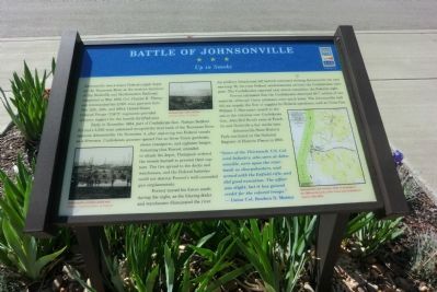
Battle of Johnsonville
Up in Smoke
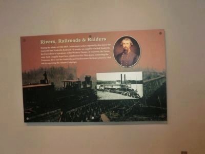
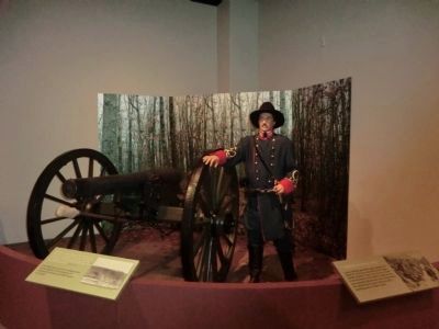
Early in November 1864, part of Confederate Gen. Nathan Bedford Forrest’s 3,500-man command occupied the west bank of the Tennessee River opposite Johnsonville. On November 4, after capturing two Federal vessels as a diversion, Confederate gunners opened fire on three Union gunboats, eleven transports, and eighteen barges. Assuming that Forrest intended to attack the depot, Thompson ordered the vessels burned to prevent their capture. The fire spread to the docks and warehouses, and the Federal batteries could not destroy Forrest’s well-concealed gun emplacements.
Forrest moved his forces south during the night, as the blazing docks and warehouses illuminated the river. An artillery detachment left behind continued shelling Johnsonville the next morning. By the time Federal reinforcements arrived, the Confederates were gone. The Confederates reported only eleven casualties, the Federals eight.
Forrest estimated that the Confederates destroyed $6.7 million of war materiel, although Union estimates were much lower. The Johnsonville raid did not impede the flow of supplies for Federal operations, such as Union Gen. William T. Sherman’s march to the sea or the victories over Confederate Gen. John Bell Hood’s army at Franklin and Nashville a few weeks later.
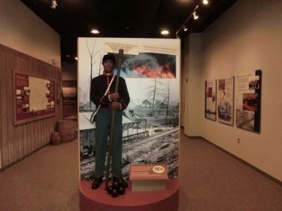
Johnsonville State Historic Park was listed on the National Register of Historic Places in 2001.
“Some of the Thirteenth U.S. Colored Infantry, who were at Johnsonville, were upon the riverbank as sharpshooters, and armed with the Enfield rifle, and did good execution. The affair was slight, but it has gained credit for the colored troop.” — Union Col. Reuben D. Mussey.
(captions)
(lower left) Johnsonville, artillery park and USCTs - Courtesy Library of Congress
(upper center) Johnsonville, with rail line Courtesy Library of Congress
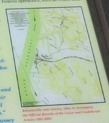
(lower right) Johnsonville and vicinity, Atlas to Accompany the Official Records of the Union and Confederate Armies (1891-1895)
Erected by Tennessee Civil War Trails.
Topics and series. This historical marker is listed in these topic lists: African Americans • War, US Civil. In addition, it is included in the Tennessee Civil War Trails series list. A significant historical month for this entry is May 1864.
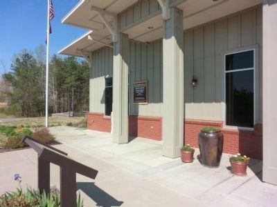
Location. 36° 1.891′ N, 87° 56.898′ W. Marker is in New Johnsonville, Tennessee, in Humphreys County. Marker is at the intersection of Nell Beard Road and Broadway Street (U.S. 70) on Nell Beard Road. The marker is in front of the Johnsonville State Historic Park Welcome Center. Touch for map. Marker is at or near this postal address: 90 Nell Beard Road, New Johnsonville TN 37134, United States of America. Touch for directions.
Other nearby markers. At least 8 other markers are within 3 miles of this marker, measured as the crow flies. Old Johnsonville Cemetery (approx. 2 miles away); Crockett Cemetery (approx. 2 miles away); Building the Upper Redoubt (approx. 2 miles away); The Turntable (approx. 2 miles away); Pisgah United Methodist Church (approx. 2.1 miles away); Old Johnsonville (approx. 2.1 miles away); Jesse James (approx. 2.1 miles away); Garrison Troops (approx. 2.1 miles away). Touch for a list and map of all markers in New Johnsonville.
Also see . . . Johnsonville State Historic Park. (Submitted on June 14, 2014.)
Credits. This page was last revised on June 16, 2016. It was originally submitted on June 14, 2014, by Don Morfe of Baltimore, Maryland. This page has been viewed 949 times since then and 32 times this year. Photos: 1, 2, 3, 4, 5, 6, 7. submitted on June 14, 2014, by Don Morfe of Baltimore, Maryland. • Bernard Fisher was the editor who published this page.
