Buchenwald Memorial in Weimar, Thuringia, Germany — Central Europe
"Blood Road" / „Blutstraße”
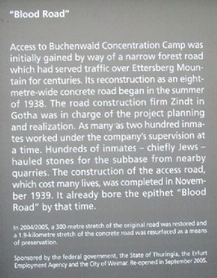
Access to Buchenwald Concentration Camp was initially gained by way of a narrow forest road which had served traffic over Ettersberg Mountain for centuries. Its reconstruction as an eight-metre-wide concrete road began in the summer of 1938. The road construction firm Zindt in Gotha was in charge of the project planning and realization. As many as two hundred inmates worked under the company's supervision at a time. Hundreds of inmates - chiefly Jews - hauled stones for the subbase from nearby quarries. The construction of the access road, which cost many lives, was completed in November 1939. It already bore the epithet "Blood Road" by that time.
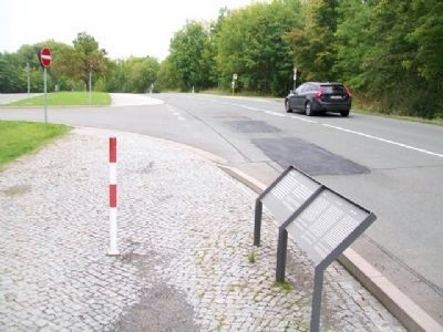
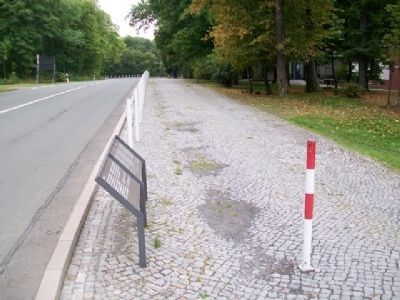
In 2004/2005, a 300-metre stretch of the original road was restored and a 1.9-kilometre stretch of the concrete road was resurfaced as a means of preservation.
Sponsored by the federal government, the State of Thuringia, the Erfurt Employment Agency and the City of Weimar. Re-opened in September 2005.
————————
Anfangs diente eine schmale Waldchaussee, die seit Jahrhunderten über den Ettersberg führte, als Zufartstraße zum Konzentrationslager Buchenwald. Ihr Ausbau zu einer acht Meter breiten Betonstraße begann im Sommer 1938. Bauplanung und -ausführung übernahm die Straßenbaufirma Zindt, Gotha. Bis zu 200 Häftlinge arbeiteten unter ihrer Leitung. Hunderte, vor allem jüdische Insassen des Lagers, schleppten aus den umliegenden Steinbrüchen die Steine für das Packlager heran. Der Bau der Zufahrtsstraße, der viele Opfer forderte, wurde im November 1939 abgeschlossen. Schon zu dieser Zeit trug sie den Beinamen „Blutstraße”.
2004/2005 wurden 300 Meter der Originalstraße restauriert und die Betonstraße auf eine Länge von 1,9 Kilometern durch einen neuen Straßenbelag konserviert.
Getragen vom Bund, vom Land Thüringen, von der Agentur für Arbeit, Erfurt, und der Stadt Weimar. Übergeben im September 2005.
————————
[French and Russian text not transcribed]
Erected by Buchenwald Memorial Foundation.
Topics. This historical marker is listed in these topic lists: Roads & Vehicles • War, World II. A significant historical month for this entry is September 2005.
Location. 51° 0.804′ N, 11° 15.357′ E. Marker is in Buchenwald Memorial, Thüringen (Thuringia), in Weimar. Marker can be reached from Blutstraße just north of the GDR Buchenwald Memorial, on the left when traveling north. Follow the signs. Site is approximately 10 km NW of Weimar, off Blutstraße, west of Ettersburger Straße (L1054). Touch for map. Marker is at or near this postal address: South of the GDR Buchenwald Memorial parking lot, Buchenwald Memorial TH 99427, Germany. Touch for directions.
Other nearby markers. At least 8 other markers are within walking distance of this marker. National Buchenwald Memorial (approx. 0.4 kilometers
away); In Memory of the Soldiers of the XX Corps of the US 3rd Army (approx. 0.9 kilometers away); SS Guard Detachment Barracks (approx. 0.9 kilometers away); Barrack / Baracke (approx. 0.9 kilometers away); Camp Headquarters / Lagerkommandantur (approx. 0.9 kilometers away); Dog Compound / Hundezwinger (approx. 0.9 kilometers away); Ernst Thälmann (approx. one kilometer away); Gate building / Torgebäude (approx. one kilometer away). Touch for a list and map of all markers in Buchenwald Memorial.
Also see . . .
1. Buchenwald Memorial Official Site. (Submitted on September 6, 2014, by William Fischer, Jr. of Scranton, Pennsylvania.)
2. Buchenwald in USHMM Holocaust Encyclopedia. (Submitted on September 6, 2014, by William Fischer, Jr. of Scranton, Pennsylvania.)
3. Buchenwald: History & Overview. (Submitted on September 6, 2014, by William Fischer, Jr. of Scranton, Pennsylvania.)
4. Buchenwald Concentration Camp. (Submitted on September 6, 2014, by William Fischer, Jr. of Scranton, Pennsylvania.)
Credits. This page was last revised on March 20, 2024. It was originally submitted on September 6, 2014, by William Fischer, Jr. of Scranton, Pennsylvania. This page has been viewed 451 times since then and 23 times this year. Photos: 1, 2, 3, 4. submitted on September 6, 2014, by William Fischer, Jr. of Scranton, Pennsylvania.


