Everest in Brown County, Kansas — The American Midwest (Upper Plains)
Everest 125th Anniversary
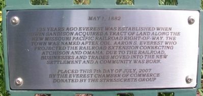
May 1, 1882
125 years ago Everest was established when Edwin Sandison acquired a tract of land along the new Missouri Pacific Railroad right-of-way. The town was named after Col. Aaron S. Everest who projected the railroad extension connecting Atchison and Omaha. Due to the railroad, businesses and trades moved into the new settlement and a community was born.
Placed this 7th day of July, 2007 by the Everest Chamber of Commerce
Donated by the Stresscrete Group
Erected 2007 by Everest Chamber of Commerce and the Stresscrete Group.
Topics. This historical marker is listed in these topic lists: Railroads & Streetcars • Settlements & Settlers. A significant historical month for this entry is July 2007.
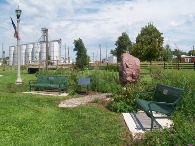
Location. 39° 40.603′ N, 95° 25.457′ W. Marker is in Everest, Kansas, in Brown County. Marker is at the intersection of 5th Street and Cedar Street, on the right when traveling north on 5th Street. Marker is in the Community Park and Honor Garden. Touch for map. Marker is in this post office area: Everest KS 66424, United States of America. Touch for directions.
Other nearby markers. At least 8 other markers are within 6 miles of this marker, measured as the crow flies. Prairie Flower Garden (here, next to this marker); The Founders of Everest (here, next to this marker); Everest Honor Garden (a few steps from this marker); Honnell - Means Honor Garden (a few steps from this marker); The "Three Amigos" Tree (a few steps from this marker); School Bell - 1886 (about 800 feet away, measured in a direct line); First REA Project in Kansas (approx. 5.1 miles away); "Four Horsemen of the Lines" (approx. 5˝ miles away). Touch for a list and map of all markers in Everest.
Also see . . . Brown County, Kansas in Cutler's History (1883). (Submitted on October 12, 2014, by William Fischer, Jr. of Scranton, Pennsylvania.)
Credits. This page was last revised on June 16, 2016. It was originally submitted on October 12, 2014, by William Fischer, Jr. of Scranton, Pennsylvania. This page has been viewed 548 times since then and 19 times this year. Photos: 1, 2. submitted on October 12, 2014, by William Fischer, Jr. of Scranton, Pennsylvania. 3, 4. submitted on October 13, 2014, by William Fischer, Jr. of Scranton, Pennsylvania.


