Near Bolivar in Jefferson County, West Virginia — The American South (Appalachia)
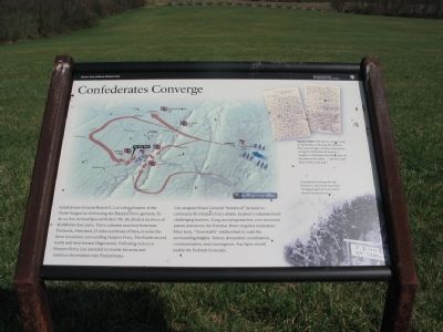
Confederates Converge
Harpers Ferry National Historical Park
— National Park Service, U.S. Department of the Interior —
Lee assigned Major General "Stonewall" Jackson to command the Harpers Ferry attack. Jackson's columns faced challenging barriers. Long sweeping marches over mountain passes and across the Potomac River required endurance. Once here, "Stonewall's" soldiers had to scale the surrounding heights. Victory demanded coordination, communication, and convergence. Any lapse would enable the Federals to escape.
Erected by National Park Service, U.S. Department of the Interior.
Topics. This historical marker is listed in this topic list: War, US Civil.
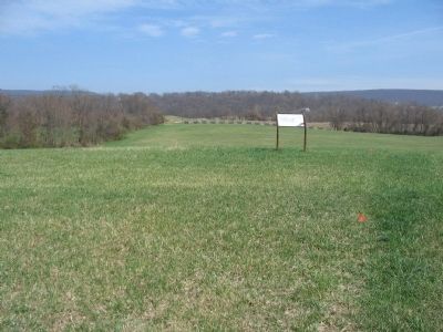
Location. 39° 19.302′ N, 77° 46.653′ W. Marker is near Bolivar, West Virginia, in Jefferson County. Marker can be reached from Bakerton Road (County Road 27), on the right when traveling south. Located in the north section of the School House Ridge unit of the Harpers Ferry National Historic Park. The marker is along a walking trail just north of the William L. Wilson Freeway (US 340). The trail is best reached from the parking area on Bakerton Road (CR 27). Touch for map. Marker is in this post office area: Harpers Ferry WV 25425, United States of America. Touch for directions.
Other nearby markers. At least 8 other markers are within walking distance of this marker. Assessing the Obstacle (about 300 feet away, measured in a direct line); Fake Attack - September 14th (about 400 feet away); Destined for Antietam (about 600 feet away); No Man's Land (approx. 0.3 miles away); Flag Talk (approx. 0.4 miles away); Battle of Harpers Ferry (approx. 0.4 miles away); Allstadt House (approx. half a mile away); A Dangerous Position (approx. half a mile away). Touch for a list and map of all markers in Bolivar.
More about this marker. On the left center of the marker is a map illustrating the movements of the Confederate columns described in the text. On the right is a reproduction describing Special Orders 191 fell into Union hands on September 13, the day the Harpers Ferry attack began. Federal Commander George B. McClellan declared in a telegram to President Lincoln, "I have all the plans of the rebels ... and will catch them in their own trap." On the lower right is a portion of a photograph of Confederates
passing through Frederick, Maryland, September 10, beginning their 3-day march toward Harpers Ferry.
Also see . . . 1862 Battle of Harpers Ferry. National Park Service summary of the battle. (Submitted on May 20, 2008, by Craig Swain of Leesburg, Virginia.)

Photographed By Craig Swain, May 17, 2008
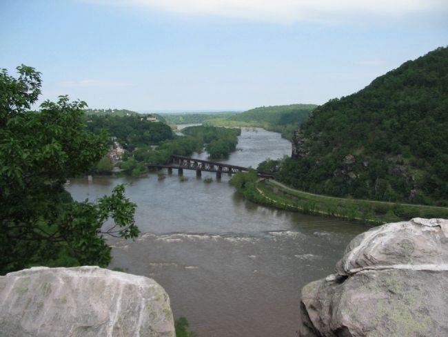
3. The Objective - Harpers Ferry
Seen from atop Loudoun Heights, to the east of the convergence of the Shenandoah and Potomac Rivers. Loudoun and Maryland Heights (rising from the river on the right) dominated the city. Once in Confederate hands, the city defenders were isolated and subjected to artillery bombardment.
Credits. This page was last revised on July 6, 2020. It was originally submitted on May 20, 2008, by Craig Swain of Leesburg, Virginia. This page has been viewed 1,387 times since then and 18 times this year. Photos: 1, 2, 3. submitted on May 20, 2008, by Craig Swain of Leesburg, Virginia.

