St. Peter's in Richmond County, Nova Scotia — The Atlantic Provinces (North America)
One Place, Four Names
Quatre noms pour un même endroit
Inscription.
English
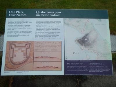
St. Peter’s is one of Nova Scotia’s oldest settlements. The Portuguese were likely here in the 1500s, calling it San Pedro.
In 1650, the French established a post nearby under the name of Saint-Pierre, where they traded with the Mi’kmaq and fished for nearly twenty years.
The French returned to this harbor during the Louisbourg era (1713-1758), renaming the area Port Toulouse. Throughout most of that period there was a small garrison of soldiers and modest fortifications.
Did you know that…
in the 1650s French explorer and trader Nicolas Denys built a “haul-over road” here, which was made of logs? As a result, boats and small ships could be hauled from the ocean to lake and vice versa.
French
St. Peter’s est l’un des plus anciens établissement en Nouvelle-Écosse. Les Portugais sont sans doute venus dans les années 1500 à cet endroit qu’ils appelaient San Pedro.
En 1650, les Français y ont établi à proximité un post qu’ils baptisèrent Saint-Pierre et où ils pratiquèrent le troc avec les Mi’kmaq et la pêche pendant près de vingt ans.
Les Français sont revenus s’installer dans ce port a l’époque de Louisbourg (1713-1758), et l’ont rebaptisé Port Toulouse. L’endroit a abrité une petite garnison de soldats et de modestes fortifications pendant presque toute cette période.
Le saviez-vous?…
Dans les années 1650, Nicolas Denys, explorateur et marchand français, aménagea à cet endroit un «chemin de halage» fait de rondins? On pouvait ainsi tirer les embarcations et les petits navires pour leur faire franchir l’isthme.
Erected by Parks Canada.
Topics. This historical marker is listed in this topic list: Forts and Castles. A significant historical year for this entry is 1650.
Location. 45° 39.247′ N, 60° 52.169′ W. Marker is in St. Peter's, Nova Scotia, in Richmond County. Marker is on Toulouse Street, on the right when traveling north. Touch for map. Marker is at or near this postal address: 160 Toulouse Street, St Peter's NS B0E, Canada. Touch for directions.
Other nearby markers. At least 5 other markers are within walking distance of this marker. St, Peter’s and Its Canal (here, next to this marker); St. Peter’s Canal / Le Canal Saint-Pierre (about 210 meters away, measured in a direct line); The French Settlement of Saint-Pierre (approx. 0.3 kilometers away); Lest We Forget (approx. half a kilometer away); Wallace R. MacAskill (approx. half a kilometer away).
Credits. This page was last revised on June 16, 2016. It was originally submitted on November 8, 2014, by Barry Swackhamer of Brentwood, California. This page has been viewed 462 times since then and 12 times this year. Photos: 1, 2. submitted on November 8, 2014, by Barry Swackhamer of Brentwood, California. • Andrew Ruppenstein was the editor who published this page.

