Brookhaven in Lincoln County, Mississippi — The American South (East South Central)
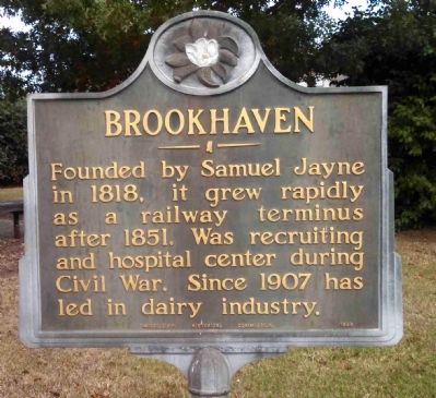
Brookhaven
Founded by Samuel Jayne in 1818, it grew rapidly as a railway terminus after 1851. Was recruiting and hospital center during Civil War. Since 1907 has led in dairy industry.
Erected 1949 by Mississippi Historical Commission.
Topics and series. This historical marker is listed in these topic lists: Agriculture • Railroads & Streetcars • Settlements & Settlers • War, US Civil. In addition, it is included in the Mississippi State Historical Marker Program series list. A significant historical year for this entry is 1818.
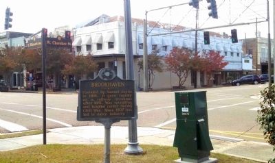
Location. 31° 34.712′ N, 90° 26.592′ W. Marker is in Brookhaven, Mississippi, in Lincoln County. Marker is at the intersection of West Cherokee Street and South Whitworth Avenue, on the right when traveling west on West Cherokee Street. Touch for map. Marker is at or near this postal address: 104 W Cherokee St, Brookhaven MS 39601, United States of America. Touch for directions.
Other nearby markers. At least 8 other markers are within walking distance of this marker. Brookhaven Blues: A Tribute (within shouting distance of this marker); Brookhaven Light Artillery (about 500 feet away, measured in a direct line); Whitworth College (about 600 feet away); Original King's Daughters Hospital (about 600 feet away); Lampton Auditorium (about 700 feet away); Horse & Mule Watering Trough (about 700 feet away); Temple B'nai Sholom (approx. 0.2 miles away); Little Brother Montgomery (approx. 0.3 miles away). Touch for a list and map of all markers in Brookhaven.
Also see . . .
1. Brookhaven, Mississippi. Brookhaven-Nalty-McGrath (Submitted on November 24, 2014.)
2. Great American Stations: Brookhaven, MS. The Godbold Transportation Center, opened in 2011, is located in the city's former power plant. (Submitted on November 22, 2014, by Cleo Robertson of Fort Lauderdale, Florida.)
3. CityTownInfo.com: Brookhaven, Mississippi. The area now covered by the City of Brookhaven was originally inhabited by the Choctaw Indians. (Submitted on November 22, 2014, by Cleo Robertson of Fort Lauderdale, Florida.)
4. Flags: Brookhaven, Mississippi. Flags of the World website entry (Submitted on November 22, 2014, by Cleo Robertson of Fort Lauderdale, Florida.)
5. Mississippi; a Guide to the Magnolia State, page 453. (Submitted on November 22, 2014, by Cleo Robertson of Fort Lauderdale, Florida.)
Credits. This page was last revised on December 13, 2022. It was originally submitted on November 22, 2014, by Cleo Robertson of Fort Lauderdale, Florida. This page has been viewed 577 times since then and 23 times this year. Photos: 1, 2, 3. submitted on November 22, 2014, by Cleo Robertson of Fort Lauderdale, Florida. • Bernard Fisher was the editor who published this page.


