Near Manassas in Prince William County, Virginia — The American South (Mid-Atlantic)
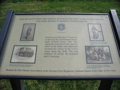
The Seventy-First Regiment
of Infantry New York State Militia
— Colonel Henry P. Martin Commanding —
Erected by Veteran Association of the Seventy-First Regiment, National Guard of the State of New York.
Topics. This historical marker is listed in this topic list: War, US Civil.
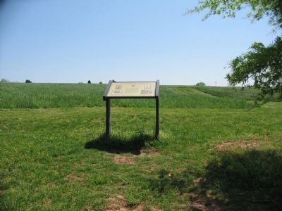
Location. This marker has been replaced by another marker nearby. It was located near 38° 49.589′ N, 77° 32.022′ W. Marker was near Manassas, Virginia, in Prince William County. Marker was on Sudley Road (Virginia Route 234), on the right when traveling north. Located at the Matthews Hill parking lot in the Manassas National Battlefield Park. Touch for map. Marker was in this post office area: Manassas VA 20109, United States of America. Touch for directions.
Other nearby markers. At least 8 other markers are within walking distance of this location. First Contact (here, next to this marker); Matthews Hill (within shouting distance of this marker); 2nd Rhode Island Infantry (about 600 feet away, measured in a direct line); Rhode Island Battery (approx. 0.2 miles away); The Fight for Matthews Hill (approx. 0.2 miles away); U.S. Infantry Battalion (approx. 0.2 miles away); 4th Alabama Infantry (approx. 0.2 miles away); The Matthew Farm (approx. 0.2 miles away). Touch for a list and map of all markers in Manassas.
More about this marker. In the upper left is a portrait of Colonel Henry P. Martin. Below it is a photograph of Members of the regiment posing at the Washington, D.C. Navy Yard prior to the Battle of Bull Run. In the upper center is a copy of the regimental crest. In the upper right is a portrait of Sergeant James T. Woolsey of Company G wearing the 1861 regimental campaign uniform. In the lower right, In 1869, the regiment's veteran association was formed. A group of them is shown here visiting the Bull Run Battlefield in 1888.
This marker was replaced by one titled "First Contact." See nearby markers.
Also see . . .
1. Manassas National Battlefield Park. (Submitted on June 2, 2008, by Craig Swain of Leesburg, Virginia.)
2. William Moir Smith. One of the casualties from the regiment later died as a prisoner of war in Richmond. He is buried near his home in Brooklyn, New York. (Submitted on June 2, 2008, by Craig Swain of Leesburg, Virginia.)
Credits. This page was last revised on June 16, 2016. It was originally submitted on June 2, 2008, by Craig Swain of Leesburg, Virginia. This page has been viewed 1,073 times since then and 7 times this year. Photos: 1, 2. submitted on June 2, 2008, by Craig Swain of Leesburg, Virginia.

