Pulaski in Giles County, Tennessee — The American South (East South Central)
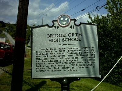
Bridgeforth High School
Erected by Tennessee Historical Commission. (Marker Number 3F 41.)
Topics and series. This historical marker is listed in these topic lists: African Americans • Education. In addition, it is included in the Tennessee Historical Commission series list. A significant historical year for this entry is 1869.
Location. 35° 12.584′ N, 87° 1.599′ W. Marker is in Pulaski, Tennessee, in Giles County. Marker is at the intersection of North 1st Street (Tennessee Route 7) and Mitchell Street, on the right when traveling north on North 1st Street. Touch for map. Marker is at or near this postal address: 910 N 1st St, Pulaski TN 38478, United States of America. Touch for directions.
Other nearby markers. At least 8 other markers are within walking distance of this marker. Pulaski Cornerstone — Northeast (approx. ¼ mile away); Gabriel McKissack (approx. ¼ mile away); Pulaski Courthouse Square Historic District (approx. 0.7 miles away); This Well (approx. ¾ mile away); Donald Grady Davidson (1893~1966) John Crowe Ransom (1888~1974) (approx. ¾ mile away); Church of the Messiah (approx. ¾ mile away); Sam Davis (approx. 0.8 miles away); Grissom Colonial Hall (approx. 0.8 miles away). Touch for a list and map of all markers in Pulaski.
Regarding Bridgeforth High School. The original school is being used today as Greater Richland Creek Association Building. The Afican American Community uses this facility for meetings, weddings, and funerals.
Credits. This page was last revised on June 16, 2016. It was originally submitted on July 19, 2012, by Giles County Tourism Foundation of Pulaski, Tennessee. This page has been viewed 810 times since then and 37 times this year. Last updated on March 15, 2015, by J. Makali Bruton of Accra, Ghana. Photo 1. submitted on July 19, 2012, by Giles County Tourism Foundation of Pulaski, Tennessee. • Bill Pfingsten was the editor who published this page.
