Bakersville in Mitchell County, North Carolina — The American South (South Atlantic)
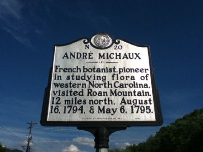
André Michaux
Erected 2000 by Division of Archives and History. (Marker Number N-20.)
Topics and series. This historical marker is listed in this topic list: Horticulture & Forestry. In addition, it is included in the North Carolina Division of Archives and History series list. A significant historical month for this entry is May 1841.
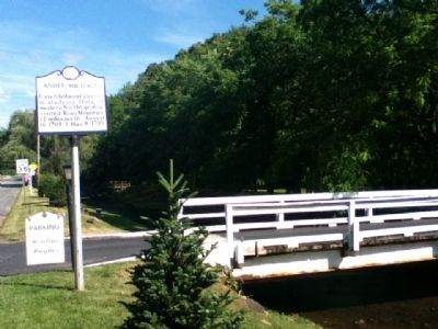
Location. 36° 0.856′ N, 82° 9.435′ W. Marker is in Bakersville, North Carolina, in Mitchell County. Marker is at the intersection of Crimson Laurel Way (State Highway 226) and Hemlock Drive, on the right when traveling south on Crimson Laurel Way. Touch for map. Marker is in this post office area: Bakersville NC 28705, United States of America. Touch for directions.
Other nearby markers. At least 8 other markers are within 11 miles of this marker, measured as the crow flies. Honoring Mitchell County's Confederate Dead (about 500 feet away, measured in a direct line); Asa Gray (about 600 feet away); Sink Hole Mine (approx. 2½ miles away); Penland School (approx. 5.3 miles away); Near This Point (approx. 8.4 miles away); Yellow Mountain Road (approx. 8.7 miles away); Overmountain Men (approx. 9.6 miles away); Yancey County War Memorial (approx. 10.4 miles away). Touch for a list and map of all markers in Bakersville.
Credits. This page was last revised on June 30, 2021. It was originally submitted on June 24, 2015, by Tom Bosse of Jefferson City, Tennessee. This page has been viewed 554 times since then and 16 times this year. Photos: 1, 2. submitted on June 24, 2015, by Tom Bosse of Jefferson City, Tennessee. • Bernard Fisher was the editor who published this page.

