Betio, Gilbert Islands, Kiribati — Micronesia Region of Oceania (Central Pacific Ocean)
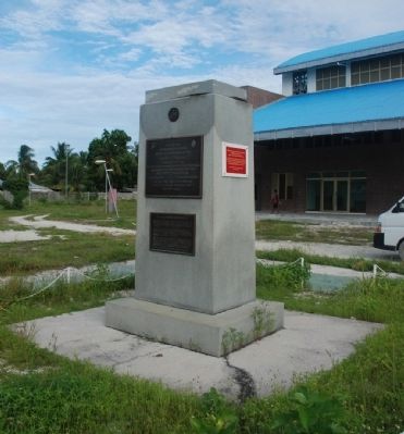
Battle of Tarawa Memorial
U.S. Marines War Memorial
Inscription.
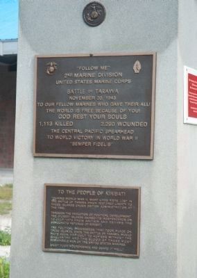
Marker front, upper plaque:
2nd Marine Division
United States Marine Corps
Battle of Tarawa
November 20, 1943
To our fellow Marines who gave their all!
The world is free because of you!
God rest your souls
1,113 killed 2,290 wounded
The Central Pacific spearhead
To world victory in World War II
“Semper Fidelis”
Marker front, lower plaque:
Through the evolution of political development the Gilbert Islands gained its independence on 12 July 1979 from Britain and became the Democratic Republic of Kiribati.
The political processes that took place on these islands, since the Battle of Tarawa, would have been difficult to achieve without the gallantry and the blood of these most remarkable men of the United States Marines.
Enjoy your independence and guard it well.”
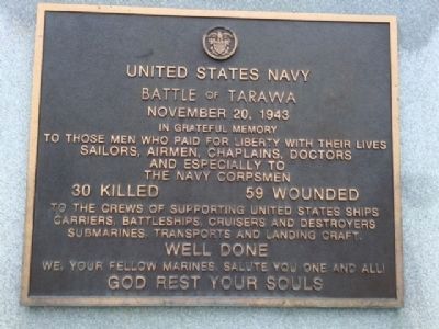
Marker reverse, upper plaque:
Battle of Tarawa
November 20, 1943
We, your fellow Marines, salute you one and all!
God rest your souls
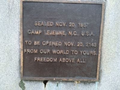
Marker reverse, lower plaque:
Camp Lejeune, NC, USA
To be opened Nov. 20, 2143
From our world to yours.
Freedom above all!
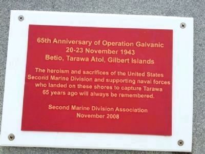
An additional, red, plaque was added in 2008. It reads:
20-23 November 1943
Betio, Tarawa Atol, Gilbert Islands
The heroism and sacrifices of the United States
Second Marine Division and supporting naval forces
who landed on these shores to capture Tarawa
65 years ago will always be remembered.
Second Marine Division Association
November 2008
Topics. This memorial is listed in these topic lists: Heroes • Military • War, World II.
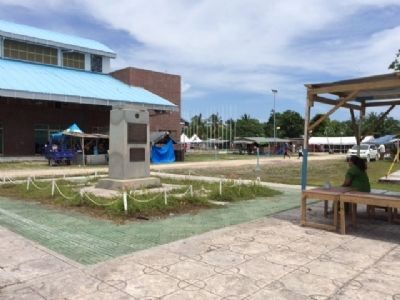
Location. 1° 21.373′ N, 172° 55.663′ E. Marker is in Betio, Gilbert Islands. Memorial can be reached from Rue de Betio. The marker is located in Prince Philip Park, a sportsground complex, which was once part
of the runway used by Japanese forces during World War II. Touch for map. Marker is in this post office area: Betio, Gilbert Islands 00197, Kiribati. Touch for directions.
Other nearby markers. At least 2 other markers are within walking distance of this marker. New Zealand Memorial to U.S. Marines and Navy (approx. 0.3 kilometers away); Betio Memorial Tarawa (approx. 0.6 kilometers away).
More about this memorial. The satellite image on the map link should be used to locate the marker.
Regarding Battle of Tarawa Memorial. In their advance across the Pacific in World War II, U.S. forces made their first major amphibious landing at the atoll of Tarawa in the Gilbert Islands, heavily defended by the Japanese. The invasion planners wanted for a flooding tide so the Marines could race ashore in small amphibious craft and Higgins boats. The planners were well aware that the date chosen for the invasion — November 20, 1943 — was a time of neap tides (tides of reduced range because the Moon was near first or last quarter). But calculations indicated the boats should still clear the surrounding coral reef at the appointed H-hour, 0830, and the boats would get in.
Instead, as it turned out, the boats got stuck on the coral 600 yards from shore and the Marines were forced to wade in, rifles over their heads, under withering fire from Japanese
shore batteries. According to Col. Joseph Alexander’s Utmost Savagery — The Three Days of Tarawa (Naval Institute Press, 1995), Tarawa’s mysterious “tide that failed” lacked scientific interpretation until Donald W. Olson published his seminal essay in Sky & Telescope magazine for November 1987, page 526. Olson showed that the neap tide on November 20th happened to coincide with an apogean tide (when the Moon was at the far point of its orbit around Earth). The combined effect of the two factors was a tide of such minimal range as to fully explain the disaster.
The momentum of the assault was lost, and fierce fighting lasted three days. Four soldiers won the Medal of Honor. As the marker records, the Marines paid a high price for their eventual victory at Tarawa.
Also see . . . Wikipedia entry for the Battle of Tarawa. An account of the 1943 landing. (Submitted on December 22, 2009, by Roger W. Sinnott of Chelmsford, Massachusetts.)
Credits. This page was last revised on July 10, 2022. It was originally submitted on December 22, 2009, by Roger W. Sinnott of Chelmsford, Massachusetts. This page has been viewed 10,034 times since then and 94 times this year. Last updated on July 7, 2015, by J. Makali Bruton of Accra, Ghana. Photos: 1. submitted on December 22, 2009, by Roger W. Sinnott of Chelmsford, Massachusetts. 2, 3, 4. submitted on July 7, 2015, by J. Makali Bruton of Accra, Ghana. 5. submitted on December 22, 2009, by Roger W. Sinnott of Chelmsford, Massachusetts. 6. submitted on July 7, 2015, by J. Makali Bruton of Accra, Ghana. 7, 8. submitted on December 22, 2009, by Roger W. Sinnott of Chelmsford, Massachusetts. • Kevin W. was the editor who published this page.
