Boulder in Boulder County, Colorado — The American Mountains (Southwest)
At the Foot of The Slabs
(Left Panel)
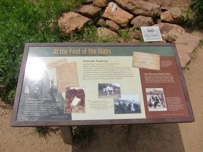
Climbing -- A Longtime Boulder Passion
Scrambling, tramping, hiking, climbing, mountaineering...No matter the name, early Colorado Chautauquans reveled in their outings into the adjacent foothills. In 1908, enthusiasts founded an official club -- a club that continues on as the Rocky Mountain Climbers Club, still housed in the Community House. Today, Boulder remains a mecca for hikers and climbers.
(Center Panel)
Naturally Inspiring
Question: How to upgrade teacher training in Texas?
Answer: Establish a chautauqua in Colorado!
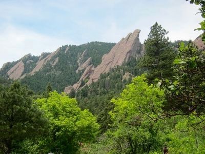
"Chautauqua" was that idea of communal summer learning and play that started in New York in 1876 and quickly swept across the nation to 10,000 communities. Along with the Chautauqua Movement came the idea of useful leisure, including outdoor play. Most Americans believed that nature could uplift both the heart and the mind. And nowhere better than the "Chautauqua Slabs" of Boulder.
"Bring a good supply of old shoes - the gravelly soil is hard on shoe leather. Broad-brimmed hats are another comfortable necessity - with such a hat the umbrella can be dispensed with." - Chautauquan, June, 1898
(Right side of marker:)
The Mountain Park is Born
Did you know that Boulder's mountain parks system began right here? In April 1898, voters approved the purchase of the 75-acre Bachelder Ranch to establish the Boulder Chautauqua. And Boulder gave its first nod to a way of life: Protect and enjoy nearby nature.
Upper photo and caption: The City teamed up with the National Park Service in 1937 to create the first master plan for Boulder Mountain Parks.
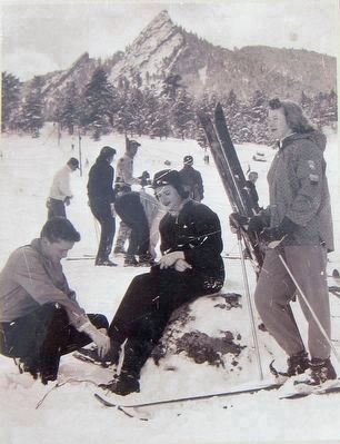
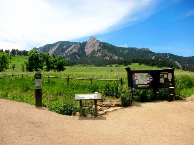
Lower photo and caption: Look out at the open field in front of you. Can you imagine a golf course here? A ski area? The Chautauqua Meadow has been home to both over the years! With changing times come changing values and recreation tastes. Today we enjoy this area as nature presents it.
This project funded in part by a grant from the National Park Service.
Topics. This historical marker is listed in these topic lists: Arts, Letters, Music • Education • Environment • Sports.
Location. 39° 59.927′ N, 105° 16.977′ W. Marker is in Boulder, Colorado, in Boulder County. Marker is on Bluebell Road, 0.1 miles south of Kinnikinic, on the right when traveling south. Touch for map. Marker is in this post office area: Boulder CO 80302, United States of America. Touch for directions.
Other nearby markers. At least 8 other markers are within 11 miles of this marker, measured as the crow flies. White-Davis Mercantile Building (approx. 1.4 miles away);
Boulder County Courthouse Fountain (approx. 1.4 miles away); The Gettysburg Address (approx. 1.4 miles away); The Holiday Drive-In Marquee 1953 (approx. 4.4 miles away); Welcome to the Crags Hotel (approx. 5 miles away); The Denver-Boulder Turnpike (approx. 5˝ miles away); Mary Miller Historical Mural (approx. 9.7 miles away); Peltier House (approx. 10.2 miles away). Touch for a list and map of all markers in Boulder.
Also see . . . Chautauqua History. The Colorado Chautauqua Association presents their history: Located at the base of Boulder’s Flatirons and one of only 24 National Historic Landmarks in the state of Colorado, the Colorado Chautauqua is one of only a few remaining chautauquas in the U.S. It is considered THE western representation of the cultural movement that swept the U.S. in the late 19th and early 20th centuries and is the only site west of the Mississippi that has been in continuous operation since its founding and with its original structures intact and used for their original purposes.... (Submitted on September 7, 2015.)
Credits. This page was last revised on June 16, 2016. It was originally submitted on September 6, 2015, by Andrew Ruppenstein of Lamorinda, California. This page has been viewed 666 times since then and 23 times this year. Photos: 1, 2, 3, 4. submitted on September 6, 2015, by Andrew Ruppenstein of Lamorinda, California.


