Near Aubrey in Denton County, Texas — The American South (West South Central)
Elm Fork Bridge
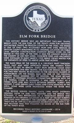
This historic bridge was an important two-way traffic bridge over the Elm Fork of the Trinity River for growing automobile traffic in Denton County in the 1920s. The bridge is one of the only two accessible iron and steel bridges in Denton County remaining in its original location on public land. Concrete piers and abutments were installed in early March 1922 while crews waited for the shipments of steel to arrive later that month.
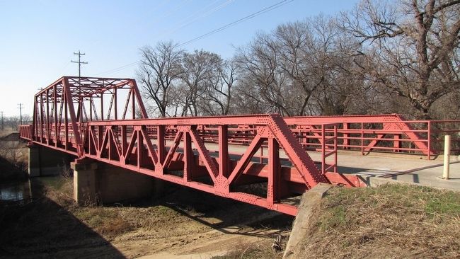
The main span of the bridge is a 100-foot Pratt through-truss; east and west approach spans are Warren pony trusses 70 feet in length. Early iron bridges could only accommodate one-way traffic. The Elm Fork bridge was built for two-way traffic in response to the growing number of automobiles on the roads. Built on one of the original wagon trails leading out of Denton, the road became known as Sherman Highway, connecting Denton, Aubrey and Sanger. It also served early farms and cattle ranches in the area; some were later inundated when the river was dammed.
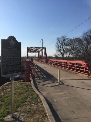
The bridge served traffic until 1990 when Sherman Highway (now FM 428) was widened and the bridge was bypassed. It was repurposed as a pedestrian bridge and remains in its original location as a part of the Ray Roberts Lake State Park Greenbelt. The Greenbelt opened on National Trails Day in 1999 as a wilderness recreation area with a 20-mile multiuse trail that follows the banks of the Elm Fork of the Trinity River.
Recorded Texas Historic Landmark - 2014
Marker is property of the State of Texas
Erected 2014 by Texas Historical Commission. (Marker Number 17887.)
Topics. This historical marker is listed in these topic lists: Bridges & Viaducts • Roads & Vehicles. A significant historical month for this entry is March 1922.
Location. 33° 18.41′ N, 97° 2.507′ W. Marker is near Aubrey, Texas, in Denton County. Marker is on West Sherman Drive (Farm to Market Road 428) 0.8 miles west of Wildcat Road, on the right when traveling west. The marker is located along the Greenbelt Trail at the east end of the bridge. Touch for map. Marker is in this post office area: Aubrey TX 76227, United States of America. Touch for directions.
Other nearby markers. At least 8 other markers are within 7 miles of this marker, measured as the crow flies. Green Valley Schools (approx. 1.4 miles away); Aubrey First United Methodist Church (approx. 3.1 miles away); First Christian Church of Aubrey (approx. 3.2 miles away); Belew Cemetery (approx. 4.7 miles away); Cooper Creek Baptist Church (approx. 5 miles away); Cooper Creek School (approx. 5.1 miles away); Cooper Creek Cemetery (approx. 5.1 miles away); Oak Grove Methodist Church (approx. 7 miles away). Touch for a list and map of all markers in Aubrey.
More about this marker. The dedication ceremony was held at 2:00 pm at the Historic First Christian Church of Aubrey at 410 North Main Street followed by the unveiling of the marker at 3:15pm at the Ray Roberts Lake State Park Greenbelt off FM 428 between Denton and Aubrey.
Credits. This page was last revised on March 17, 2021. It was originally submitted on February 14, 2016, by QuesterMark of Fort Worth, Texas. This page has been viewed 976 times since then and 98 times this year. Photos: 1, 2, 3. submitted on February 14, 2016, by QuesterMark of Fort Worth, Texas. • Bernard Fisher was the editor who published this page.


